
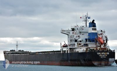
GALAPAGOS
Bulk Carrier
Current Trip
| Time Travelled | 10 days |
|---|---|
| Remaining Time | 1 day |
| Distance Travelled | 2585.83 морская миля |
| Remaining Distance | 424.68 морская миля |
| AVG Speed | 9.6 Узлы |
| MAX Speed | 12 Узлы |
| AVG Wind | 12 knots |
| MAX Wind | 24 knots |
| MIN Temp | 9.2°C / 48.56°F |
| MAX Temp | 30.4°C / 86.72°F |
| Осадка | 13.3 м |
| Позиция Получена | 8 d тому назад |
Current Position
| Долгота | 128.98617° |
|---|---|
| Широта | 34.54335° |
| Статус | Under way using engine |
| Скорость | 9.7 Узлы |
| Курс | 214.8° |
| Район | Japan Sea |
| Станция | T-AIS |
| Позиция Получена | 8 d тому назад |
Info
Information
The current position of GALAPAGOS is in Japan Sea with coordinates 34.54335° / 128.98617° as reported on 2024-05-28 23:01 by AIS to our vessel tracker app. The vessel's current speed is 9.7 Узлы and is heading at the port of SINGAPORE. The estimated time of arrival as calculated by MyShipTracking vessel tracking app is 2024-06-08 03:22 LT
The vessel GALAPAGOS (IMO: 9473169, MMSI: 248146000) is a Bulk Carrier that was built in 2010 ( 14 лет ). It's sailing under the flag of [MT] Malta.
In this page you can find informations about the vessels current position, last detected port calls, and current voyage information. If the vessels is not in coverage by AIS you will find the latest position.
The current position of GALAPAGOS is detected by our AIS receivers and we are not responsible for the reliability of the data. The last position was recorded while the vessel was in Coverage by the Ais receivers of our vessel tracking app.
The current draught of GALAPAGOS as reported by AIS is 13.3 meters
Weather
| Temperature | 29.7°C / 85.46°F |
|---|---|
| Wind Speed | 8 knots |
| Direction | 276° W |
| Pressure | 1007.9 hPa |
| Humidity | 73.3 % |
| Cloud Coverage | 100 % |
Featured Company
Last Port Calls
| Port | Arrival | Departure | Time In Port |
|---|---|---|---|
| 2024-05-23 16:48 | 2024-05-26 18:54 | 3 d | |
| 2024-05-14 05:28 | 2024-05-17 04:49 | 2 d | |
| 2024-05-02 06:36 | 2024-05-07 00:12 | 4 d |
Most Visited Ports (Last year)
| Port | Arrivals | |
|---|---|---|
| 3 | ||
| 3 | ||
| 3 | ||
| 2 | ||
| 2 | ||
| 1 |
Last Trips
| Origin | Departure | Destination | Arrival | Distance | |
|---|---|---|---|---|---|
| 2024-05-17 12:49 | 2024-05-24 02:48 | 1057.63 морская миля | |||
| 2024-05-07 07:12 | 2024-05-14 13:28 | 1883.00 морская миля | |||
| 2024-03-18 23:37 | 2024-05-02 13:36 | 6886.86 морская миля |
Events
| Время | Событие | Детали | Позиция / Направление | Информация |
|---|---|---|---|---|
| 2024-05-28 23:05 | Статус изменился | Default Under way using engine |
34.53422 / 128.97881
SGSIN
|
Скорость: 9.7 kn Курс: 214.8° |
| 2024-05-28 23:01 | Вне покрытия |
34.54335 / 128.98617
Japan Sea
SGSIN
|
Скорость: 9.7 kn Курс: 214.8° |
|
| 2024-05-28 22:44 | Изменение морского района | South Korean part of the Japan Sea Japanese part of the Japan Sea |
34.57908 / 129.02348
Japan Sea
SGSIN
|
Скорость: 9.8 kn Курс: 213.2° |
| 2024-05-28 22:38 | Статус изменился | Under way using engine Default |
34.59273 / 129.03453
SGSIN
|
Скорость: 9.7 kn Курс: 217° |
| 2024-05-28 22:14 | Статус изменился | Default Under way using engine |
34.64551 / 129.08142
SGSIN
|
Скорость: 9.5 kn Курс: 216.8° |
| 2024-05-28 20:08 | Изменение морского района | Japanese part of the Japan Sea South Korean part of the Japan Sea |
34.90751 / 129.31105
Japan Sea
SGSIN
|
Скорость: 8.8 kn Курс: 209.8° |
| 2024-05-28 17:09 | Статус изменился | Under way using engine Default |
35.28932 / 129.60987
SGSIN
|
Скорость: 9 kn Курс: 210° |
| 2024-05-28 16:57 | Статус изменился | Default Under way using engine |
35.31500 / 129.62833
SGSIN
|
Скорость: 9.4 kn Курс: 210.7° |
| 2024-05-28 16:54 | Статус изменился | Under way using engine Default |
35.32261 / 129.63366
SGSIN
|
Скорость: 9.4 kn Курс: 211° |
| 2024-05-28 16:49 | Статус изменился | Default Under way using engine |
35.33358 / 129.64154
SGSIN
|
Скорость: 9.4 kn Курс: 210.8° |