
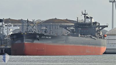
ECO MALIBU
Tanker
Current Trip
IQ BSR
| Time Travelled | 19 days |
|---|---|
| Remaining Time | --- |
| Distance Travelled | 3999.71 морская миля |
| Remaining Distance | --- |
| AVG Speed | 11.1 Узлы |
| MAX Speed | 14 Узлы |
| AVG Wind | 9.1 knots |
| MAX Wind | 22.8 knots |
| MIN Temp | 25.6°C / 78.08°F |
| MAX Temp | 37.2°C / 98.96°F |
| Осадка | 9.3 м |
| Позиция Получена | 10 h, 37 m тому назад |
Current Position
| Долгота | 49.63154° |
|---|---|
| Широта | 29.11879° |
| Статус | Under way using engine |
| Скорость | 5.5 Узлы |
| Курс | 348.4° |
| Район | Persian Gulf |
| Станция | T-AIS |
| Позиция Получена | 10 h, 37 m тому назад |
Info
Information
The current position of ECO MALIBU is in Persian Gulf with coordinates 29.11879° / 49.63154° as reported on 2024-06-04 10:24 by AIS to our vessel tracker app. The vessel's current speed is 5.5 Узлы
The vessel ECO MALIBU (IMO: 9902823, MMSI: 538009214) is a Tanker It's sailing under the flag of [MH] Marshall Is.
In this page you can find informations about the vessels current position, last detected port calls, and current voyage information. If the vessels is not in coverage by AIS you will find the latest position.
The current position of ECO MALIBU is detected by our AIS receivers and we are not responsible for the reliability of the data. The last position was recorded while the vessel was in Coverage by the Ais receivers of our vessel tracking app.
The current draught of ECO MALIBU as reported by AIS is 9.3 meters
Weather
| Temperature | 32.6°C / 90.68°F |
|---|---|
| Wind Speed | 13 knots |
| Direction | 296° WNW |
| Pressure | 1001.4 hPa |
| Humidity | 47.4 % |
| Cloud Coverage | --- |
Featured Company
Last Port Calls
| Port | Arrival | Departure | Time In Port |
|---|---|---|---|
| 2024-05-15 02:21 | 2024-05-16 13:59 | 1 d |
Most Visited Ports (Last year)
| Port | Arrivals | |
|---|---|---|
| 3 | ||
| 3 | ||
| 1 | ||
| 1 | ||
| 1 | ||
| 1 |
Last Trips
| Origin | Departure | Destination | Arrival | Distance | |
|---|---|---|---|---|---|
| 2024-03-26 09:43 | 2024-05-15 05:21 | 12236.02 морская миля |
Events
| Время | Событие | Детали | Позиция / Направление | Информация |
|---|---|---|---|---|
| 2024-06-04 15:49 | Окончание движения |
29.62044 / 48.86961
IQ BSR
|
Скорость: 0.3 kn Курс: 45° |
|
| 2024-06-04 10:31 | Статус изменился | Default Under way using engine |
29.12324 / 49.62418
IQ BSR
|
Скорость: 5.5 kn Курс: 348.4° |
| 2024-06-04 10:24 | Вне покрытия |
29.11879 / 49.63154
Persian Gulf
IQ BSR
|
Скорость: 5.5 kn Курс: 348.4° |
|
| 2024-06-04 08:10 | Статус изменился | Under way using engine Default |
28.83226 / 49.92088
IQ BSR
|
Скорость: 7.4 kn Курс: 319° |
| 2024-06-04 07:45 | Статус изменился | Default Under way using engine |
28.79477 / 49.95786
IQ BSR
|
Скорость: 4.7 kn Курс: 319° |
| 2024-06-03 22:34 | Статус изменился | Under way using engine Default |
27.26127 / 51.10086
IQ BSR
|
Скорость: 13.4 kn Курс: 282° |
| 2024-06-03 22:13 | Статус изменился | Default Under way using engine |
27.23938 / 51.18986
IQ BSR
|
Скорость: 12 kn Курс: 276.2° |
| 2024-06-03 22:09 | Статус изменился | Under way using engine Default |
27.23784 / 51.20560
IQ BSR
|
Скорость: 13.4 kn Курс: 276° |
| 2024-06-03 21:59 | Статус изменился | Default Under way using engine |
27.23354 / 51.24986
IQ BSR
|
Скорость: 13.6 kn Курс: 276.3° |
| 2024-06-03 21:48 | Статус изменился | Under way using engine Default |
27.22848 / 51.30112
IQ BSR
|
Скорость: 13.2 kn Курс: 276° |