
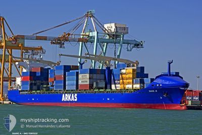
DIANE A
Container Ship
Current Trip
| Time Travelled | 4 days |
|---|---|
| Remaining Time | -2 mins |
| Distance Travelled | 1081.78 морская миля |
| Remaining Distance | 1.70 морская миля |
| AVG Speed | 11.9 Узлы |
| MAX Speed | 17.4 Узлы |
| AVG Wind | 9.7 knots |
| MAX Wind | 31 knots |
| MIN Temp | 10.5°C / 50.9°F |
| MAX Temp | 20.6°C / 69.08°F |
| Осадка | 9 м |
| Позиция Получена | 3 d тому назад |
Current Position
| Долгота | --- |
|---|---|
| Широта | --- |
| Статус | Under way using engine |
| Скорость | 12.1 Узлы |
| Курс | 164° |
| Район | Mediterranean Sea - Eastern Basin |
| Станция | T-AIS |
| Позиция Получена | 3 d тому назад |
Info
Information
The current position of DIANE A is in Mediterranean Sea - Eastern Basin with coordinates 36.60560° / 15.51360° as reported on 2025-12-03 03:57 by AIS to our vessel tracker app. The vessel's current speed is 12.1 Узлы and is heading at the port of ALEXANDRIA. The estimated time of arrival as calculated by MyShipTracking vessel tracking app is 2025-12-06 15:58 LT
The vessel DIANE A (IMO: 9385532, MMSI: 229142000) is a Container Ship that was built in 2008 ( 17 лет ). It's sailing under the flag of [MT] Malta.
In this page you can find informations about the vessels current position, last detected port calls, and current voyage information. If the vessels is not in coverage by AIS you will find the latest position.
The current position of DIANE A is detected by our AIS receivers and we are not responsible for the reliability of the data. The last position was recorded while the vessel was in Coverage by the Ais receivers of our vessel tracking app.
The current draught of DIANE A as reported by AIS is 9 meters
Weather
| Temperature | 19.5°C / 67.1°F |
|---|---|
| Wind Speed | 17 knots |
| Direction | 244° WSW |
| Pressure | 1010.4 hPa |
| Humidity | 45.2 % |
| Cloud Coverage | --- |
Featured Company
Last Port Calls
| Port | Arrival | Departure | Time In Port |
|---|---|---|---|
| 2025-12-01 22:29 | 2025-12-02 08:05 | 9 h | |
| 2025-11-29 19:23 | 2025-11-30 22:18 | 1 d | |
| 2025-11-28 03:51 | 2025-11-28 20:45 | 16 h | |
| 2025-11-24 23:51 | 2025-11-25 17:28 | 17 h | |
| 2025-11-23 12:27 | 2025-11-24 09:51 | 21 h | |
| 2025-11-14 01:06 | 2025-11-15 00:13 | 23 h | |
| 2025-11-05 22:30 | 2025-11-06 12:38 | 14 h | |
| 2025-11-02 01:36 | 2025-11-03 03:16 | 1 d | |
| 2025-10-28 20:12 | 2025-10-30 11:48 | 1 d | |
| 2025-10-16 05:06 | 2025-10-17 17:42 | 1 d |
Most Visited Ports (Last year)
| Port | Arrivals | |
|---|---|---|
| 12 | ||
| 6 | ||
| 6 | ||
| 5 | ||
| 5 | ||
| 5 |
Last Trips
| Origin | Departure | Destination | Arrival | Distance | |
|---|---|---|---|---|---|
| 2025-11-30 22:18 | 2025-12-01 22:29 | 388.08 морская миля | |||
| 2025-11-28 20:45 | 2025-11-29 19:23 | 53.47 морская миля | |||
| 2025-11-25 17:28 | 2025-11-28 03:51 | 456.12 морская миля | |||
| 2025-11-24 09:51 | 2025-11-24 23:51 | 172.39 морская миля | |||
| 2025-11-15 00:13 | 2025-11-23 12:27 | 1843.87 морская миля | |||
| 2025-11-06 12:38 | 2025-11-14 01:06 | 1482.60 морская миля | |||
| 2025-11-03 03:16 | 2025-11-05 22:30 | 347.75 морская миля | |||
| 2025-10-30 11:48 | 2025-11-02 01:36 | 243.55 морская миля | |||
| 2025-10-17 17:42 | 2025-10-28 20:12 | 3080.48 морская миля | |||
| 2025-10-05 13:02 | 2025-10-16 05:06 | 3010.20 морская миля |
Events
| Время | Событие | Детали | Позиция / Направление | Информация |
|---|---|---|---|---|
| 2025-12-06 12:56 | Начало движения | 7.61 nm, North West of EL DEKHEILA |
31.21319 / 29.68024
EGALY
|
Скорость: 7.6 kn Курс: 134° |
| 2025-12-05 23:49 | Окончание движения | 8.28 nm, North West of EL DEKHEILA |
31.22898 / 29.67690
EGALY
|
Скорость: 0.3 kn Курс: 182° |
| 2025-12-03 04:01 | Статус изменился | Default Under way using engine |
36.59167 / 15.51667
EGALY
|
Скорость: 12.1 kn Курс: 164° |
| 2025-12-03 03:57 | Вне покрытия |
36.60560 / 15.51360
Mediterranean Sea - Eastern Basin
EGALY
|
Скорость: 12.1 kn Курс: 164° |
|
| 2025-12-03 03:52 | Изменение морского района | Italian part of the Mediterranean Sea - Eastern Basin Italian part of the Ionian Sea |
36.62307 / 15.50721
Mediterranean Sea - Eastern Basin
EGALY
|
Скорость: 12.2 kn Курс: 164.2° |
| 2025-12-03 03:52 | Статус изменился | Under way using engine Default |
36.62307 / 15.50721
EGALY
|
Скорость: 12.3 kn Курс: 165° |
| 2025-12-03 03:46 | Статус изменился | Default Under way using engine |
36.64281 / 15.50017
EGALY
|
Скорость: 12.1 kn Курс: 165.6° |
| 2025-12-03 03:33 | Статус изменился | Under way using engine Default |
36.68374 / 15.48738
EGALY
|
Скорость: 12 kn Курс: 171° |
| 2025-12-03 03:28 | Статус изменился | Default Under way using engine |
36.70167 / 15.48333
EGALY
|
Скорость: 11.8 kn Курс: 170.7° |
| 2025-12-03 01:18 | Статус изменился | Under way using engine Default |
37.15445 / 15.46609
EGALY
|
Скорость: 13 kn Курс: 174° |