
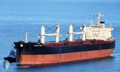
DARYA MIRA
Cargo
Current Trip
| Time Travelled | 1 day |
|---|---|
| Remaining Time | --- |
| Distance Travelled | --- |
| Remaining Distance | --- |
| AVG Speed | --- |
| MAX Speed | --- |
| AVG Wind | --- |
| MAX Wind | --- |
| MIN Temp | --- |
| MAX Temp | --- |
| Осадка | 8.5 м |
| Позиция Получена | 2024-04-12 05:00 |
Current Position
| Долгота | 31.36663° |
|---|---|
| Широта | -29.88997° |
| Статус | Under way using engine |
| Скорость | 6.1 Узлы |
| Курс | 222° |
| Район | Indian Ocean |
| Станция | T-AIS |
| Позиция Получена | 2024-04-12 05:00 |
Info
Information
The current position of DARYA MIRA is in Indian Ocean with coordinates -29.88997° / 31.36663° as reported on 2024-04-12 05:00 by AIS to our vessel tracker app. The vessel's current speed is 6.1 Узлы and is heading at the port of PORT ELIZABETH.
The vessel DARYA MIRA (IMO: 9909089, MMSI: 477714800) is a Cargo It's sailing under the flag of [HK] Hong Kong.
In this page you can find informations about the vessels current position, last detected port calls, and current voyage information. If the vessels is not in coverage by AIS you will find the latest position.
The current position of DARYA MIRA is detected by our AIS receivers and we are not responsible for the reliability of the data. The last position was recorded while the vessel was in Coverage by the Ais receivers of our vessel tracking app.
The current draught of DARYA MIRA as reported by AIS is 8.5 meters
Weather
| Temperature | 29.2°C / 84.56°F |
|---|---|
| Wind Speed | 18 knots |
| Direction | 233° SW |
| Pressure | 1008.1 hPa |
| Humidity | 83.4 % |
| Cloud Coverage | 100 % |
Featured Company
Last Port Calls
| Port | Arrival | Departure | Time In Port |
|---|---|---|---|
| 2024-06-01 07:27 | 2024-06-02 13:42 | 1 d | |
| 2024-05-15 01:57 | 2024-05-21 01:45 | 5 d | |
| 2024-04-20 03:23 | 2024-04-22 10:11 | 2 d | |
| 2024-04-14 03:05 | 2024-04-20 01:55 | 5 d |
Most Visited Ports (Last year)
| Port | Arrivals | |
|---|---|---|
| 2 | ||
| 2 | ||
| 1 | ||
| 1 | ||
| 1 | ||
| 1 |
Last Trips
| Origin | Departure | Destination | Arrival | Distance | |
|---|---|---|---|---|---|
| 2024-05-21 01:45 | 2024-06-01 07:27 | 906.99 морская миля | |||
| 2024-04-22 10:11 | 2024-05-15 01:57 | 4808.02 морская миля | |||
| 2024-04-20 01:55 | 2024-04-20 03:23 | 9.11 морская миля | |||
| 2024-03-29 07:12 | 2024-04-14 03:05 | 4155.72 морская миля |
Events
| Время | Событие | Детали | Позиция / Направление | Информация |
|---|---|---|---|---|
| 2024-06-02 08:12 | ПОРТ ОТПРАВЛЕНИЯ |
|
20.25667 / 86.68667
ZA PLZ
|
Скорость: 5 kn Курс: -1° |
| 2024-06-02 08:03 | Начало движения |
20.26500 / 86.67500
[IN] PARADIP
|
Скорость: 4 kn Курс: -1° |
|
| 2024-06-01 02:36 | Окончание движения |
20.27102 / 86.67649
[IN] PARADIP
|
Скорость: Курс: 208° |
|
| 2024-06-01 01:57 | Порт |
|
20.26500 / 86.67500
[IN] PARADIP
|
Скорость: 9 kn Курс: 298° |
| 2024-06-01 00:15 | Начало движения | 10.93 nm, South East of PARADIP |
20.15667 / 86.82833
ZA PLZ
|
Скорость: 8 kn Курс: 322° |
| 2024-05-29 13:30 | Окончание движения | 11.81 nm, South East of PARADIP |
20.14500 / 86.83833
ZA PLZ
|
Скорость: Курс: -1° |
| 2024-05-28 04:29 | Начало движения |
19.97275 / 86.90746
ZA PLZ
|
Скорость: 3.6 kn Курс: 229° |
|
| 2024-05-28 02:12 | Окончание движения | 19.78 nm, South East of PARADIP |
20.01833 / 86.90500
ZA PLZ
|
Скорость: Курс: -1° |
| 2024-05-28 00:59 | Начало движения | 18.97 nm, South East of PARADIP |
20.04593 / 86.91478
ZA PLZ
|
Скорость: 3.7 kn Курс: 217° |
| 2024-05-27 20:27 | Окончание движения | 14.95 nm, South East of PARADIP |
20.12100 / 86.88883
ZA PLZ
|
Скорость: 0.3 kn Курс: 165° |