
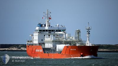
CORAL STAR
Tanker D
Current Trip
| Trip Time | 19 days |
|---|---|
| Trip Distance | 540.94 морская миля |
| AVG Speed | 9.2 Узлы |
| MAX Speed | 13.2 Узлы |
| Осадка | 6 м |
| AVG Wind | 9.6 knots |
| MAX Wind | 35.6 knots |
| MIN Temp | 7.4°C / 45.32°F |
| MAX Temp | 21.6°C / 70.88°F |
| Позиция Получена | 1 d тому назад |
Current Position
| Долгота | 4.95523° |
|---|---|
| Широта | 43.40106° |
| Статус | At anchor |
| Скорость | |
| Курс | 162° |
| Район | Mediterranean Sea - Western Basin |
| Станция | T-AIS |
| Позиция Получена | 1 d тому назад |
Info
Information
The current position of CORAL STAR is in Mediterranean Sea - Western Basin with coordinates 43.40106° / 4.95523° as reported on 2024-05-05 03:37 by AIS to our vessel tracker app. The vessel's current speed is 0 Узлы and is currently inside the port of LAVERA.
The vessel CORAL STAR (IMO: 9685499, MMSI: 244790522) is a Tanker D It's sailing under the flag of [NL] Netherlands.
In this page you can find informations about the vessels current position, last detected port calls, and current voyage information. If the vessels is not in coverage by AIS you will find the latest position.
The current position of CORAL STAR is detected by our AIS receivers and we are not responsible for the reliability of the data. The last position was recorded while the vessel was in Coverage by the Ais receivers of our vessel tracking app.
The current draught of CORAL STAR as reported by AIS is 6 meters
Weather
| Temperature | 15.7°C / 60.26°F |
|---|---|
| Wind Speed | 11 knots |
| Direction | 349° N |
| Pressure | 1012 hPa |
| Humidity | 71.5 % |
| Cloud Coverage | 97 % |
Featured Company
Last Trips
| Origin | Departure | Destination | Arrival | Distance | |
|---|---|---|---|---|---|
| 2024-04-16 22:19 | 2024-05-06 00:01 | 540.94 морская миля | |||
| 2024-03-14 21:01 | 2024-04-15 19:55 | 611.97 морская миля | |||
| 2024-03-03 21:21 | 2024-03-13 09:57 | 519.36 морская миля | |||
| 2024-02-28 23:34 | 2024-03-02 20:44 | 522.88 морская миля |
Events
| Время | Событие | Детали | Позиция / Направление | Информация |
|---|---|---|---|---|
| 2024-05-05 22:01 | Окончание движения |
43.39639 / 4.99172
[FR] LAVERA
|
Скорость: Курс: 319° |
|
| 2024-05-05 22:01 | Порт |
|
43.39639 / 4.99172
[FR] LAVERA
|
Скорость: 0.9 kn Курс: 327° |
| 2024-05-05 21:05 | Начало движения | 1.14 nm, West of PORT DE BOUC |
43.39582 / 4.95788
FR LAV
|
Скорость: 5.5 kn Курс: 143° |
| 2024-05-05 03:43 | Статус изменился | Default At anchor |
43.40104 / 4.95529
FR LAV
|
Скорость: Курс: 162° |
| 2024-05-05 03:37 | Статус изменился | At anchor Default |
43.40106 / 4.95523
FR LAV
|
Скорость: Курс: 174° |
| 2024-05-05 03:37 | Вне покрытия |
43.40106 / 4.95523
Mediterranean Sea - Western Basin
|
Скорость: Курс: 83.8° |
|
| 2024-05-05 03:28 | В покрытии |
43.40106 / 4.95523
Mediterranean Sea - Western Basin
|
Скорость: Курс: 83.8° |
|
| 2024-05-05 00:43 | Статус изменился | Default At anchor |
43.40099 / 4.95496
FR LAV
|
Скорость: Курс: 138° |
| 2024-05-05 00:37 | Статус изменился | At anchor Default |
43.40094 / 4.95496
FR LAV
|
Скорость: Курс: 141° |
| 2024-05-05 00:37 | Вне покрытия |
43.40094 / 4.95496
Mediterranean Sea - Western Basin
|
Скорость: Курс: 83.8° |