
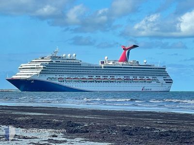
CARNIVAL LIBERTY
Passengers Ship
Current Trip
| Time Travelled | 1 day |
|---|---|
| Remaining Time | 1 day |
| Distance Travelled | 392.18 морская миля |
| Remaining Distance | 646.41 морская миля |
| AVG Speed | 15.8 Узлы |
| MAX Speed | 18.7 Узлы |
| AVG Wind | 14.8 knots |
| MAX Wind | 18.8 knots |
| MIN Temp | 24.4°C / 75.92°F |
| MAX Temp | 28.7°C / 83.66°F |
| Осадка | 8.3 м |
| Позиция Получена | 10 h, 26 m тому назад |
Current Position
| Долгота | -88.16267° |
|---|---|
| Широта | 26.68402° |
| Статус | Under way using engine |
| Скорость | 17.3 Узлы |
| Курс | 159.4° |
| Район | Gulf of Mexico |
| Станция | T-AIS |
| Позиция Получена | 10 h, 26 m тому назад |
Info
Information
The current position of CARNIVAL LIBERTY is in Gulf of Mexico with coordinates 26.68402° / -88.16267° as reported on 2024-05-13 13:14 by AIS to our vessel tracker app. The vessel's current speed is 17.3 Узлы and is heading at the port of MONTEGO BAY. The estimated time of arrival as calculated by MyShipTracking vessel tracking app is 2024-05-15 09:59 LT
The vessel CARNIVAL LIBERTY (IMO: 9278181, MMSI: 371083000) is a Passengers Ship that was built in 2005 ( 19 лет ). It's sailing under the flag of [PA] Panama.
In this page you can find informations about the vessels current position, last detected port calls, and current voyage information. If the vessels is not in coverage by AIS you will find the latest position.
The current position of CARNIVAL LIBERTY is detected by our AIS receivers and we are not responsible for the reliability of the data. The last position was recorded while the vessel was in Coverage by the Ais receivers of our vessel tracking app.
The current draught of CARNIVAL LIBERTY as reported by AIS is 8.3 meters
Weather
| Temperature | 28.3°C / 82.94°F |
|---|---|
| Wind Speed | 14 knots |
| Direction | 157° SSE |
| Pressure | 1010.3 hPa |
| Humidity | 79.7 % |
| Cloud Coverage | 100 % |
Featured Company
Last Port Calls
| Port | Arrival | Departure | Time In Port |
|---|---|---|---|
| 2024-05-12 03:00 | 2024-05-12 18:05 | 15 h | |
| 2024-05-10 07:15 | 2024-05-10 16:12 | 8 h | |
| 2024-05-09 06:46 | 2024-05-09 16:38 | 9 h | |
| 2024-05-08 12:14 | 2024-05-08 20:09 | 7 h | |
| 2024-05-06 02:55 | 2024-05-06 17:23 | 14 h | |
| 2024-05-03 05:52 | 2024-05-03 13:22 | 7 h | |
| 2024-05-01 06:42 | 2024-05-01 16:23 | 9 h | |
| 2024-04-29 05:28 | 2024-04-29 15:31 | 10 h | |
| 2024-04-27 09:10 | 2024-04-27 18:59 | 9 h | |
| 2024-04-26 05:52 | 2024-04-26 15:20 | 9 h |
Most Visited Ports (Last year)
| Port | Arrivals | |
|---|---|---|
| 102 | ||
| 73 | ||
| 36 | ||
| 2 | ||
| 1 | ||
| 1 |
Last Trips
| Origin | Departure | Destination | Arrival | Distance | |
|---|---|---|---|---|---|
| 2024-05-10 16:12 | 2024-05-12 03:00 | 622.30 морская миля | |||
| 2024-05-09 16:38 | 2024-05-10 07:15 | 221.40 морская миля | |||
| 2024-05-08 20:09 | 2024-05-09 06:46 | 145.73 морская миля | |||
| 2024-05-06 17:23 | 2024-05-08 12:14 | 736.00 морская миля | |||
| 2024-05-03 13:22 | 2024-05-06 02:55 | 913.56 морская миля | |||
| 2024-05-01 16:23 | 2024-05-03 05:52 | 370.54 морская миля | |||
| 2024-04-29 15:31 | 2024-05-01 06:42 | 317.13 морская миля | |||
| 2024-04-27 18:59 | 2024-04-29 05:28 | 303.05 морская миля | |||
| 2024-04-26 15:20 | 2024-04-27 09:10 | 273.73 морская миля | |||
| 2024-04-24 17:12 | 2024-04-26 05:52 | 382.09 морская миля |
Events
| Время | Событие | Детали | Позиция / Направление | Информация |
|---|---|---|---|---|
| 2024-05-13 13:20 | Статус изменился | Default Under way using engine |
26.65833 / -88.15166
USNOLA>JMMBJ
|
Скорость: 17.3 kn Курс: 159.4° |
| 2024-05-13 13:14 | Вне покрытия |
26.68402 / -88.16267
Gulf of Mexico
USNOLA>JMMBJ
|
Скорость: 17.3 kn Курс: 159.4° |
|
| 2024-05-13 13:04 | Статус изменился | Under way using engine Default |
26.72761 / -88.18154
USNOLA>JMMBJ
|
Скорость: 17 kn Курс: 159° |
| 2024-05-13 12:42 | Статус изменился | Default Under way using engine |
26.82506 / -88.23650
USNOLA>JMMBJ
|
Скорость: 17.9 kn Курс: 152.7° |
| 2024-05-13 12:23 | Статус изменился | Under way using engine Default |
26.90707 / -88.28400
USNOLA>JMMBJ
|
Скорость: 18 kn Курс: 150° |
| 2024-05-13 12:16 | В покрытии |
26.90707 / -88.28400
Gulf of Mexico
USNOLA>JMMBJ
|
Скорость: 17.9 kn Курс: 152.5° |
|
| 2024-05-13 11:01 | Статус изменился | Default Under way using engine |
27.26500 / -88.49667
USNOLA>JMMBJ
|
Скорость: 17.8 kn Курс: 151.9° |
| 2024-05-13 10:58 | Вне покрытия |
27.27989 / -88.50536
Gulf of Mexico
USNOLA>JMMBJ
|
Скорость: 17.8 kn Курс: 151.9° |
|
| 2024-05-13 10:57 | Статус изменился | Under way using engine Default |
27.28336 / -88.50732
USNOLA>JMMBJ
|
Скорость: 18 kn Курс: 143° |
| 2024-05-13 10:18 | Статус изменился | Default Under way using engine |
27.43988 / -88.63748
USNOLA>JMMBJ
|
Скорость: 17.9 kn Курс: 141.9° |