
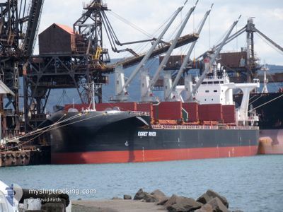
EGRET RIVER
Cargo
Current Trip
CN DAG
| Time Travelled | 7 days |
|---|---|
| Remaining Time | --- |
| Distance Travelled | 774.21 морская миля |
| Remaining Distance | --- |
| AVG Speed | 11.2 Узлы |
| MAX Speed | 14.6 Узлы |
| AVG Wind | 10.8 knots |
| MAX Wind | 22.2 knots |
| MIN Temp | 9°C / 48.2°F |
| MAX Temp | 16.6°C / 61.88°F |
| Осадка | 12.7 м |
| Позиция Получена | 6 d тому назад |
Current Position
| Долгота | 123.60331° |
|---|---|
| Широта | 34.97202° |
| Статус | Under way using engine |
| Скорость | 12.3 Узлы |
| Курс | 172.8° |
| Район | Yellow Sea |
| Станция | T-AIS |
| Позиция Получена | 6 d тому назад |
Info
Information
The current position of EGRET RIVER is in Yellow Sea with coordinates 34.97202° / 123.60331° as reported on 2024-04-28 01:23 by AIS to our vessel tracker app. The vessel's current speed is 12.3 Узлы
The vessel EGRET RIVER (IMO: 9708978, MMSI: 353156000) is a Cargo It's sailing under the flag of [PA] Panama.
In this page you can find informations about the vessels current position, last detected port calls, and current voyage information. If the vessels is not in coverage by AIS you will find the latest position.
The current position of EGRET RIVER is detected by our AIS receivers and we are not responsible for the reliability of the data. The last position was recorded while the vessel was in Coverage by the Ais receivers of our vessel tracking app.
The current draught of EGRET RIVER as reported by AIS is 12.7 meters
Weather
| Temperature | 15.7°C / 60.26°F |
|---|---|
| Wind Speed | 6 knots |
| Direction | 128° SE |
| Pressure | 1012.8 hPa |
| Humidity | 80.8 % |
| Cloud Coverage | 100 % |
Featured Company
Last Port Calls
| Port | Arrival | Departure | Time In Port |
|---|---|---|---|
| 2024-04-25 07:12 | 2024-04-26 14:24 | 1 d | |
| 2024-03-19 10:45 | 2024-03-23 04:59 | 3 d | |
| 2024-03-14 05:44 | 2024-03-17 02:27 | 2 d | |
| 2024-03-05 20:12 |
Last Trips
| Origin | Departure | Destination | Arrival | Distance | |
|---|---|---|---|---|---|
| 2024-03-23 15:29 | 2024-04-25 15:12 | 6174.32 морская миля | |||
| 2024-03-17 12:57 | 2024-03-19 21:15 | 149.74 морская миля | |||
| 2024-03-06 07:12 | 2024-03-14 16:14 | 1189.35 морская миля |
Events
| Время | Событие | Детали | Позиция / Направление | Информация |
|---|---|---|---|---|
| 2024-05-04 04:00 | Начало движения | 8.67 nm, North West of SHANGHAI |
31.44717 / 121.46549
CN DAG
|
Скорость: 6.6 kn Курс: 344° |
| 2024-05-02 01:35 | Окончание движения | 8.03 nm, North West of SHANGHAI |
31.43349 / 121.47019
CN DAG
|
Скорость: Курс: 311° |
| 2024-05-01 15:52 | Начало движения |
31.04213 / 122.83336
CN DAG
|
Скорость: 3.7 kn Курс: 310° |
|
| 2024-04-28 23:22 | Окончание движения |
31.03833 / 122.83833
CN DAG
|
Скорость: Курс: -1° |
|
| 2024-04-28 01:28 | Статус изменился | Default Under way using engine |
34.95500 / 123.60500
CN DAG
|
Скорость: 12.3 kn Курс: 172.8° |
| 2024-04-28 01:23 | Вне покрытия |
34.97202 / 123.60331
Yellow Sea
|
Скорость: 12.3 kn Курс: 172.8° |
|
| 2024-04-28 01:19 | Изменение морского района | South Korean part of the Yellow Sea Chinese part of the Yellow Sea |
34.98630 / 123.60132
Yellow Sea
|
Скорость: 12.5 kn Курс: 172.8° |
| 2024-04-28 01:19 | Статус изменился | Under way using engine Default |
34.98630 / 123.60132
CN DAG
|
Скорость: 12.6 kn Курс: 167° |
| 2024-04-28 01:19 | В покрытии |
34.98630 / 123.60132
Yellow Sea
|
Скорость: 12.5 kn Курс: 172.8° |
|
| 2024-04-27 21:14 | Вне покрытия |
35.79340 / 123.27939
Yellow Sea
|
Скорость: 12.3 kn Курс: 142° |