
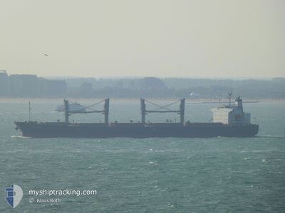
ASIA STAR
Bulk Carrier
Current Trip
| Time Travelled | 28 days |
|---|---|
| Remaining Time | 11 h, 11 mins |
| Distance Travelled | 6123.26 морская миля |
| Remaining Distance | 143.84 морская миля |
| AVG Speed | 9.6 Узлы |
| MAX Speed | 13.1 Узлы |
| AVG Wind | 20 knots |
| MAX Wind | 36 knots |
| MIN Temp | 7.6°C / 45.68°F |
| MAX Temp | 29.2°C / 84.56°F |
| Осадка | 12.5 м |
| Позиция Получена | 3 h, 17 m тому назад |
Current Position
| Долгота | --- |
|---|---|
| Широта | --- |
| Статус | Under way using engine |
| Скорость | 10.2 Узлы |
| Курс | 50.7° |
| Район | Sea of Marmara |
| Станция | T-AIS |
| Позиция Получена | 3 h, 17 m тому назад |
Info
Information
The current position of ASIA STAR is in Sea of Marmara with coordinates 40.28320° / 26.56151° as reported on 2026-01-05 23:27 by AIS to our vessel tracker app. The vessel's current speed is 10.2 Узлы and is heading at the port of DILISKELESI. The estimated time of arrival as calculated by MyShipTracking vessel tracking app is 2026-01-06 16:56 LT
The vessel ASIA STAR (IMO: 9284477, MMSI: 538003048) is a Bulk Carrier that was built in 2003 ( 23 лет ). It's sailing under the flag of [MH] Marshall Is.
In this page you can find informations about the vessels current position, last detected port calls, and current voyage information. If the vessels is not in coverage by AIS you will find the latest position.
The current position of ASIA STAR is detected by our AIS receivers and we are not responsible for the reliability of the data. The last position was recorded while the vessel was in Coverage by the Ais receivers of our vessel tracking app.
The current draught of ASIA STAR as reported by AIS is 12.5 meters
Weather
| Temperature | 12.3°C / 54.14°F |
|---|---|
| Wind Speed | 5 knots |
| Direction | 140° SE |
| Pressure | 1015.1 hPa |
| Humidity | 78.1 % |
| Cloud Coverage | 99 % |
Featured Company
Last Port Calls
| Port | Arrival | Departure | Time In Port |
|---|---|---|---|
| 2025-12-30 07:18 | 2025-12-31 00:56 | 17 h | |
| 2025-12-02 20:33 | 2025-12-09 00:33 | 6 d |
Most Visited Ports (Last year)
| Port | Arrivals | |
|---|---|---|
| 12 | ||
| 5 | ||
| 3 | ||
| 2 | ||
| 1 | ||
| 1 |
Last Trips
| Origin | Departure | Destination | Arrival | Distance | |
|---|---|---|---|---|---|
| 2025-12-09 00:33 | 2025-12-30 07:18 | 5255.41 морская миля | |||
| 2025-09-24 21:28 | 2025-12-02 20:33 | 5393.91 морская миля |
Events
| Время | Событие | Детали | Позиция / Направление | Информация |
|---|---|---|---|---|
| 2026-01-05 23:28 | Статус изменился | Default Under way using engine |
40.28402 / 26.56287
DILISKELESI
|
Скорость: 10.2 kn Курс: 50.7° |
| 2026-01-05 23:27 | Вне покрытия |
40.28320 / 26.56151
Sea of Marmara
DILISKELESI
|
Скорость: 10.2 kn Курс: 50.7° |
|
| 2026-01-05 20:59 | Изменение морского района | Turkish part of the Sea of Marmara Turkish part of the Aegean Sea |
40.02088 / 26.19737
Sea of Marmara
DILISKELESI
|
Скорость: 8.4 kn Курс: 68.4° |
| 2026-01-05 20:57 | ETA изменился | 2026/01/06 16:30 2026/01/06 08:00 |
40.01899 / 26.19071
DILISKELESI
|
Скорость: 8.3 kn Курс: 69.4° |
| 2026-01-05 20:24 | Статус изменился | Under way using engine Default |
40.00319 / 26.12706
DILISKELESI
|
Скорость: 4.8 kn Курс: 76° |
| 2026-01-05 20:15 | Статус изменился | Default Under way using engine |
40.00005 / 26.11178
DILISKELESI
|
Скорость: 4.4 kn Курс: 74° |
| 2026-01-05 19:52 | Изменение морского района | Turkish part of the Aegean Sea Greek part of the Aegean Sea |
39.99099 / 26.07540
Aegean Sea
DILISKELESI
|
Скорость: 4.1 kn Курс: 89.7° |
| 2026-01-05 19:52 | Статус изменился | Under way using engine Default |
39.99099 / 26.07540
DILISKELESI
|
Скорость: 4.2 kn Курс: 76° |
| 2026-01-05 19:52 | В покрытии |
39.99099 / 26.07540
Aegean Sea
DILISKELESI
|
Скорость: 4.1 kn Курс: 89.7° |
|
| 2026-01-05 16:21 | Вне покрытия |
39.79081 / 25.85251
Aegean Sea
DILISKELESI
|
Скорость: 5 kn Курс: 324.2° |