
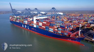
APL VANDA
Container Ship
Current Trip
| Time Travelled | 26 days |
|---|---|
| Remaining Time | 7 h, 51 mins |
| Distance Travelled | 10599.12 морская миля |
| Remaining Distance | 141.78 морская миля |
| AVG Speed | 16.8 Узлы |
| MAX Speed | 21.7 Узлы |
| AVG Wind | 12.4 knots |
| MAX Wind | 27.8 knots |
| MIN Temp | 13.9°C / 57.02°F |
| MAX Temp | 28.3°C / 82.94°F |
| Осадка | 16.3 м |
| Позиция Получена | 2 h, 18 m тому назад |
Current Position
| Долгота | --- |
|---|---|
| Широта | --- |
| Статус | Under way using engine |
| Скорость | 13.3 Узлы |
| Курс | 42° |
| Район | North Atlantic Ocean |
| Станция | T-AIS |
| Позиция Получена | 2 h, 18 m тому назад |
Info
Information
The current position of APL VANDA is in North Atlantic Ocean with coordinates 34.57619° / -7.75642° as reported on 2026-01-07 13:16 by AIS to our vessel tracker app. The vessel's current speed is 13.3 Узлы and is heading at the port of TANGER MED. The estimated time of arrival as calculated by MyShipTracking vessel tracking app is 2026-01-08 00:26 LT
The vessel APL VANDA (IMO: 9631993, MMSI: 566954000) is a Container Ship that was built in 2013 ( 13 лет ). It's sailing under the flag of [SG] Singapore.
In this page you can find informations about the vessels current position, last detected port calls, and current voyage information. If the vessels is not in coverage by AIS you will find the latest position.
The current position of APL VANDA is detected by our AIS receivers and we are not responsible for the reliability of the data. The last position was recorded while the vessel was in Coverage by the Ais receivers of our vessel tracking app.
The current draught of APL VANDA as reported by AIS is 16.3 meters
Weather
| Temperature | 14°C / 57.2°F |
|---|---|
| Wind Speed | 10 knots |
| Direction | 282° WNW |
| Pressure | 1028.2 hPa |
| Humidity | 63.8 % |
| Cloud Coverage | 78 % |
Featured Company
Last Port Calls
| Port | Arrival | Departure | Time In Port |
|---|---|---|---|
| 2025-12-11 22:25 | 2025-12-12 17:34 | 19 h | |
| 2025-12-06 22:57 | 2025-12-08 01:25 | 1 d | |
| 2025-12-02 23:39 | 2025-12-04 03:17 | 1 d | |
| 2025-11-18 02:45 | 2025-11-19 01:24 | 22 h |
Most Visited Ports (Last year)
| Port | Arrivals | |
|---|---|---|
| 4 | ||
| 4 | ||
| 4 | ||
| 3 | ||
| 3 | ||
| 3 |
Last Trips
| Origin | Departure | Destination | Arrival | Distance | |
|---|---|---|---|---|---|
| 2025-12-08 01:25 | 2025-12-11 22:25 | 1466.34 морская миля | |||
| 2025-12-04 03:17 | 2025-12-06 22:57 | 828.84 морская миля | |||
| 2025-11-19 01:24 | 2025-12-02 23:39 | 2593.67 морская миля | |||
| 2025-10-10 07:31 | 2025-11-18 02:45 | 11613.07 морская миля |
Events
| Время | Событие | Детали | Позиция / Направление | Информация |
|---|---|---|---|---|
| 2026-01-07 13:20 | Статус изменился | Default Under way using engine |
34.58529 / -7.74634
MAPTM
|
Скорость: 13.3 kn Курс: 42° |
| 2026-01-07 13:16 | Вне покрытия |
34.57619 / -7.75642
North Atlantic Ocean
|
Скорость: 13.3 kn Курс: 42° |
|
| 2026-01-07 12:48 | Статус изменился | Under way using engine Default |
34.49884 / -7.84959
MAPTM
|
Скорость: 13.3 kn Курс: 50° |
| 2026-01-07 12:43 | В покрытии |
34.49884 / -7.84959
North Atlantic Ocean
|
Скорость: 13.3 kn Курс: 49.6° |
|
| 2026-01-07 11:53 | Статус изменился | Default Under way using engine |
34.35172 / -8.02547
MAPTM
|
Скорость: 14.6 kn Курс: 43.7° |
| 2026-01-07 11:46 | Вне покрытия |
34.33010 / -8.05043
North Atlantic Ocean
|
Скорость: 14.6 kn Курс: 43.7° |
|
| 2026-01-07 09:33 | Обнаружено в море | Moroccan part of the North Atlantic Ocean |
33.93586 / -8.47459
North Atlantic Ocean
|
Скорость: 14.1 kn Курс: 41.5° |
| 2026-01-07 09:32 | Статус изменился | Under way using engine Default |
33.93087 / -8.47980
MAPTM
|
Скорость: 14.1 kn Курс: 40° |
| 2026-01-07 09:15 | В покрытии |
33.93586 / -8.47459
North Atlantic Ocean
|
Скорость: 14.1 kn Курс: 41.5° |
|
| 2026-01-05 22:25 | Вне покрытия |
28.51652 / -13.28268
North Atlantic Ocean
MAPTM
|
Скорость: 6.8 kn Курс: 30.3° |