
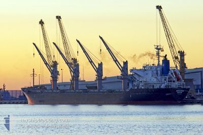
AMIRA SARA
Cargo
Current Trip
| Time Travelled | 2 days |
|---|---|
| Remaining Time | 20 h, 12 mins |
| Distance Travelled | 87.38 морская миля |
| Remaining Distance | 244.40 морская миля |
| AVG Speed | 8.4 Узлы |
| MAX Speed | 13.1 Узлы |
| AVG Wind | 4.3 knots |
| MAX Wind | 7.9 knots |
| MIN Temp | 20.3°C / 68.54°F |
| MAX Temp | 27°C / 80.6°F |
| Осадка | 5.2 м |
| Позиция Получена | 1 m тому назад |
Current Position
| Долгота | 29.10889° |
|---|---|
| Широта | 41.20188° |
| Статус | Under way using engine |
| Скорость | 7.4 Узлы |
| Курс | 36.9° |
| Район | Sea of Marmara |
| Станция | T-AIS |
| Позиция Получена | 1 m тому назад |
Info
Information
The current position of AMIRA SARA is in Sea of Marmara with coordinates 41.20188° / 29.10889° as reported on 2024-06-05 00:07 by AIS to our vessel tracker app. The vessel's current speed is 7.4 Узлы and is heading at the port of SULINA. The estimated time of arrival as calculated by MyShipTracking vessel tracking app is 2024-06-05 23:21 LT
The vessel AMIRA SARA (IMO: 9691503, MMSI: 314573000) is a Cargo It's sailing under the flag of [BB] Barbados.
In this page you can find informations about the vessels current position, last detected port calls, and current voyage information. If the vessels is not in coverage by AIS you will find the latest position.
The current position of AMIRA SARA is detected by our AIS receivers and we are not responsible for the reliability of the data. The last position was recorded while the vessel was in Coverage by the Ais receivers of our vessel tracking app.
The current draught of AMIRA SARA as reported by AIS is 5.2 meters
Weather
| Temperature | 22°C / 71.6°F |
|---|---|
| Wind Speed | 7 knots |
| Direction | 240° WSW |
| Pressure | 1010.8 hPa |
| Humidity | 62.5 % |
| Cloud Coverage | 2 % |
Featured Company
Most Visited Ports (Last year)
| Port | Arrivals | |
|---|---|---|
| 4 | ||
| 2 | ||
| 1 | ||
| 1 | ||
| 1 | ||
| 1 |
Last Trips
| Origin | Departure | Destination | Arrival | Distance | |
|---|---|---|---|---|---|
| 2024-05-17 15:56 | 2024-05-28 21:28 | 1121.52 морская миля | |||
| 2024-04-29 08:54 | 2024-05-10 17:48 | 1517.99 морская миля | |||
| 2024-04-10 20:36 | 2024-04-26 18:56 | 1443.32 морская миля | |||
| 2024-03-28 00:19 | 2024-04-10 19:02 | 3347.12 морская миля |
Events
| Время | Событие | Детали | Позиция / Направление | Информация |
|---|---|---|---|---|
| 2024-06-04 20:56 | Начало движения | 12.6 nm, West of YALOVA |
40.71434 / 29.00793
SULINA
|
Скорость: 3.1 kn Курс: 136° |
| 2024-06-04 15:32 | Окончание движения | 11.73 nm, South West of MALTEPE |
40.76129 / 28.96968
SULINA
|
Скорость: 0.3 kn Курс: 205° |
| 2024-06-03 22:26 | ETA изменился | 2024/06/06 12:00 2025/05/22 01:00 |
40.82443 / 29.06411
SULINA
|
Скорость: 12.5 kn Курс: 286° |
| 2024-06-03 21:39 | Начало движения | 1.51 nm, South West of TUZLA |
40.81656 / 29.24106
SULINA
|
Скорость: 3.2 kn Курс: 273° |
| 2024-06-03 21:26 | Пункт назначения изменился | SULINA TR TUZ |
40.81468 / 29.24349
SULINA
|
Скорость: 1.9 kn Курс: 5° |
| 2024-06-03 21:25 | Статус изменился | Under way using engine At anchor |
40.81544 / 29.24361
TR TUZ
|
Скорость: 2.6 kn Курс: 1° |
| 2024-06-03 21:22 | Статус изменился | At anchor Default |
40.81698 / 29.24375
TR TUZ
|
Скорость: 1.8 kn Курс: 5° |
| 2024-06-03 21:19 | Статус изменился | Default At anchor |
40.81892 / 29.24397
TR TUZ
|
Скорость: 0.3 kn Курс: 13° |
| 2024-06-03 20:30 | Статус изменился | At anchor Default |
40.81840 / 29.24293
TR TUZ
|
Скорость: 0.1 kn Курс: 29° |
| 2024-06-03 20:27 | Статус изменился | Default At anchor |
40.81842 / 29.24288
TR TUZ
|
Скорость: 0.1 kn Курс: 32° |