
AETERNO
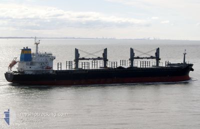
Bulk Carrier
Current Trip
| Time Travelled | 11 days |
|---|---|
| Remaining Time | 15 days |
| Distance Travelled | 2581.33 морская миля |
| Remaining Distance | 4180.51 морская миля |
| AVG Speed | 10.6 Узлы |
| MAX Speed | 13.2 Узлы |
| AVG Wind | 9 knots |
| MAX Wind | 25 knots |
| MIN Temp | 13.3°C / 55.94°F |
| MAX Temp | 24.1°C / 75.38°F |
| Осадка | 9.7 м |
| Позиция Получена | 8 m тому назад |
Current Position
| Долгота | -8.66920° |
|---|---|
| Широта | 33.78140° |
| Статус | Under way using engine |
| Скорость | 11.1 Узлы |
| Курс | 221.8° |
| Район | North Atlantic Ocean |
| Станция | T-AIS |
| Позиция Получена | 8 m тому назад |
Info
Information
The current position of AETERNO is in North Atlantic Ocean with coordinates 33.78140° / -8.66920° as reported on 2024-06-01 04:28 by AIS to our vessel tracker app. The vessel's current speed is 11.1 Узлы and is heading at the port of SANTOS. The estimated time of arrival as calculated by MyShipTracking vessel tracking app is 2024-06-16 21:37 LT
The vessel AETERNO (IMO: 9474228, MMSI: 538007976) is a Bulk Carrier that was built in 2011 ( 13 лет ). It's sailing under the flag of [MH] Marshall Is.
In this page you can find informations about the vessels current position, last detected port calls, and current voyage information. If the vessels is not in coverage by AIS you will find the latest position.
The current position of AETERNO is detected by our AIS receivers and we are not responsible for the reliability of the data. The last position was recorded while the vessel was in Coverage by the Ais receivers of our vessel tracking app.
The current draught of AETERNO as reported by AIS is 9.7 meters
Weather
| Temperature | 18.8°C / 65.84°F |
|---|---|
| Wind Speed | 10 knots |
| Direction | 341° NNW |
| Pressure | 1009.2 hPa |
| Humidity | 87.3 % |
| Cloud Coverage | 10 % |
Featured Company
Events
| Время | Событие | Детали | Позиция / Направление | Информация |
|---|---|---|---|---|
| 2024-06-01 04:27 | Статус изменился | Under way using engine Default |
33.78215 / -8.66836
SANTOS BRAZIL
|
Скорость: 11 kn Курс: 224° |
| 2024-06-01 04:09 | Статус изменился | Default Under way using engine |
33.82333 / -8.62000
SANTOS BRAZIL
|
Скорость: 10.9 kn Курс: 227° |
| 2024-06-01 04:05 | Статус изменился | Under way using engine Default |
33.83215 / -8.61208
SANTOS BRAZIL
|
Скорость: 11.1 kn Курс: 229° |
| 2024-06-01 03:54 | Статус изменился | Default Under way using engine |
33.85667 / -8.58333
SANTOS BRAZIL
|
Скорость: 11 kn Курс: 217° |
| 2024-06-01 03:27 | Статус изменился | Under way using engine Default |
33.91810 / -8.51684
SANTOS BRAZIL
|
Скорость: 11 kn Курс: 219° |
| 2024-06-01 03:15 | Статус изменился | Default Under way using engine |
33.94500 / -8.48500
SANTOS BRAZIL
|
Скорость: 11 kn Курс: 218.1° |
| 2024-05-31 20:13 | Статус изменился | Under way using engine Default |
34.91279 / -7.41219
SANTOS BRAZIL
|
Скорость: 11.3 kn Курс: 223° |
| 2024-05-31 20:12 | Статус изменился | Default Under way using engine |
34.91543 / -7.40908
SANTOS BRAZIL
|
Скорость: 11.4 kn Курс: 218.1° |
| 2024-05-31 17:42 | Статус изменился | Under way using engine Default |
35.26604 / -7.02022
SANTOS BRAZIL
|
Скорость: 11 kn Курс: 220° |
| 2024-05-31 17:33 | Статус изменился | Default Under way using engine |
35.28667 / -6.99667
SANTOS BRAZIL
|
Скорость: 11.2 kn Курс: 224.9° |