
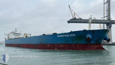
ADVANTAGE SUN
Crude Oil Tanker
Current Trip
ESLPA>NGODU
| Time Travelled | 9 days |
|---|---|
| Remaining Time | --- |
| Distance Travelled | 2794.28 морская миля |
| Remaining Distance | --- |
| AVG Speed | 13.1 Узлы |
| MAX Speed | 15.2 Узлы |
| AVG Wind | 13.5 knots |
| MAX Wind | 37.8 knots |
| MIN Temp | 12.2°C / 53.96°F |
| MAX Temp | 29.1°C / 84.38°F |
| Осадка | 9.4 м |
| Позиция Получена | 1 d тому назад |
Current Position
| Долгота | -18.98045° |
|---|---|
| Широта | 9.60582° |
| Статус | Under way using engine |
| Скорость | 14 Узлы |
| Курс | 137.5° |
| Район | North Atlantic Ocean |
| Станция | T-AIS |
| Позиция Получена | 1 d тому назад |
Info
Information
The current position of ADVANTAGE SUN is in North Atlantic Ocean with coordinates 9.60582° / -18.98045° as reported on 2024-04-29 12:46 by AIS to our vessel tracker app. The vessel's current speed is 14 Узлы
The vessel ADVANTAGE SUN (IMO: 9513141, MMSI: 538006201) is a Crude Oil Tanker that was built in 2012 ( 12 лет ). It's sailing under the flag of [MH] Marshall Is.
In this page you can find informations about the vessels current position, last detected port calls, and current voyage information. If the vessels is not in coverage by AIS you will find the latest position.
The current position of ADVANTAGE SUN is detected by our AIS receivers and we are not responsible for the reliability of the data. The last position was recorded while the vessel was in Coverage by the Ais receivers of our vessel tracking app.
The current draught of ADVANTAGE SUN as reported by AIS is 9.4 meters
Weather
| Temperature | 28.7°C / 83.66°F |
|---|---|
| Wind Speed | 5 knots |
| Direction | 223° SW |
| Pressure | 1008.9 hPa |
| Humidity | 74.7 % |
| Cloud Coverage | 100 % |
Featured Company
Last Port Calls
| Port | Arrival | Departure | Time In Port |
|---|---|---|---|
| 2024-04-19 09:24 | 2024-04-21 18:18 | 2 d | |
| 2024-03-19 00:19 | 2024-03-20 23:17 | 1 d | |
| 2024-03-12 17:50 | 2024-03-14 16:49 | 1 d | |
| 2024-03-08 15:06 |
Events
| Время | Событие | Детали | Позиция / Направление | Информация |
|---|---|---|---|---|
| 2024-04-29 12:51 | Статус изменился | Default Under way using engine |
9.59131 / -18.96723
ESLPA>NGODU
|
Скорость: 14 kn Курс: 137.5° |
| 2024-04-29 12:46 | Изменение морского района | Guinea Bissau part of the North Atlantic Ocean Senegalese part of the North Atlantic Ocean |
9.60582 / -18.98045
North Atlantic Ocean
ESLPA>NGODU
|
Скорость: 14 kn Курс: 137.5° |
| 2024-04-29 12:46 | Статус изменился | Under way using engine Default |
9.60582 / -18.98045
ESLPA>NGODU
|
Скорость: 13 kn Курс: 137° |
| 2024-04-29 12:46 | Вне покрытия |
9.60582 / -18.98045
North Atlantic Ocean
ESLPA>NGODU
|
Скорость: 14 kn Курс: 137.5° |
|
| 2024-04-29 12:40 | В покрытии |
9.60582 / -18.98045
North Atlantic Ocean
ESLPA>NGODU
|
Скорость: 14 kn Курс: 137.5° |
|
| 2024-04-29 02:46 | Статус изменился | Default Under way using engine |
11.66500 / -19.50667
ESLPA>NGODU
|
Скорость: 12.7 kn Курс: 179.5° |
| 2024-04-29 02:29 | Вне покрытия |
11.74742 / -19.50628
North Atlantic Ocean
ESLPA>NGODU
|
Скорость: 12.7 kn Курс: 179.5° |
|
| 2024-04-29 01:03 | Статус изменился | Under way using engine Default |
12.03820 / -19.50683
ESLPA>NGODU
|
Скорость: 13 kn Курс: 180° |
| 2024-04-29 00:54 | В покрытии |
12.03820 / -19.50683
North Atlantic Ocean
ESLPA>NGODU
|
Скорость: 13.1 kn Курс: 179.7° |
|
| 2024-04-28 23:57 | Вне покрытия |
12.28046 / -19.50687
North Atlantic Ocean
ESLPA>NGODU
|
Скорость: 13.2 kn Курс: 180° |