
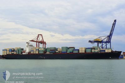
ABYAN
Container Ship
Current Trip
CN ZUH
| Time Travelled | --- |
|---|---|
| Remaining Time | --- |
| Distance Travelled | --- |
| Remaining Distance | --- |
| AVG Speed | --- |
| MAX Speed | --- |
| AVG Wind | --- |
| MAX Wind | --- |
| MIN Temp | --- |
| MAX Temp | --- |
| Осадка | 14 м |
| Позиция Получена | 3 h, 4 m тому назад |
Current Position
| Долгота | 121.01976° |
|---|---|
| Широта | 25.45202° |
| Статус | Under way using engine |
| Скорость | 16.5 Узлы |
| Курс | 200.9° |
| Район | Eastern China Sea |
| Станция | T-AIS |
| Позиция Получена | 3 h, 4 m тому назад |
Info
Information
The current position of ABYAN is in Eastern China Sea with coordinates 25.45202° / 121.01976° as reported on 2024-04-27 13:44 by AIS to our vessel tracker app. The vessel's current speed is 16.5 Узлы
The vessel ABYAN (IMO: 9349667, MMSI: 422031600) is a Container Ship that was built in 2008 ( 16 лет ). It's sailing under the flag of [IR] Iran.
In this page you can find informations about the vessels current position, last detected port calls, and current voyage information. If the vessels is not in coverage by AIS you will find the latest position.
The current position of ABYAN is detected by our AIS receivers and we are not responsible for the reliability of the data. The last position was recorded while the vessel was in Coverage by the Ais receivers of our vessel tracking app.
The current draught of ABYAN as reported by AIS is 14 meters
Weather
| Temperature | 25.8°C / 78.44°F |
|---|---|
| Wind Speed | 6 knots |
| Direction | 210° SSW |
| Pressure | 1009.9 hPa |
| Humidity | 86.2 % |
| Cloud Coverage | 84 % |
Featured Company
Last Trips
| Origin | Departure | Destination | Arrival | Distance | |
|---|---|---|---|---|---|
| 2024-04-05 22:26 | 2024-04-18 16:02 | 4900.95 морская миля | |||
| 2024-03-22 14:33 | 2024-03-31 03:41 | 351.45 морская миля | |||
| 2024-02-19 10:16 | 2024-02-28 11:29 | 1976.72 морская миля | |||
| 2024-02-06 09:48 | 2024-02-17 13:58 | 4306.08 морская миля | |||
| 2024-01-28 23:20 | 2024-02-05 09:20 | 869.56 морская миля |
Events
| Время | Событие | Детали | Позиция / Направление | Информация |
|---|---|---|---|---|
| 2024-04-27 13:51 | Статус изменился | Default Under way using engine |
25.42347 / 121.00454
CN ZUH
|
Скорость: 16.5 kn Курс: 200.9° |
| 2024-04-27 13:44 | Вне покрытия |
25.45202 / 121.01976
Eastern China Sea
|
Скорость: 16.5 kn Курс: 200.9° |
|
| 2024-04-27 13:31 | Изменение морского района | Taiwanese part of the Eastern China Sea Malaysian part of the South China Sea |
25.50533 / 121.04334
Eastern China Sea
|
Скорость: 16.2 kn Курс: 204.2° |
| 2024-04-27 13:31 | Статус изменился | Under way using engine Default |
25.50700 / 121.04417
CN ZUH
|
Скорость: 16.2 kn Курс: 206° |
| 2024-04-27 13:11 | В покрытии |
25.50533 / 121.04334
Eastern China Sea
|
Скорость: 16.2 kn Курс: 204.2° |
|
| 2024-04-23 19:24 | Начало движения |
31.17415 / 123.12799
CN ZUH
|
Скорость: 5.4 kn Курс: 217° |
|
| 2024-04-21 13:51 | Окончание движения |
31.18026 / 123.13139
CN ZUH
|
Скорость: 0.2 kn Курс: 134° |
|
| 2024-04-18 08:02 | Порт |
|
21.93055 / 113.21654
[CN] ZHUHAI
|
Скорость: 10.8 kn Курс: 350° |