
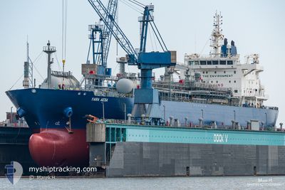
YARA AESA
Tanker
Current Trip
| Time Travelled | 3 days |
|---|---|
| Remaining Time | 6 days |
| Distance Travelled | 1254.79 nm |
| Remaining Distance | 2161.31 nm |
| AVG Speed | 13.4 Knopen |
| MAX Speed | 15.7 Knopen |
| AVG Wind | 14.3 knots |
| MAX Wind | 21 knots |
| MIN Temp | 27°C / 80.6°F |
| MAX Temp | 31.7°C / 89.06°F |
| Diepgang | 8.4 M |
| Positie ontvangen | 3 d geleden |
Current Position
| Lengtegraad | -61.78836° |
|---|---|
| Breedtegraat | 10.68061° |
| Status | Under way using engine |
| Snelheid | 14.7 Knopen |
| Koers | 18.1° |
| Gebied | Caribbean Sea |
| Station | T-AIS |
| Positie ontvangen | 3 d geleden |
Info
Information
The current position of YARA AESA is in Caribbean Sea with coordinates 10.68061° / -61.78836° as reported on 2024-05-28 20:48 by AIS to our vessel tracker app. The vessel's current speed is 14.7 Knopen and is heading at the port of SANTOS. The estimated time of arrival as calculated by MyShipTracking vessel tracking app is 2024-06-07 22:47 LT
The vessel YARA AESA (IMO: 9725495, MMSI: 258914000) is a Tanker It's sailing under the flag of [NO] Norway.
In this page you can find informations about the vessels current position, last detected port calls, and current voyage information. If the vessels is not in coverage by AIS you will find the latest position.
The current position of YARA AESA is detected by our AIS receivers and we are not responsible for the reliability of the data. The last position was recorded while the vessel was in Coverage by the Ais receivers of our vessel tracking app.
The current draught of YARA AESA as reported by AIS is 8.4 meters
Weather
| Temperature | 28.5°C / 83.3°F |
|---|---|
| Wind Speed | 15 knots |
| Direction | 113° ESE |
| Pressure | 1012.8 hPa |
| Humidity | 74.7 % |
| Cloud Coverage | 68 % |
Featured Company
Last Port Calls
| Port | Arrival | Departure | Time In Port |
|---|---|---|---|
| 2024-05-27 18:39 | 2024-05-28 18:39 | 1 d | |
| 2024-05-16 19:33 | 2024-05-16 20:24 | 51 m | |
| 2024-04-29 10:30 | 2024-04-30 13:02 | 1 d |
Most Visited Ports (Last year)
| Port | Arrivals | |
|---|---|---|
| 12 | ||
| 7 | ||
| 2 | ||
| 2 | ||
| 2 | ||
| 1 |
Last Trips
| Origin | Departure | Destination | Arrival | Distance | |
|---|---|---|---|---|---|
| 2024-05-16 17:24 | 2024-05-27 14:39 | 3474.86 nm | |||
| 2024-04-30 09:02 | 2024-05-16 16:33 | 3530.55 nm | |||
| 2024-03-27 16:45 | 2024-04-29 06:30 | 2833.43 nm |
Events
| Tijd | Evenement | Details | Positie / Bestemming | Info |
|---|---|---|---|---|
| 2024-05-31 13:55 | Start beweging |
6.42294 / -48.55463
TTPTS>BRSSZ
|
Snelheid: 6.8 kn Koers: 124° |
|
| 2024-05-31 12:58 | Stop beweging |
6.43931 / -48.55866
TTPTS>BRSSZ
|
Snelheid: 0.3 kn Koers: 135° |
|
| 2024-05-28 20:55 | Status Changed | Default Under way using engine |
10.70500 / -61.77667
TTPTS>BRSSZ
|
Snelheid: 14.7 kn Koers: 18.1° |
| 2024-05-28 20:48 | Buitenbereik |
10.68061 / -61.78836
Caribbean Sea
TTPTS>BRSSZ
|
Snelheid: 14.7 kn Koers: 18.1° |
|
| 2024-05-28 20:25 | Draught Changed | 8.4 7.5 |
10.58438 / -61.78265
TTPTS>BRSSZ
|
Snelheid: 14.3 kn Koers: 344.9° |
| 2024-05-28 20:25 | Destination Changed | TTPTS>BRSSZ BRSSZ>TTPTS |
10.58438 / -61.78265
TTPTS>BRSSZ
|
Snelheid: 14.3 kn Koers: 344.9° |
| 2024-05-28 20:25 | ETA Changed | 2024/06/07 18:00 2024/05/27 18:00 |
10.58438 / -61.78265
TTPTS>BRSSZ
|
Snelheid: 14.3 kn Koers: 344.9° |
| 2024-05-28 19:40 | Status Changed | Under way using engine Default |
10.43777 / -61.67995
BRSSZ>TTPTS
|
Snelheid: 14.2 kn Koers: 302° |
| 2024-05-28 19:32 | Status Changed | Default Under way using engine |
10.41971 / -61.65143
BRSSZ>TTPTS
|
Snelheid: 13.6 kn Koers: 302.7° |
| 2024-05-28 19:25 | Status Changed | Under way using engine Default |
10.40602 / -61.62993
BRSSZ>TTPTS
|
Snelheid: 13.5 kn Koers: 303° |