
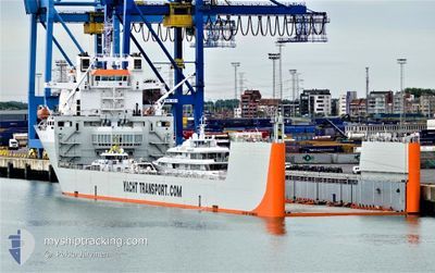
YACHT EXPRESS
Heavy Lift Vessel
Current Trip
| Time Travelled | 8 days |
|---|---|
| Remaining Time | --- |
| Distance Travelled | 2557.16 nm |
| Remaining Distance | --- |
| AVG Speed | 11.9 Knopen |
| MAX Speed | 15.4 Knopen |
| AVG Wind | 14.5 knots |
| MAX Wind | 23 knots |
| MIN Temp | 19°C / 66.2°F |
| MAX Temp | 26°C / 78.8°F |
| Diepgang | 6.6 M |
| Positie ontvangen | 7 d geleden |
Current Position
| Lengtegraad | -73.78829° |
|---|---|
| Breedtegraat | 26.73228° |
| Status | Under way using engine |
| Snelheid | 14.3 Knopen |
| Koers | 81.6° |
| Gebied | North Atlantic Ocean |
| Station | T-AIS |
| Positie ontvangen | 7 d geleden |
Info
Information
The current position of YACHT EXPRESS is in North Atlantic Ocean with coordinates 26.73228° / -73.78829° as reported on 2024-04-23 01:31 by AIS to our vessel tracker app. The vessel's current speed is 14.3 Knopen and is heading at the port of GENOVA. The estimated time of arrival as calculated by MyShipTracking vessel tracking app is 2024-05-07 08:00 LT
The vessel YACHT EXPRESS (IMO: 9346029, MMSI: 244870311) is a Heavy Lift Vessel that was built in 2007 ( 17 Jaar oud ). It's sailing under the flag of [NL] Netherlands.
In this page you can find informations about the vessels current position, last detected port calls, and current voyage information. If the vessels is not in coverage by AIS you will find the latest position.
The current position of YACHT EXPRESS is detected by our AIS receivers and we are not responsible for the reliability of the data. The last position was recorded while the vessel was in Coverage by the Ais receivers of our vessel tracking app.
The current draught of YACHT EXPRESS as reported by AIS is 6.6 meters
Weather
| Temperature | 19.4°C / 66.92°F |
|---|---|
| Wind Speed | 19 knots |
| Direction | 153° SSE |
| Pressure | 1024.2 hPa |
| Humidity | 77.7 % |
| Cloud Coverage | 48 % |
Featured Company
Last Port Calls
| Port | Arrival | Departure | Time In Port |
|---|---|---|---|
| 2024-04-20 00:32 | 2024-04-21 23:12 | 1 d | |
| 2024-03-28 07:09 | 2024-03-29 16:24 | 1 d | |
| 2024-03-06 18:44 | 2024-03-08 23:24 | 2 d | |
| 2024-02-13 23:22 | 2024-02-17 03:50 | 3 d |
Most Visited Ports (Last year)
| Port | Arrivals | |
|---|---|---|
| 5 | ||
| 3 | ||
| 3 | ||
| 3 | ||
| 2 | ||
| 2 |
Last Trips
| Origin | Departure | Destination | Arrival | Distance | |
|---|---|---|---|---|---|
| 2024-03-29 17:24 | 2024-04-19 20:32 | 5110.24 nm | |||
| 2024-03-08 18:24 | 2024-03-28 08:09 | 4925.74 nm | |||
| 2024-02-16 19:50 | 2024-03-06 13:44 | 3992.31 nm | |||
| 2024-01-22 03:29 | 2024-02-13 15:22 | 6584.63 nm |
Events
| Tijd | Evenement | Details | Positie / Bestemming | Info |
|---|---|---|---|---|
| 2024-04-23 01:35 | Status Changed | Default Under way using engine |
26.73333 / -73.76833
IT GOA
|
Snelheid: 14.3 kn Koers: 81.6° |
| 2024-04-23 01:31 | Buitenbereik |
26.73228 / -73.78829
North Atlantic Ocean
IT GOA
|
Snelheid: 14.3 kn Koers: 81.6° |
|
| 2024-04-22 23:41 | Status Changed | Under way using engine Default |
26.66219 / -74.27233
IT GOA
|
Snelheid: 14.9 kn Koers: 85° |
| 2024-04-22 23:34 | Status Changed | Default Under way using engine |
26.65946 / -74.30589
IT GOA
|
Snelheid: 14.9 kn Koers: 84.9° |
| 2024-04-22 23:22 | Status Changed | Under way using engine Default |
26.65442 / -74.36176
IT GOA
|
Snelheid: 15 kn Koers: 82° |
| 2024-04-22 22:59 | Status Changed | Default Under way using engine |
26.63833 / -74.46667
IT GOA
|
Snelheid: 15.5 kn Koers: 79.1° |
| 2024-04-22 22:48 | Status Changed | Under way using engine Default |
26.63054 / -74.52181
IT GOA
|
Snelheid: 15 kn Koers: 80° |
| 2024-04-22 22:32 | Binnenbereik |
26.63256 / -74.50996
North Atlantic Ocean
IT GOA
|
Snelheid: 15.5 kn Koers: 79.1° |
|
| 2024-04-22 21:32 | Status Changed | Default Under way using engine |
26.56833 / -74.87666
IT GOA
|
Snelheid: 15 kn Koers: 78.1° |
| 2024-04-22 21:29 | Buitenbereik |
26.56680 / -74.88992
North Atlantic Ocean
IT GOA
|
Snelheid: 15 kn Koers: 78.1° |