
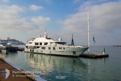
IDOL
Yacht
Current Trip
| Time Travelled | 4 days |
|---|---|
| Remaining Time | 18 mins |
| Distance Travelled | 408.83 nm |
| Remaining Distance | 6.57 nm |
| AVG Speed | 9.7 Knopen |
| MAX Speed | 11.7 Knopen |
| AVG Wind | 5.7 knots |
| MAX Wind | 14 knots |
| MIN Temp | 14.6°C / 58.28°F |
| MAX Temp | 21°C / 69.8°F |
| Diepgang | 2.9 M |
| Positie ontvangen | Nu |
Current Position
| Lengtegraad | 14.24768° |
|---|---|
| Breedtegraat | 40.77051° |
| Status | Under way using engine |
| Snelheid | 11.1 Knopen |
| Koers | 347.4° |
| Gebied | Tyrrhenian Sea |
| Station | T-AIS |
| Positie ontvangen | Nu |
Info
Information
The current position of IDOL is in Tyrrhenian Sea with coordinates 40.77051° / 14.24768° as reported on 2024-05-15 14:59 by AIS to our vessel tracker app. The vessel's current speed is 11.1 Knopen and is heading at the port of NAPOLI. The estimated time of arrival as calculated by MyShipTracking vessel tracking app is 2024-05-15 17:18 LT
The vessel IDOL (IMO: 1008205, MMSI: 248344000) is a Yacht that was built in 2007 ( 17 Jaar oud ). It's sailing under the flag of [MT] Malta.
In this page you can find informations about the vessels current position, last detected port calls, and current voyage information. If the vessels is not in coverage by AIS you will find the latest position.
The current position of IDOL is detected by our AIS receivers and we are not responsible for the reliability of the data. The last position was recorded while the vessel was in Coverage by the Ais receivers of our vessel tracking app.
The current draught of IDOL as reported by AIS is 2.9 meters
Weather
| Temperature | 21°C / 69.8°F |
|---|---|
| Wind Speed | 14 knots |
| Direction | 158° SSE |
| Pressure | 1008.1 hPa |
| Humidity | 73.1 % |
| Cloud Coverage | 100 % |
Featured Company
Last Port Calls
| Port | Arrival | Departure | Time In Port |
|---|---|---|---|
| 2024-04-09 12:45 | 2024-05-10 20:42 | ||
| 2024-04-04 12:00 | |||
| 2024-04-02 08:58 | 2024-04-02 18:02 | 9 h | |
| 2024-03-01 08:21 | 2024-03-08 13:02 | 7 d |
Events
| Tijd | Evenement | Details | Positie / Bestemming | Info |
|---|---|---|---|---|
| 2024-05-15 14:22 | Destination Changed | NAPOLI RECOMMONE BEACH |
40.65421 / 14.26455
NAPOLI
|
Snelheid: 11.4 kn Koers: 352.4° |
| 2024-05-15 14:22 | ETA Changed | 2024/05/15 16:00 2024/05/13 09:00 |
40.65421 / 14.26455
NAPOLI
|
Snelheid: 11.4 kn Koers: 352.4° |
| 2024-05-15 13:40 | Binnenbereik |
40.53642 / 14.25114
Tyrrhenian Sea
|
Snelheid: 10.1 kn Koers: 102° |
|
| 2024-05-15 10:01 | Buitenbereik |
40.54196 / 14.24162
Tyrrhenian Sea
|
Snelheid: 0.1 kn Koers: 259.9° |
|
| 2024-05-13 16:14 | Status Changed | At anchor Under way using engine |
40.54224 / 14.24212
RECOMMONE BEACH
|
Snelheid: 0.1 kn Koers: 335° |
| 2024-05-13 16:14 | Stop beweging | 0.87 nm, South of CAPRI |
40.54221 / 14.24211
RECOMMONE BEACH
|
Snelheid: 0.1 kn Koers: 338° |
| 2024-05-13 14:56 | Start beweging | 0.3 nm, South East of POSITANO |
40.62145 / 14.49273
RECOMMONE BEACH
|
Snelheid: 4.9 kn Koers: 268° |
| 2024-05-13 14:48 | Status Changed | Under way using engine At anchor |
40.62077 / 14.49487
RECOMMONE BEACH
|
Snelheid: Koers: 296° |
| 2024-05-13 11:58 | Stop beweging | 0.4 nm, South East of POSITANO |
40.62049 / 14.49486
RECOMMONE BEACH
|
Snelheid: 0.2 kn Koers: 326° |
| 2024-05-13 11:14 | Start beweging | 2.86 nm, South of SORRENTO |
40.58237 / 14.37214
RECOMMONE BEACH
|
Snelheid: 7.1 kn Koers: 98.3° |