
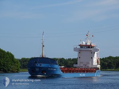
WILSON CAEN
General Cargo
Current Trip
NO ORS
| Time Travelled | 7 days |
|---|---|
| Remaining Time | --- |
| Distance Travelled | 1526.88 nm |
| Remaining Distance | --- |
| AVG Speed | 8.8 Knopen |
| MAX Speed | 11.1 Knopen |
| AVG Wind | 13.1 knots |
| MAX Wind | 24.9 knots |
| MIN Temp | 10.2°C / 50.36°F |
| MAX Temp | 18.6°C / 65.48°F |
| Diepgang | 4 M |
| Positie ontvangen | 2 d geleden |
Current Position
| Lengtegraad | -9.62156° |
|---|---|
| Breedtegraat | 43.39207° |
| Status | Under way using engine |
| Snelheid | 8.9 Knopen |
| Koers | 25.1° |
| Gebied | North Atlantic Ocean |
| Station | T-AIS |
| Positie ontvangen | 2 d geleden |
Info
Information
The current position of WILSON CAEN is in North Atlantic Ocean with coordinates 43.39207° / -9.62156° as reported on 2024-04-24 23:21 by AIS to our vessel tracker app. The vessel's current speed is 8.9 Knopen
The vessel WILSON CAEN (IMO: 9173290, MMSI: 314179000) is a General Cargo that was built in 1998 ( 26 Jaar oud ). It's sailing under the flag of [BB] Barbados.
In this page you can find informations about the vessels current position, last detected port calls, and current voyage information. If the vessels is not in coverage by AIS you will find the latest position.
The current position of WILSON CAEN is detected by our AIS receivers and we are not responsible for the reliability of the data. The last position was recorded while the vessel was in Coverage by the Ais receivers of our vessel tracking app.
The current draught of WILSON CAEN as reported by AIS is 4 meters
Weather
| Temperature | 10.6°C / 51.08°F |
|---|---|
| Wind Speed | 8 knots |
| Direction | 265° W |
| Pressure | 999.9 hPa |
| Humidity | 76.8 % |
| Cloud Coverage | 100 % |
Featured Company
Last Port Calls
| Port | Arrival | Departure | Time In Port |
|---|---|---|---|
| 2024-04-17 05:25 | 2024-04-20 04:29 | 2 d | |
| 2024-04-15 17:45 | 2024-04-16 13:57 | 20 h | |
| 2024-04-03 17:55 | 2024-04-05 15:15 | 1 d | |
| 2024-03-22 18:16 | 2024-03-22 21:15 | 2 h | |
| 2024-03-12 17:30 | 2024-03-14 03:02 | 1 d | |
| 2024-03-04 15:17 | 2024-03-06 03:17 | 1 d | |
| 2024-02-20 17:58 | 2024-02-22 07:46 | 1 d | |
| 2024-02-08 20:46 | 2024-02-19 15:33 | 10 d |
Last Trips
| Origin | Departure | Destination | Arrival | Distance | |
|---|---|---|---|---|---|
| 2024-04-16 15:57 | 2024-04-17 07:25 | 76.38 nm | |||
| 2024-04-05 17:15 | 2024-04-15 19:45 | 1890.16 nm | |||
| 2024-03-22 22:15 | 2024-04-03 19:55 | 1368.80 nm | |||
| 2024-03-14 04:02 | 2024-03-22 19:16 | 1035.69 nm | |||
| 2024-03-06 04:17 | 2024-03-12 18:30 | 1322.88 nm | |||
| 2024-02-22 08:46 | 2024-03-04 16:17 | 2197.51 nm | |||
| 2024-02-19 16:33 | 2024-02-20 18:58 | 235.63 nm | |||
| 2024-01-30 14:21 | 2024-02-08 21:46 | 1781.96 nm |
Events
| Tijd | Evenement | Details | Positie / Bestemming | Info |
|---|---|---|---|---|
| 2024-04-24 23:33 | Status Changed | Default Under way using engine |
43.41819 / -9.60387
NO ORS
|
Snelheid: 8.9 kn Koers: 25.1° |
| 2024-04-24 23:21 | Gevonden in zee | Spanish part of the North Atlantic Ocean |
43.39207 / -9.62156
North Atlantic Ocean
NO ORS
|
Snelheid: 8.9 kn Koers: 25.1° |
| 2024-04-24 23:21 | Buitenbereik |
43.39207 / -9.62156
North Atlantic Ocean
NO ORS
|
Snelheid: 8.9 kn Koers: 25.1° |
|
| 2024-04-24 23:21 | Status Changed | Under way using engine Default |
43.39137 / -9.62204
NO ORS
|
Snelheid: 8.7 kn Koers: 31° |
| 2024-04-24 23:03 | Binnenbereik |
43.39207 / -9.62156
North Atlantic Ocean
NO ORS
|
Snelheid: 8.9 kn Koers: 25.1° |
|
| 2024-04-24 11:36 | Buitenbereik |
41.69040 / -9.78224
North Atlantic Ocean
NO ORS
|
Snelheid: 8.7 kn Koers: 359.7° |
|
| 2024-04-24 10:33 | Status Changed | Under way using engine Default |
41.57026 / -9.79401
NO ORS
|
Snelheid: 8.5 kn Koers: 1° |
| 2024-04-24 10:33 | Binnenbereik |
41.57026 / -9.79401
North Atlantic Ocean
NO ORS
|
Snelheid: 8.4 kn Koers: 5.3° |
|
| 2024-04-24 09:26 | Status Changed | Default Under way using engine |
41.42683 / -9.80091
NO ORS
|
Snelheid: 8.5 kn Koers: 359.9° |
| 2024-04-24 09:14 | Buitenbereik |
41.38802 / -9.80151
North Atlantic Ocean
NO ORS
|
Snelheid: 8.5 kn Koers: 359.9° |