
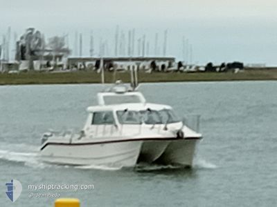
WHITE CHEETAH
Fishing
Current Trip
Unknown
| Time Travelled | 9 h, 44 mins |
|---|---|
| Remaining Time | --- |
| Distance Travelled | 37.73 nm |
| Remaining Distance | --- |
| AVG Speed | 11.7 Knopen |
| MAX Speed | 18.5 Knopen |
| AVG Wind | 10.8 knots |
| MAX Wind | 13 knots |
| MIN Temp | 9.4°C / 48.92°F |
| MAX Temp | 11°C / 51.8°F |
| Diepgang | 0 M |
| Positie ontvangen | 1 h, 47 m geleden |
Current Position
| Lengtegraad | --- |
|---|---|
| Breedtegraat | --- |
| Status | Under way using engine |
| Snelheid | 8.6 Knopen |
| Koers | 126.2° |
| Gebied | North Sea |
| Station | T-AIS |
| Positie ontvangen | 1 h, 47 m geleden |
Info
Information
The current position of WHITE CHEETAH is in North Sea with coordinates 51.15479° / 2.72086° as reported on 2025-12-12 14:18 by AIS to our vessel tracker app. The vessel's current speed is 8.6 Knopen
The vessel WHITE CHEETAH (MMSI: 244182911) is a Fishing It's sailing under the flag of [NL] Netherlands.
In this page you can find informations about the vessels current position, last detected port calls, and current voyage information. If the vessels is not in coverage by AIS you will find the latest position.
The current position of WHITE CHEETAH is detected by our AIS receivers and we are not responsible for the reliability of the data. The last position was recorded while the vessel was in Coverage by the Ais receivers of our vessel tracking app.
Weather
| Temperature | 11°C / 51.8°F |
|---|---|
| Wind Speed | 11 knots |
| Direction | 187° S |
| Pressure | 1019.1 hPa |
| Humidity | 88.2 % |
| Cloud Coverage | 100 % |
Featured Company
Last Port Calls
| Port | Arrival | Departure | Time In Port |
|---|---|---|---|
| 2025-12-12 07:21 | |||
| 2025-12-07 17:41 | 2025-12-11 07:46 | 3 d | |
| 2025-12-07 07:38 | |||
| 2025-12-05 08:09 | |||
| 2025-11-08 16:53 | 2025-11-09 06:59 | 14 h | |
| 2025-11-07 14:55 | 2025-11-08 06:07 | 15 h | |
| 2025-11-01 12:05 | 2025-11-07 06:21 | 5 d | |
| 2025-10-13 16:05 | 2025-10-19 04:09 | 5 d | |
| 2025-10-12 18:28 | 2025-10-13 09:34 | 15 h | |
| 2025-10-10 19:32 | 2025-10-12 07:43 | 1 d |
Most Visited Ports (Last year)
| Port | Arrivals | |
|---|---|---|
| 58 | ||
| 1 |
Last Trips
| Origin | Departure | Destination | Arrival | Distance | |
|---|---|---|---|---|---|
| 2025-12-07 07:38 | 2025-12-07 17:41 | 18.42 nm | |||
| 2025-11-08 06:07 | 2025-11-08 16:53 | 32.71 nm | |||
| 2025-11-07 06:21 | 2025-11-07 14:55 | 28.33 nm | |||
| 2025-10-19 04:09 | 2025-11-01 12:05 | 72.31 nm | |||
| 2025-10-13 09:34 | 2025-10-13 16:05 | 30.25 nm | |||
| 2025-10-12 07:43 | 2025-10-12 18:28 | 27.94 nm | |||
| 2025-10-10 06:24 | 2025-10-10 19:32 | 24.68 nm | |||
| 2025-10-07 05:35 | 2025-10-07 13:25 | 26.67 nm |
Events
| Tijd | Evenement | Details | Positie / Bestemming | Info |
|---|---|---|---|---|
| 2025-12-12 14:18 | Buitenbereik |
51.15479 / 2.72086
North Sea
|
Snelheid: 8.6 kn Koers: 126.2° |
|
| 2025-12-12 13:45 | Start beweging | 5.66 nm, North West of NIEUWPOORT |
51.20921 / 2.66074
|
Snelheid: 12.5 kn Koers: 77.1° |
| 2025-12-12 13:33 | Stop beweging | 5.77 nm, North West of NIEUWPOORT |
51.20991 / 2.65719
|
Snelheid: 0.3 kn Koers: 74° |
| 2025-12-12 13:08 | Start beweging | 10.33 nm, North West of NIEUWPOORT |
51.24966 / 2.54889
|
Snelheid: 6.5 kn Koers: 340.1° |
| 2025-12-12 13:02 | Stop beweging | 10.27 nm, North West of NIEUWPOORT |
51.25014 / 2.55177
|
Snelheid: 0.3 kn Koers: 63° |
| 2025-12-12 12:36 | Start beweging | 13.73 nm, North West of NIEUWPOORT |
51.27120 / 2.46039
|
Snelheid: 14.7 kn Koers: 129.7° |
| 2025-12-12 12:19 | Stop beweging | 14.2 nm, North West of NIEUWPOORT |
51.27468 / 2.44914
|
Snelheid: 0.3 kn Koers: 236° |
| 2025-12-12 12:05 | Wijzig zee gebeid | Belgian part of the North Sea French part of the North Sea |
51.28835 / 2.41118
North Sea
|
Snelheid: 15.4 kn Koers: 74.3° |
| 2025-12-12 11:55 | Binnenbereik |
51.30014 / 2.35198
North Sea
|
Snelheid: 15.7 kn Koers: 119.9° |
|
| 2025-12-12 06:58 | Buitenbereik |
51.16200 / 2.48298
North Sea
|
Snelheid: 16.2 kn Koers: 283.4° |