
W NORTH
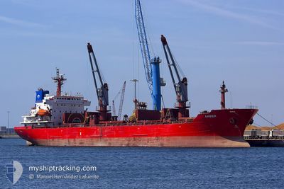
Oil/Chemical Tanker
Current Trip
| Time Travelled | 1 day |
|---|---|
| Remaining Time | 5 h, 14 mins |
| Distance Travelled | 93.35 nm |
| Remaining Distance | 72.79 nm |
| AVG Speed | 9.9 Knopen |
| MAX Speed | 13.6 Knopen |
| AVG Wind | 13.5 knots |
| MAX Wind | 24 knots |
| MIN Temp | 3.9°C / 39.02°F |
| MAX Temp | 10°C / 50°F |
| Diepgang | 5.7 M |
| Positie ontvangen | 1 m geleden |
Current Position
| Lengtegraad | --- |
|---|---|
| Breedtegraat | --- |
| Status | Under way using engine |
| Snelheid | 13 Knopen |
| Koers | 87.5° |
| Gebied | North Sea |
| Station | T-AIS |
| Positie ontvangen | 1 m geleden |
Info
Information
The current position of W NORTH is in North Sea with coordinates 51.40217° / 3.13589° as reported on 2025-12-15 22:14 by AIS to our vessel tracker app. The vessel's current speed is 13 Knopen and is heading at the port of HEMIKSEM. The estimated time of arrival as calculated by MyShipTracking vessel tracking app is 2025-12-16 04:29 LT
The vessel W NORTH (IMO: 9272735, MMSI: 256585000) is a Oil/Chemical Tanker that was built in 2003 ( 22 Jaar oud ). It's sailing under the flag of [MT] Malta.
In this page you can find informations about the vessels current position, last detected port calls, and current voyage information. If the vessels is not in coverage by AIS you will find the latest position.
The current position of W NORTH is detected by our AIS receivers and we are not responsible for the reliability of the data. The last position was recorded while the vessel was in Coverage by the Ais receivers of our vessel tracking app.
The current draught of W NORTH as reported by AIS is 5.7 meters
Weather
| Temperature | 9.1°C / 48.38°F |
|---|---|
| Wind Speed | 16 knots |
| Direction | 169° S |
| Pressure | 1008.9 hPa |
| Humidity | 89.4 % |
| Cloud Coverage | 100 % |
Featured Company
Last Port Calls
| Port | Arrival | Departure | Time In Port |
|---|---|---|---|
| 2025-12-14 03:20 | 2025-12-14 05:46 | 2 h | |
| 2025-12-09 12:31 | 2025-12-10 04:55 | 16 h | |
| 2025-12-07 12:50 | 2025-12-08 02:51 | 14 h | |
| 2025-12-02 08:15 | 2025-12-02 17:55 | 9 h | |
| 2025-11-25 11:34 | 2025-11-27 17:53 | 2 d | |
| 2025-11-21 19:33 | 2025-11-23 20:26 | 2 d | |
| 2025-11-10 23:24 | 2025-11-12 21:24 | 1 d | |
| 2025-11-08 07:42 | 2025-11-09 02:46 | 19 h | |
| 2025-11-06 12:18 | 2025-11-07 09:50 | 21 h | |
| 2025-11-02 11:13 | 2025-11-04 16:12 | 2 d |
Last Trips
| Origin | Departure | Destination | Arrival | Distance | |
|---|---|---|---|---|---|
| 2025-12-10 04:55 | 2025-12-14 03:20 | 786.41 nm | |||
| 2025-12-08 02:51 | 2025-12-09 12:31 | 94.73 nm | |||
| 2025-12-02 17:55 | 2025-12-07 12:50 | 532.06 nm | |||
| 2025-11-27 17:53 | 2025-12-02 08:15 | 812.61 nm | |||
| 2025-11-23 20:26 | 2025-11-25 11:34 | 180.26 nm | |||
| 2025-11-12 21:24 | 2025-11-21 19:33 | 2129.33 nm | |||
| 2025-11-09 02:46 | 2025-11-10 23:24 | 483.40 nm | |||
| 2025-11-07 09:50 | 2025-11-08 07:42 | 171.38 nm | |||
| 2025-11-04 16:12 | 2025-11-06 12:18 | 451.59 nm | |||
| 2025-10-24 08:59 | 2025-11-02 11:13 | 1661.34 nm |
Events
| Tijd | Evenement | Details | Positie / Bestemming | Info |
|---|---|---|---|---|
| 2025-12-15 20:07 | Start beweging | 16 nm, North West of OOSTENDE |
51.41630 / 2.64524
BEHEX
|
Snelheid: 3.2 kn Koers: 204° |
| 2025-12-15 20:05 | Status Changed | Under way using engine At anchor |
51.41786 / 2.64499
BEHEX
|
Snelheid: 0.8 kn Koers: 224° |
| 2025-12-15 19:55 | Status Changed | At anchor Default |
51.41964 / 2.64643
BEHEX
|
Snelheid: 0.4 kn Koers: 201° |
| 2025-12-15 19:49 | Status Changed | Default At anchor |
51.41965 / 2.64638
BEHEX
|
Snelheid: 0.4 kn Koers: 201° |
| 2025-12-15 19:07 | Status Changed | At anchor Default |
51.41987 / 2.64590
BEHEX
|
Snelheid: 0.2 kn Koers: 200° |
| 2025-12-15 19:01 | Status Changed | Default At anchor |
51.41983 / 2.64603
BEHEX
|
Snelheid: 0.1 kn Koers: 200° |
| 2025-12-15 16:55 | Status Changed | At anchor Default |
51.41768 / 2.64370
BEHEX
|
Snelheid: Koers: 98° |
| 2025-12-15 16:49 | Status Changed | Default At anchor |
51.41769 / 2.64368
BEHEX
|
Snelheid: Koers: 98° |
| 2025-12-15 16:31 | Status Changed | At anchor Default |
51.41861 / 2.64349
BEHEX
|
Snelheid: 0.2 kn Koers: 122° |
| 2025-12-15 16:25 | Status Changed | Default At anchor |
51.41896 / 2.64357
BEHEX
|
Snelheid: 0.1 kn Koers: 122° |