
VINES
General Cargo
Current Trip
| Time Travelled | 3 days |
|---|---|
| Remaining Time | 1 day |
| Distance Travelled | 157.13 nm |
| Remaining Distance | 475.94 nm |
| AVG Speed | 6.4 Knopen |
| MAX Speed | 7.2 Knopen |
| AVG Wind | 7.7 knots |
| MAX Wind | 20 knots |
| MIN Temp | 8.7°C / 47.66°F |
| MAX Temp | 19.5°C / 67.1°F |
| Diepgang | 4.2 M |
| Positie ontvangen | 2 m geleden |
Current Position
| Lengtegraad | --- |
|---|---|
| Breedtegraat | --- |
| Status | At anchor |
| Snelheid | 0.1 Knopen |
| Koers | 27° |
| Gebied | Mediterranean Sea - Eastern Basin |
| Station | T-AIS |
| Positie ontvangen | 2 m geleden |
Info
Information
The current position of VINES is in Mediterranean Sea - Eastern Basin with coordinates 36.18984° / 29.64400° as reported on 2025-12-06 19:37 by AIS to our vessel tracker app. The vessel's current speed is 0.1 Knopen and is heading at the port of ALEXANDRIA. The estimated time of arrival as calculated by MyShipTracking vessel tracking app is 2025-12-08 07:16 LT
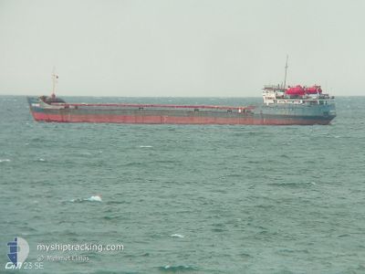
The vessel VINES (IMO: 8416798, MMSI: 613549400) is a General Cargo that was built in 1985 ( 40 Jaar oud ). It's sailing under the flag of [CM] Cameroon.
In this page you can find informations about the vessels current position, last detected port calls, and current voyage information. If the vessels is not in coverage by AIS you will find the latest position.
The current position of VINES is detected by our AIS receivers and we are not responsible for the reliability of the data. The last position was recorded while the vessel was in Coverage by the Ais receivers of our vessel tracking app.
The current draught of VINES as reported by AIS is 4.2 meters
Weather
| Temperature | 9.6°C / 49.28°F |
|---|---|
| Wind Speed | 5 knots |
| Direction | 29° NNE |
| Pressure | 1009.3 hPa |
| Humidity | 81.6 % |
| Cloud Coverage | 100 % |
Featured Company
Events
| Tijd | Evenement | Details | Positie / Bestemming | Info |
|---|---|---|---|---|
| 2025-12-06 08:16 | Status Changed | At anchor Default |
36.19079 / 29.64581
EG ALY
|
Snelheid: 0.4 kn Koers: 273° |
| 2025-12-06 08:16 | Binnenbereik |
36.19079 / 29.64581
Mediterranean Sea - Eastern Basin
EG ALY
|
Snelheid: 0.1 kn Koers: 305° |
|
| 2025-12-06 06:22 | Status Changed | Default At anchor |
36.19011 / 29.64325
EG ALY
|
Snelheid: 0.3 kn Koers: 19° |
| 2025-12-06 05:43 | Buitenbereik |
36.18986 / 29.64374
Mediterranean Sea - Eastern Basin
EG ALY
|
Snelheid: 0.3 kn Koers: 263.9° |
|
| 2025-12-05 16:28 | Status Changed | At anchor Default |
36.19111 / 29.64316
EG ALY
|
Snelheid: 0.1 kn Koers: 153° |
| 2025-12-05 16:28 | Binnenbereik |
36.19111 / 29.64316
Mediterranean Sea - Eastern Basin
EG ALY
|
Snelheid: 0.1 kn Koers: 140.8° |
|
| 2025-12-05 15:25 | Status Changed | Default At anchor |
36.19093 / 29.64340
EG ALY
|
Snelheid: 0.1 kn Koers: 79° |
| 2025-12-05 15:13 | Buitenbereik |
36.19074 / 29.64336
Mediterranean Sea - Eastern Basin
EG ALY
|
Snelheid: 0.1 kn Koers: 28.3° |
|
| 2025-12-05 14:22 | Status Changed | At anchor Default |
36.19046 / 29.64348
EG ALY
|
Snelheid: 0.1 kn Koers: 32° |
| 2025-12-05 14:13 | Status Changed | Default At anchor |
36.19026 / 29.64357
EG ALY
|
Snelheid: 0.1 kn Koers: 73° |