
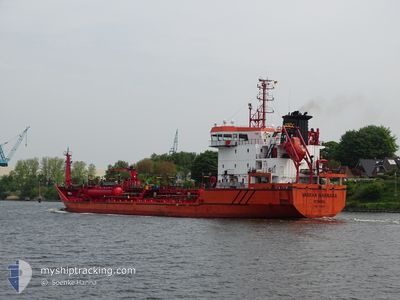
VARKAN MARMARA
Oil/Chemical Tanker
Current Trip
| Time Travelled | 2 days |
|---|---|
| Remaining Time | 22 h, 13 mins |
| Distance Travelled | 672.92 nm |
| Remaining Distance | 266.91 nm |
| AVG Speed | 10.7 Knopen |
| MAX Speed | 12.8 Knopen |
| AVG Wind | 6.9 knots |
| MAX Wind | 35.2 knots |
| MIN Temp | 11.6°C / 52.88°F |
| MAX Temp | 14.5°C / 58.1°F |
| Diepgang | 5 M |
| Positie ontvangen | 5 h, 46 m geleden |
Current Position
| Lengtegraad | --- |
|---|---|
| Breedtegraat | --- |
| Status | Under way using engine |
| Snelheid | 11.6 Knopen |
| Koers | 171° |
| Gebied | North Atlantic Ocean |
| Station | T-AIS |
| Positie ontvangen | 5 h, 46 m geleden |
Info
Information
The current position of VARKAN MARMARA is in North Atlantic Ocean with coordinates 38.59817° / -10.16267° as reported on 2025-12-12 16:25 by AIS to our vessel tracker app. The vessel's current speed is 11.6 Knopen and is heading at the port of CEUTA. The estimated time of arrival as calculated by MyShipTracking vessel tracking app is 2025-12-13 21:25 LT
The vessel VARKAN MARMARA (IMO: 9458145, MMSI: 271002685) is a Oil/Chemical Tanker that was built in 2009 ( 16 Jaar oud ). It's sailing under the flag of [TR] Turkey.
In this page you can find informations about the vessels current position, last detected port calls, and current voyage information. If the vessels is not in coverage by AIS you will find the latest position.
The current position of VARKAN MARMARA is detected by our AIS receivers and we are not responsible for the reliability of the data. The last position was recorded while the vessel was in Coverage by the Ais receivers of our vessel tracking app.
The current draught of VARKAN MARMARA as reported by AIS is 5 meters
Weather
| Temperature | 14.2°C / 57.56°F |
|---|---|
| Wind Speed | 21 knots |
| Direction | 62° ENE |
| Pressure | 1012.1 hPa |
| Humidity | 86.5 % |
| Cloud Coverage | 100 % |
Featured Company
Last Port Calls
| Port | Arrival | Departure | Time In Port |
|---|---|---|---|
| 2025-12-08 16:43 | 2025-12-10 09:14 | 1 d | |
| 2025-12-01 10:05 | 2025-12-02 02:01 | 15 h | |
| 2025-11-27 20:25 | 2025-11-28 23:25 | 1 d | |
| 2025-11-21 04:36 | 2025-11-21 08:43 | 4 h | |
| 2025-11-16 01:18 | 2025-11-18 04:14 | 2 d | |
| 2025-11-12 08:12 | 2025-11-15 13:24 | 3 d | |
| 2025-11-01 12:41 | 2025-11-05 07:00 | 3 d | |
| 2025-10-31 12:41 | 2025-10-31 21:47 | 9 h | |
| 2025-10-27 11:15 | 2025-10-29 02:50 | 1 d | |
| 2025-10-17 13:54 | 2025-10-24 18:42 | 7 d |
Last Trips
| Origin | Departure | Destination | Arrival | Distance | |
|---|---|---|---|---|---|
| 2025-12-02 02:01 | 2025-12-08 16:43 | 1769.57 nm | |||
| 2025-11-28 23:25 | 2025-12-01 10:05 | 412.08 nm | |||
| 2025-11-21 08:43 | 2025-11-27 20:25 | 503.73 nm | |||
| 2025-11-18 04:14 | 2025-11-21 04:36 | 817.84 nm | |||
| 2025-11-15 13:24 | 2025-11-16 01:18 | 132.95 nm | |||
| 2025-11-05 07:00 | 2025-11-12 08:12 | 1523.70 nm | |||
| 2025-10-31 21:47 | 2025-11-01 12:41 | 164.11 nm | |||
| 2025-10-29 02:50 | 2025-10-31 12:41 | 707.30 nm | |||
| 2025-10-24 18:42 | 2025-10-27 11:15 | 697.63 nm | |||
| 2025-10-13 15:38 | 2025-10-17 13:54 | 915.74 nm |
Events
| Tijd | Evenement | Details | Positie / Bestemming | Info |
|---|---|---|---|---|
| 2025-12-12 16:39 | Status Changed | Default Under way using engine |
38.55383 / -10.15283
ESBIO>ESCEU
|
Snelheid: 11.6 kn Koers: 171° |
| 2025-12-12 16:25 | Buitenbereik |
38.59817 / -10.16267
North Atlantic Ocean
ESBIO>ESCEU
|
Snelheid: 11.6 kn Koers: 171° |
|
| 2025-12-12 16:22 | Wijzig zee gebeid | Portuguese part of the North Atlantic Ocean Spanish part of the North Atlantic Ocean |
38.60883 / -10.16500
North Atlantic Ocean
ESBIO>ESCEU
|
Snelheid: 11.5 kn Koers: 172° |
| 2025-12-12 16:20 | Status Changed | Under way using engine Default |
38.61533 / -10.16617
ESBIO>ESCEU
|
Snelheid: 11.8 kn Koers: 169° |
| 2025-12-12 16:08 | Binnenbereik |
38.60883 / -10.16500
North Atlantic Ocean
ESBIO>ESCEU
|
Snelheid: 11.5 kn Koers: 172° |
|
| 2025-12-11 08:55 | Status Changed | Default Under way using engine |
43.67317 / -9.10467
ESBIO>ESCEU
|
Snelheid: 9.9 kn Koers: 255° |
| 2025-12-11 08:46 | Buitenbereik |
43.67850 / -9.06967
North Atlantic Ocean
ESBIO>ESCEU
|
Snelheid: 9.9 kn Koers: 255° |
|
| 2025-12-11 08:44 | Status Changed | Under way using engine Default |
43.67950 / -9.06483
ESBIO>ESCEU
|
Snelheid: 10.1 kn Koers: 259° |
| 2025-12-11 08:32 | Status Changed | Default Under way using engine |
43.68733 / -9.01966
ESBIO>ESCEU
|
Snelheid: 9.8 kn Koers: 257° |
| 2025-12-11 08:08 | Status Changed | Under way using engine Default |
43.70167 / -8.92950
ESBIO>ESCEU
|
Snelheid: 10.2 kn Koers: 259° |