
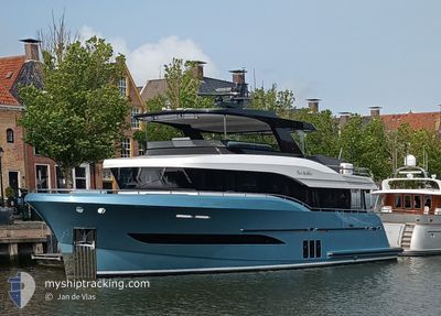
TWO BUBBLES
Pleasure Craft
Current Trip
| Trip Time | 40 days |
|---|---|
| Trip Distance | 3246.16 nm |
| AVG Speed | 5.7 Knopen |
| MAX Speed | 9.7 Knopen |
| Diepgang | 2 M |
| AVG Wind | 8.1 knots |
| MAX Wind | 17.7 knots |
| MIN Temp | 15.4°C / 59.72°F |
| MAX Temp | 27°C / 80.6°F |
| Positie ontvangen | 9 h, 56 m geleden |
Current Position
| Lengtegraad | --- |
|---|---|
| Breedtegraat | --- |
| Status | Under way using engine |
| Snelheid | |
| Koers | --- |
| Gebied | Caribbean Sea |
| Station | T-AIS |
| Positie ontvangen | 9 h, 56 m geleden |
Info
Information
The current position of TWO BUBBLES is in Caribbean Sea with coordinates 18.03438° / -63.08899° as reported on 2026-01-06 17:10 by AIS to our vessel tracker app. The vessel's current speed is 0 Knopen and is currently inside the port of ST MAARTEN.
The vessel TWO BUBBLES (MMSI: 319188600) is a Pleasure Craft It's sailing under the flag of [KY] Cayman Is.
In this page you can find informations about the vessels current position, last detected port calls, and current voyage information. If the vessels is not in coverage by AIS you will find the latest position.
The current position of TWO BUBBLES is detected by our AIS receivers and we are not responsible for the reliability of the data. The last position was recorded while the vessel was in Coverage by the Ais receivers of our vessel tracking app.
The current draught of TWO BUBBLES as reported by AIS is 2 meters
Weather
| Temperature | 25.8°C / 78.44°F |
|---|---|
| Wind Speed | 2 knots |
| Direction | 39° NE |
| Pressure | 1013.8 hPa |
| Humidity | 66.1 % |
| Cloud Coverage | 92 % |
Featured Company
Last Port Calls
| Port | Arrival | Departure | Time In Port |
|---|---|---|---|
| 2025-12-28 15:36 | |||
| 2025-11-18 08:11 |
Most Visited Ports (Last year)
| Port | Arrivals | |
|---|---|---|
| 4 | ||
| 3 | ||
| 2 | ||
| 2 | ||
| 2 | ||
| 2 |
Last Trips
| Origin | Departure | Destination | Arrival | Distance | |
|---|---|---|---|---|---|
| 2025-11-18 08:11 | 2025-12-28 11:36 | 3246.16 nm |
Events
| Tijd | Evenement | Details | Positie / Bestemming | Info |
|---|---|---|---|---|
| 2026-01-06 17:10 | Buitenbereik |
18.03438 / -63.08899
Caribbean Sea
[SX] ST MAARTEN
|
Snelheid: Koers: 511° |
|
| 2026-01-06 17:07 | ETA Changed | 2026/12/07 17:00 2025/12/06 17:00 |
18.03438 / -63.08900
[SX] ST MAARTEN
|
Snelheid: Koers: 511° |
| 2026-01-06 17:06 | Binnenbereik |
18.03438 / -63.08899
Caribbean Sea
[SX] ST MAARTEN
|
Snelheid: Koers: 511° |
|
| 2025-12-28 16:00 | Buitenbereik |
18.03439 / -63.08899
Caribbean Sea
[SX] ST MAARTEN
|
Snelheid: Koers: 511° |
|
| 2025-12-28 15:36 | Stop beweging |
18.03475 / -63.08914
[SX] ST MAARTEN
|
Snelheid: 0.2 kn Koers: 511° |
|
| 2025-12-28 15:36 | Aankomsthaven |
|
18.03475 / -63.08914
[SX] ST MAARTEN
|
Snelheid: 0.7 kn Koers: 511° |
| 2025-12-28 15:28 | Start beweging | 0.2 nm, South West of ST MAARTEN |
18.03552 / -63.09498
BARBADOS
|
Snelheid: 4 kn Koers: 70.6° |
| 2025-12-28 15:14 | Stop beweging | 0.36 nm, South West of ST MAARTEN |
18.03447 / -63.09761
BARBADOS
|
Snelheid: 0.3 kn Koers: 511° |
| 2025-12-28 14:30 | Wijzig zee gebeid | Sint-Maarten part of the Caribbean Sea Saint-Martin part of the Caribbean Sea |
18.04908 / -63.15239
Caribbean Sea
|
Snelheid: 5.4 kn Koers: 118° |
| 2025-12-28 13:29 | Start beweging | 0.83 nm, North West of MARIGOT |
18.07535 / -63.09446
BARBADOS
|
Snelheid: 8.1 kn Koers: 298.2° |