
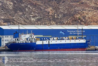
TULEEN
Livestock Carrier
Current Trip
| Time Travelled | 1 day |
|---|---|
| Remaining Time | --- |
| Distance Travelled | 169.12 nm |
| Remaining Distance | --- |
| AVG Speed | 10.1 Knopen |
| MAX Speed | 10.8 Knopen |
| AVG Wind | 4.5 knots |
| MAX Wind | 8 knots |
| MIN Temp | 14.6°C / 58.28°F |
| MAX Temp | 18.9°C / 66.02°F |
| Diepgang | 4 M |
| Positie ontvangen | 8 h, 50 m geleden |
Current Position
| Lengtegraad | --- |
|---|---|
| Breedtegraat | --- |
| Status | Under way using engine |
| Snelheid | 9.4 Knopen |
| Koers | 298.4° |
| Gebied | Mediterranean Sea - Eastern Basin |
| Station | T-AIS |
| Positie ontvangen | 8 h, 50 m geleden |
Info
Information
The current position of TULEEN is in Mediterranean Sea - Eastern Basin with coordinates 34.45630° / 32.27425° as reported on 2025-12-14 15:58 by AIS to our vessel tracker app. The vessel's current speed is 9.4 Knopen and is heading at the port of MIDIA. The estimated time of arrival as calculated by MyShipTracking vessel tracking app is 2025-12-18 22:00 LT
The vessel TULEEN (IMO: 7396630, MMSI: 511100448) is a Livestock Carrier that was built in 1975 ( 50 Jaar oud ). It's sailing under the flag of [PW] Palau.
In this page you can find informations about the vessels current position, last detected port calls, and current voyage information. If the vessels is not in coverage by AIS you will find the latest position.
The current position of TULEEN is detected by our AIS receivers and we are not responsible for the reliability of the data. The last position was recorded while the vessel was in Coverage by the Ais receivers of our vessel tracking app.
The current draught of TULEEN as reported by AIS is 4 meters
Weather
| Temperature | 18.3°C / 64.94°F |
|---|---|
| Wind Speed | 3 knots |
| Direction | 232° SW |
| Pressure | 1018.5 hPa |
| Humidity | 56.1 % |
| Cloud Coverage | 4 % |
Featured Company
Last Port Calls
| Port | Arrival | Departure | Time In Port |
|---|---|---|---|
| 2025-12-13 13:43 | 2025-12-14 01:02 | 11 h | |
| 2025-12-04 09:43 | 2025-12-08 09:40 | 3 d | |
| 2025-11-26 20:18 | 2025-11-27 02:31 | 6 h | |
| 2025-11-21 15:56 | 2025-11-22 00:48 | 8 h | |
| 2025-11-14 03:24 | 2025-11-14 16:16 | 12 h | |
| 2025-11-08 12:03 | 2025-11-09 14:31 | 1 d | |
| 2025-11-02 13:19 | 2025-11-03 00:09 | 10 h | |
| 2025-10-27 13:34 | 2025-10-28 01:44 | 12 h | |
| 2025-10-21 05:23 | 2025-10-21 16:11 | 10 h | |
| 2025-10-15 13:07 | 2025-10-16 14:44 | 1 d |
Last Trips
| Origin | Departure | Destination | Arrival | Distance | |
|---|---|---|---|---|---|
| 2025-12-08 09:40 | 2025-12-13 13:43 | 1058.36 nm | |||
| 2025-11-27 02:31 | 2025-12-04 09:43 | 1095.12 nm | |||
| 2025-11-22 00:48 | 2025-11-26 20:18 | 1049.40 nm | |||
| 2025-11-14 16:16 | 2025-11-21 15:56 | 1134.17 nm | |||
| 2025-11-09 14:31 | 2025-11-14 03:24 | 1043.20 nm | |||
| 2025-11-03 00:09 | 2025-11-08 12:03 | 1097.38 nm | |||
| 2025-10-28 01:44 | 2025-11-02 13:19 | 1082.49 nm | |||
| 2025-10-21 16:11 | 2025-10-27 13:34 | 1109.17 nm | |||
| 2025-10-16 14:44 | 2025-10-21 05:23 | 1071.18 nm | |||
| 2025-10-09 11:36 | 2025-10-15 13:07 | 1085.55 nm |
Events
| Tijd | Evenement | Details | Positie / Bestemming | Info |
|---|---|---|---|---|
| 2025-12-14 15:58 | Buitenbereik |
34.45630 / 32.27425
Mediterranean Sea - Eastern Basin
ROMID
|
Snelheid: 9.4 kn Koers: 298.4° |
|
| 2025-12-14 15:58 | Status Changed | Under way using engine Default |
34.45630 / 32.27425
ROMID
|
Snelheid: 9.1 kn Koers: 298° |
| 2025-12-14 15:41 | Binnenbereik |
34.45630 / 32.27425
Mediterranean Sea - Eastern Basin
ROMID
|
Snelheid: 9.4 kn Koers: 298.4° |
|
| 2025-12-14 13:17 | Status Changed | Default Under way using engine |
34.22780 / 32.71299
ROMID
|
Snelheid: 9.9 kn Koers: 304.4° |
| 2025-12-14 13:09 | Gevonden in zee | Cypriote part of the Mediterranean Sea - Eastern Basin |
34.21553 / 32.73627
Mediterranean Sea - Eastern Basin
ROMID
|
Snelheid: 9.9 kn Koers: 304.4° |
| 2025-12-14 13:09 | Status Changed | Under way using engine Default |
34.21553 / 32.73627
ROMID
|
Snelheid: 9.6 kn Koers: 299° |
| 2025-12-14 13:09 | Buitenbereik |
34.21553 / 32.73627
Mediterranean Sea - Eastern Basin
ROMID
|
Snelheid: 9.9 kn Koers: 304.4° |
|
| 2025-12-14 13:01 | Binnenbereik |
34.21553 / 32.73627
Mediterranean Sea - Eastern Basin
ROMID
|
Snelheid: 9.9 kn Koers: 304.4° |
|
| 2025-12-14 01:29 | Status Changed | Default Under way using engine |
33.12982 / 34.67307
ROMID
|
Snelheid: 10.3 kn Koers: 314.5° |
| 2025-12-14 01:27 | Buitenbereik |
33.12539 / 34.67845
Mediterranean Sea - Eastern Basin
ROMID
|
Snelheid: 10.3 kn Koers: 314.5° |