
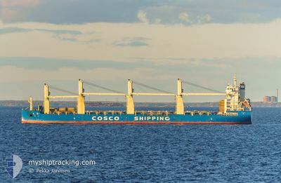
TIAN LE
Cargo
Current Trip
CNFAN
| Time Travelled | 2 days |
|---|---|
| Remaining Time | --- |
| Distance Travelled | 589.94 nm |
| Remaining Distance | --- |
| AVG Speed | 11.6 Knopen |
| MAX Speed | 14.1 Knopen |
| AVG Wind | 11.4 knots |
| MAX Wind | 26 knots |
| MIN Temp | 23.3°C / 73.94°F |
| MAX Temp | 27.5°C / 81.5°F |
| Diepgang | 11.1 M |
| Positie ontvangen | 8 d geleden |
Current Position
| Lengtegraad | 108.23199° |
|---|---|
| Breedtegraat | 20.80843° |
| Status | Under way using engine |
| Snelheid | 13.5 Knopen |
| Koers | 2.1° |
| Gebied | South China Sea |
| Station | T-AIS |
| Positie ontvangen | 8 d geleden |
Info
Information
The current position of TIAN LE is in South China Sea with coordinates 20.80843° / 108.23199° as reported on 2024-04-30 10:15 by AIS to our vessel tracker app. The vessel's current speed is 13.5 Knopen
The vessel TIAN LE (IMO: 9722730, MMSI: 412478730) is a Cargo It's sailing under the flag of [CN] China.
In this page you can find informations about the vessels current position, last detected port calls, and current voyage information. If the vessels is not in coverage by AIS you will find the latest position.
The current position of TIAN LE is detected by our AIS receivers and we are not responsible for the reliability of the data. The last position was recorded while the vessel was in Coverage by the Ais receivers of our vessel tracking app.
The current draught of TIAN LE as reported by AIS is 11.1 meters
Weather
| Temperature | 23.6°C / 74.48°F |
|---|---|
| Wind Speed | 24 knots |
| Direction | 61° ENE |
| Pressure | 1015.7 hPa |
| Humidity | 76.3 % |
| Cloud Coverage | 84 % |
Featured Company
Events
| Tijd | Evenement | Details | Positie / Bestemming | Info |
|---|---|---|---|---|
| 2024-05-07 04:08 | Vertrekhaven |
|
21.53407 / 108.35447
CNFAN
|
Snelheid: 10 kn Koers: 149° |
| 2024-05-07 03:48 | Start beweging |
21.57205 / 108.33306
[CN] FANGCHENG
|
Snelheid: 4.8 kn Koers: 169° |
|
| 2024-05-02 12:48 | Stop beweging |
21.57833 / 108.33334
[CN] FANGCHENG
|
Snelheid: Koers: -1° |
|
| 2024-05-02 12:00 | Aankomsthaven |
|
21.54606 / 108.35237
[CN] FANGCHENG
|
Snelheid: 8.2 kn Koers: 0° |
| 2024-05-02 10:39 | Start beweging | 11.48 nm, South of FANGCHENG |
21.39706 / 108.39468
CNFAN
|
Snelheid: 3.3 kn Koers: 7° |
| 2024-04-30 14:00 | Stop beweging | 11.7 nm, South of FANGCHENG |
21.39356 / 108.39635
CNFAN
|
Snelheid: 0.3 kn Koers: 254° |
| 2024-04-30 10:20 | Status Changed | Default Under way using engine |
20.82975 / 108.23299
CNFAN
|
Snelheid: 13.5 kn Koers: 2.1° |
| 2024-04-30 10:15 | Buitenbereik |
20.80843 / 108.23199
South China Sea
CNFAN
|
Snelheid: 13.5 kn Koers: 2.1° |
|
| 2024-04-30 10:07 | Status Changed | Under way using engine Default |
20.78074 / 108.23118
CNFAN
|
Snelheid: 13.7 kn Koers: 11° |
| 2024-04-30 09:56 | Status Changed | Default Under way using engine |
20.73771 / 108.22424
CNFAN
|
Snelheid: 13.8 kn Koers: 10.8° |