
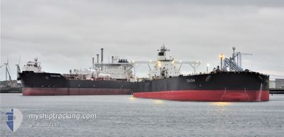
TAIGA
Crude Oil Tanker
Current Trip
| Time Travelled | --- |
|---|---|
| Remaining Time | --- |
| Distance Travelled | 12812.71 nm |
| Remaining Distance | 1399.03 nm |
| AVG Speed | 10.9 Knopen |
| MAX Speed | 17.4 Knopen |
| AVG Wind | 8.9 knots |
| MAX Wind | 26.9 knots |
| MIN Temp | 25.1°C / 77.18°F |
| MAX Temp | 34.8°C / 94.64°F |
| Diepgang | 10.5 M |
| Positie ontvangen | 2 d geleden |
Current Position
| Lengtegraad | 76.79107° |
|---|---|
| Breedtegraat | 7.05757° |
| Status | Under way using engine |
| Snelheid | 12 Knopen |
| Koers | 313.7° |
| Gebied | Laccadive Sea |
| Station | T-AIS |
| Positie ontvangen | 2 d geleden |
Info
Information
The current position of TAIGA is in Laccadive Sea with coordinates 7.05757° / 76.79107° as reported on 2024-04-29 21:47 by AIS to our vessel tracker app. The vessel's current speed is 12 Knopen and is heading at the port of RAS TANURA. The estimated time of arrival as calculated by MyShipTracking vessel tracking app is 2024-05-06 21:00 LT
The vessel TAIGA (IMO: 9339973, MMSI: 372618000) is a Crude Oil Tanker that was built in 2007 ( 17 Jaar oud ). It's sailing under the flag of [PA] Panama.
In this page you can find informations about the vessels current position, last detected port calls, and current voyage information. If the vessels is not in coverage by AIS you will find the latest position.
The current position of TAIGA is detected by our AIS receivers and we are not responsible for the reliability of the data. The last position was recorded while the vessel was in Coverage by the Ais receivers of our vessel tracking app.
The current draught of TAIGA as reported by AIS is 10.5 meters
Weather
| Temperature | 29°C / 84.2°F |
|---|---|
| Wind Speed | 11 knots |
| Direction | 12° NNE |
| Pressure | 1006.1 hPa |
| Humidity | 60.3 % |
| Cloud Coverage | --- |
Featured Company
Last Port Calls
Most Visited Ports (Last year)
| Port | Arrivals | |
|---|---|---|
| 1 |
Last Trips
| Origin | Departure | Destination | Arrival | Distance |
|---|
Events
| Tijd | Evenement | Details | Positie / Bestemming | Info |
|---|---|---|---|---|
| 2024-04-29 21:49 | Status Changed | Default Under way using engine |
7.06301 / 76.78537
SA RTA
|
Snelheid: 12 kn Koers: 313.7° |
| 2024-04-29 21:47 | Buitenbereik |
7.05757 / 76.79107
Laccadive Sea
SA RTA
|
Snelheid: 12 kn Koers: 313.7° |
|
| 2024-04-29 21:42 | Status Changed | Under way using engine Default |
7.04626 / 76.80347
SA RTA
|
Snelheid: 11 kn Koers: 310° |
| 2024-04-29 21:33 | Status Changed | Default Under way using engine |
7.02667 / 76.82500
SA RTA
|
Snelheid: 12 kn Koers: 311.8° |
| 2024-04-29 21:26 | Status Changed | Under way using engine Default |
7.01126 / 76.84343
SA RTA
|
Snelheid: 12 kn Koers: 309° |
| 2024-04-29 20:51 | Status Changed | Default Under way using engine |
6.93667 / 76.93333
SA RTA
|
Snelheid: 11.6 kn Koers: 309.9° |
| 2024-04-29 20:45 | Wijzig zee gebeid | Indian part of the Laccadive Sea Malaysian part of the Malacca Strait |
6.92409 / 76.95100
Laccadive Sea
SA RTA
|
Snelheid: 11.6 kn Koers: 309.9° |
| 2024-04-29 20:44 | Status Changed | Under way using engine Default |
6.92370 / 76.95146
SA RTA
|
Snelheid: 11 kn Koers: 313° |
| 2024-04-29 20:39 | Binnenbereik |
6.92409 / 76.95100
Laccadive Sea
SA RTA
|
Snelheid: 11.6 kn Koers: 309.9° |
|
| 2024-04-24 05:13 | Buitenbereik |
1.21746 / 103.44804
Malacca Strait
SA RTA
|
Snelheid: 12.5 kn Koers: 288.5° |