
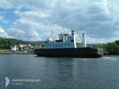
SVELVIKSUND
Ro-Ro/Passenger Ship
Current Trip
OANES / LAUVVIK
| Time Travelled | 127 days |
|---|---|
| Remaining Time | --- |
| Distance Travelled | 2228.34 nm |
| Remaining Distance | --- |
| AVG Speed | 7.3 Knopen |
| MAX Speed | 10.7 Knopen |
| AVG Wind | 7.6 knots |
| MAX Wind | 21.8 knots |
| MIN Temp | -1.7°C / 28.94°F |
| MAX Temp | 9.9°C / 49.82°F |
| Diepgang | 3.2 M |
| Positie ontvangen | 2 m geleden |
Current Position
| Lengtegraad | 6.05584° |
|---|---|
| Breedtegraat | 58.89423° |
| Status | Under way using engine |
| Snelheid | |
| Koers | --- |
| Gebied | North Sea |
| Station | T-AIS |
| Positie ontvangen | 2 m geleden |
Info
Information
The current position of SVELVIKSUND is in North Sea with coordinates 58.89423° / 6.05584° as reported on 2024-05-29 07:44 by AIS to our vessel tracker app. The vessel's current speed is 0 Knopen
The vessel SVELVIKSUND (IMO: 7719935, MMSI: 257392400) is a Ro-Ro/Passenger Ship that was built in 1978 ( 46 Jaar oud ). It's sailing under the flag of [NO] Norway.
In this page you can find informations about the vessels current position, last detected port calls, and current voyage information. If the vessels is not in coverage by AIS you will find the latest position.
The current position of SVELVIKSUND is detected by our AIS receivers and we are not responsible for the reliability of the data. The last position was recorded while the vessel was in Coverage by the Ais receivers of our vessel tracking app.
The current draught of SVELVIKSUND as reported by AIS is 3.2 meters
Weather
| Temperature | 11.9°C / 53.42°F |
|---|---|
| Wind Speed | 4 knots |
| Direction | 110° ESE |
| Pressure | 1008.2 hPa |
| Humidity | 69.8 % |
| Cloud Coverage | 96 % |
Featured Company
Last Port Calls
Most Visited Ports (Last year)
| Port | Arrivals | |
|---|---|---|
| 3 |
Last Trips
| Origin | Departure | Destination | Arrival | Distance |
|---|
Events
| Tijd | Evenement | Details | Positie / Bestemming | Info |
|---|---|---|---|---|
| 2024-05-29 07:42 | Stop beweging | 1.13 nm, South West of FORSAND |
58.89424 / 6.05582
OANES / LAUVVIK
|
Snelheid: Koers: 511° |
| 2024-05-29 07:33 | Start beweging | 0.34 nm, West of FORSAND |
58.90366 / 6.07835
OANES / LAUVVIK
|
Snelheid: 6.5 kn Koers: 172.1° |
| 2024-05-29 07:28 | Stop beweging | 0.46 nm, North West of FORSAND |
58.90576 / 6.07559
OANES / LAUVVIK
|
Snelheid: Koers: 511° |
| 2024-05-29 07:19 | Start beweging | 0.88 nm, South West of FORSAND |
58.89628 / 6.06285
OANES / LAUVVIK
|
Snelheid: 7.5 kn Koers: 62.4° |
| 2024-05-29 07:11 | Stop beweging | 1.13 nm, South West of FORSAND |
58.89425 / 6.05581
OANES / LAUVVIK
|
Snelheid: Koers: 511° |
| 2024-05-29 07:03 | Start beweging | 0.34 nm, West of FORSAND |
58.90188 / 6.07795
OANES / LAUVVIK
|
Snelheid: 7.8 kn Koers: 200.2° |
| 2024-05-29 06:57 | Stop beweging | 0.46 nm, North West of FORSAND |
58.90577 / 6.07558
OANES / LAUVVIK
|
Snelheid: Koers: 511° |
| 2024-05-29 06:49 | Start beweging | 0.82 nm, South West of FORSAND |
58.89673 / 6.06450
OANES / LAUVVIK
|
Snelheid: 7.1 kn Koers: 54.4° |
| 2024-05-29 06:43 | Stop beweging | 1.13 nm, South West of FORSAND |
58.89427 / 6.05581
OANES / LAUVVIK
|
Snelheid: Koers: 511° |
| 2024-05-29 06:32 | Start beweging | 0.34 nm, West of FORSAND |
58.90357 / 6.07802
OANES / LAUVVIK
|
Snelheid: 7.6 kn Koers: 161° |