
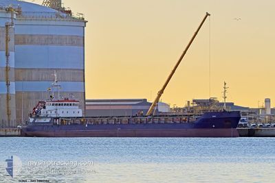
SUNA
General Cargo
Current Trip
GRFLS
| Time Travelled | 11 h, 14 mins |
|---|---|
| Remaining Time | --- |
| Distance Travelled | 68.96 nm |
| Remaining Distance | --- |
| AVG Speed | 8.7 Knopen |
| MAX Speed | 9.5 Knopen |
| AVG Wind | 5.5 knots |
| MAX Wind | 13 knots |
| MIN Temp | 8.8°C / 47.84°F |
| MAX Temp | 12.8°C / 55.04°F |
| Diepgang | 5.2 M |
| Positie ontvangen | 3 h, 39 m geleden |
Current Position
| Lengtegraad | --- |
|---|---|
| Breedtegraat | --- |
| Status | Under way using engine |
| Snelheid | 8.9 Knopen |
| Koers | 145.6° |
| Gebied | Adriatic Sea |
| Station | T-AIS |
| Positie ontvangen | 3 h, 39 m geleden |
Info
Information
The current position of SUNA is in Adriatic Sea with coordinates 44.74536° / 13.43028° as reported on 2025-12-05 16:36 by AIS to our vessel tracker app. The vessel's current speed is 8.9 Knopen
The vessel SUNA (IMO: 9080986, MMSI: 352001191) is a General Cargo that was built in 1994 ( 31 Jaar oud ). It's sailing under the flag of [PA] Panama.
In this page you can find informations about the vessels current position, last detected port calls, and current voyage information. If the vessels is not in coverage by AIS you will find the latest position.
The current position of SUNA is detected by our AIS receivers and we are not responsible for the reliability of the data. The last position was recorded while the vessel was in Coverage by the Ais receivers of our vessel tracking app.
The current draught of SUNA as reported by AIS is 5.2 meters
Weather
| Temperature | 13.1°C / 55.58°F |
|---|---|
| Wind Speed | 13 knots |
| Direction | 349° N |
| Pressure | 1010.5 hPa |
| Humidity | 70.8 % |
| Cloud Coverage | 100 % |
Featured Company
Last Port Calls
| Port | Arrival | Departure | Time In Port |
|---|---|---|---|
| 2025-12-01 08:04 | 2025-12-05 10:02 | 4 d | |
| 2025-11-06 10:05 | 2025-11-07 23:27 | 1 d | |
| 2025-10-15 01:48 | 2025-10-16 18:10 | 1 d |
Events
| Tijd | Evenement | Details | Positie / Bestemming | Info |
|---|---|---|---|---|
| 2025-12-05 16:39 | Status Changed | Default Under way using engine |
44.74014 / 13.43515
GRFLS
|
Snelheid: 8.9 kn Koers: 145.6° |
| 2025-12-05 16:36 | Status Changed | Under way using engine Default |
44.74536 / 13.43028
GRFLS
|
Snelheid: 8.9 kn Koers: 146° |
| 2025-12-05 16:36 | Buitenbereik |
44.74536 / 13.43028
Adriatic Sea
GRFLS
|
Snelheid: 8.9 kn Koers: 145.6° |
|
| 2025-12-05 16:15 | Status Changed | Default Under way using engine |
44.79006 / 13.38752
GRFLS
|
Snelheid: 8.9 kn Koers: 146° |
| 2025-12-05 15:53 | Status Changed | Under way using engine Default |
44.83452 / 13.34538
GRFLS
|
Snelheid: 9.1 kn Koers: 145° |
| 2025-12-05 15:53 | Binnenbereik |
44.83452 / 13.34538
Adriatic Sea
GRFLS
|
Snelheid: 8.9 kn Koers: 146° |
|
| 2025-12-05 13:57 | Status Changed | Default Under way using engine |
45.08025 / 13.11215
GRFLS
|
Snelheid: 9.3 kn Koers: 166.8° |
| 2025-12-05 13:41 | Buitenbereik |
45.11881 / 13.08586
Adriatic Sea
GRFLS
|
Snelheid: 9.3 kn Koers: 166.8° |
|
| 2025-12-05 12:53 | Wijzig zee gebeid | Croatian part of the Adriatic Sea Italian part of the Adriatic Sea |
45.23990 / 13.04482
Adriatic Sea
GRFLS
|
Snelheid: 9.3 kn Koers: 167.9° |
| 2025-12-05 09:02 | Vertrekhaven |
|
45.76957 / 13.24532
GRFLS
|
Snelheid: 7.5 kn Koers: 190° |