
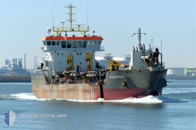
STRANDWAY
Trailing Suction Hopper Dredger
Current Trip
| Time Travelled | 5 h, 10 mins |
|---|---|
| Remaining Time | --- |
| Distance Travelled | 36.01 nm |
| Remaining Distance | 1.56 nm |
| AVG Speed | 8.5 Knopen |
| MAX Speed | 11.5 Knopen |
| AVG Wind | 29.4 knots |
| MAX Wind | 31 knots |
| MIN Temp | 6.2°C / 43.16°F |
| MAX Temp | 7.6°C / 45.68°F |
| Diepgang | 4 M |
| Positie ontvangen | 4 m geleden |
Current Position
| Lengtegraad | --- |
|---|---|
| Breedtegraat | --- |
| Status | Under way using engine |
| Snelheid | 10.6 Knopen |
| Koers | 321.5° |
| Gebied | North Sea |
| Station | T-AIS |
| Positie ontvangen | 4 m geleden |
Info
Information
The current position of STRANDWAY is in North Sea with coordinates 51.99255° / 4.04208° as reported on 2025-12-06 04:14 by AIS to our vessel tracker app. The vessel's current speed is 10.6 Knopen and is heading at the port of ROTTERDAM. The estimated time of arrival as calculated by MyShipTracking vessel tracking app is 2025-12-05 11:00 LT
The vessel STRANDWAY (IMO: 9664457, MMSI: 212396000) is a Trailing Suction Hopper Dredger that was built in 2014 ( 11 Jaar oud ). It's sailing under the flag of [CY] Cyprus.
In this page you can find informations about the vessels current position, last detected port calls, and current voyage information. If the vessels is not in coverage by AIS you will find the latest position.
The current position of STRANDWAY is detected by our AIS receivers and we are not responsible for the reliability of the data. The last position was recorded while the vessel was in Coverage by the Ais receivers of our vessel tracking app.
The current draught of STRANDWAY as reported by AIS is 4 meters
Weather
| Temperature | 7.5°C / 45.5°F |
|---|---|
| Wind Speed | 27 knots |
| Direction | 186° S |
| Pressure | 998.9 hPa |
| Humidity | 86.5 % |
| Cloud Coverage | 100 % |
Featured Company
Last Port Calls
| Port | Arrival | Departure | Time In Port |
|---|---|---|---|
| 2025-12-06 00:05 | 2025-12-06 00:08 | 3 m | |
| 2025-12-05 15:02 | 2025-12-05 15:13 | 10 m | |
| 2025-12-05 03:20 | 2025-12-05 04:07 | 46 m | |
| 2025-12-05 02:18 | 2025-12-05 03:03 | 45 m | |
| 2025-12-05 01:13 | 2025-12-05 01:55 | 42 m | |
| 2025-12-05 00:02 | 2025-12-05 00:55 | 52 m | |
| 2025-12-04 22:56 | 2025-12-04 23:51 | 55 m | |
| 2025-12-04 21:46 | 2025-12-04 22:43 | 57 m | |
| 2025-12-04 20:32 | 2025-12-04 21:32 | 1 h | |
| 2025-12-04 19:12 | 2025-12-04 20:19 | 1 h |
Most Visited Ports (Last year)
| Port | Arrivals | |
|---|---|---|
| 299 | ||
| 207 | ||
| 111 | ||
| 38 | ||
| 32 | ||
| 23 |
Last Trips
| Origin | Departure | Destination | Arrival | Distance | |
|---|---|---|---|---|---|
| 2025-12-05 15:13 | 2025-12-06 00:05 | 66.41 nm | |||
| 2025-12-05 04:07 | 2025-12-05 15:02 | 96.29 nm | |||
| 2025-12-05 03:03 | 2025-12-05 03:20 | 1.65 nm | |||
| 2025-12-05 01:55 | 2025-12-05 02:18 | 1.25 nm | |||
| 2025-12-05 00:55 | 2025-12-05 01:13 | 2.11 nm | |||
| 2025-12-04 23:51 | 2025-12-05 00:02 | 1.73 nm | |||
| 2025-12-04 22:43 | 2025-12-04 22:56 | 1.44 nm | |||
| 2025-12-04 21:32 | 2025-12-04 21:46 | 1.90 nm | |||
| 2025-12-04 20:19 | 2025-12-04 20:32 | 1.62 nm | |||
| 2025-12-04 19:01 | 2025-12-04 19:12 | 1.56 nm |
Events
| Tijd | Evenement | Details | Positie / Bestemming | Info |
|---|---|---|---|---|
| 2025-12-05 23:08 | Vertrekhaven |
|
51.96104 / 4.08203
ROTTERDAM
|
Snelheid: 2.8 kn Koers: 55° |
| 2025-12-05 23:05 | Aankomsthaven |
|
51.96048 / 4.07934
[NL] MAASVLAKTE - ROTTERDAM
|
Snelheid: 2.8 kn Koers: 161° |
| 2025-12-05 14:13 | Vertrekhaven |
|
51.96938 / 4.11113
ROTTERDAM
|
Snelheid: 2.9 kn Koers: 342° |
| 2025-12-05 14:02 | Aankomsthaven |
|
51.96782 / 4.11109
[NL] ROTTERDAM
|
Snelheid: 2.1 kn Koers: 108° |
| 2025-12-05 10:16 | Start beweging | 1.06 nm, North East of MAASVLAKTE - ROTTERDAM |
51.97557 / 4.08709
ROTTERDAM
|
Snelheid: 3.2 kn Koers: 304° |
| 2025-12-05 09:41 | Stop beweging | 0.85 nm, North East of MAASVLAKTE - ROTTERDAM |
51.97211 / 4.08491
ROTTERDAM
|
Snelheid: 0.2 kn Koers: 166° |
| 2025-12-05 09:36 | Start beweging | 0.87 nm, North East of MAASVLAKTE - ROTTERDAM |
51.97293 / 4.08435
ROTTERDAM
|
Snelheid: 3.5 kn Koers: 168° |
| 2025-12-05 09:33 | Stop beweging | 0.94 nm, North East of MAASVLAKTE - ROTTERDAM |
51.97490 / 4.08330
ROTTERDAM
|
Snelheid: 0.1 kn Koers: 161° |
| 2025-12-05 03:33 | Destination Changed | ROTTERDAM VLISSINGEN |
51.43574 / 3.60692
ROTTERDAM
|
Snelheid: 5.6 kn Koers: 263° |
| 2025-12-05 03:33 | ETA Changed | 2025/12/05 10:00 2026/11/27 09:00 |
51.43574 / 3.60692
ROTTERDAM
|
Snelheid: 5.6 kn Koers: 263° |