
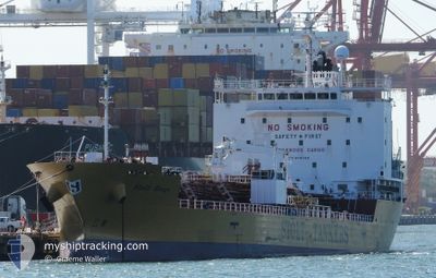
STOLT RENGE
Tanker B
Current Trip
| Time Travelled | 12 days |
|---|---|
| Remaining Time | 1 day |
| Distance Travelled | 3520.77 nm |
| Remaining Distance | 325.55 nm |
| AVG Speed | 12.9 Knopen |
| MAX Speed | 15 Knopen |
| AVG Wind | 11.6 knots |
| MAX Wind | 19.5 knots |
| MIN Temp | 24.9°C / 76.82°F |
| MAX Temp | 31.1°C / 87.98°F |
| Diepgang | 8.8 M |
| Positie ontvangen | 13 h, 23 m geleden |
Current Position
| Lengtegraad | --- |
|---|---|
| Breedtegraat | --- |
| Status | Under way using engine |
| Snelheid | 12.6 Knopen |
| Koers | 138.5° |
| Gebied | Coral Sea |
| Station | T-AIS |
| Positie ontvangen | 13 h, 23 m geleden |
Info
Information
The current position of STOLT RENGE is in Coral Sea with coordinates -20.77820° / 149.76235° as reported on 2026-01-03 13:25 by AIS to our vessel tracker app. The vessel's current speed is 12.6 Knopen and is heading at the port of BRISBANE. The estimated time of arrival as calculated by MyShipTracking vessel tracking app is 2026-01-05 16:00 LT
The vessel STOLT RENGE (IMO: 9781126, MMSI: 563206400) is a Tanker B It's sailing under the flag of [SG] Singapore.
In this page you can find informations about the vessels current position, last detected port calls, and current voyage information. If the vessels is not in coverage by AIS you will find the latest position.
The current position of STOLT RENGE is detected by our AIS receivers and we are not responsible for the reliability of the data. The last position was recorded while the vessel was in Coverage by the Ais receivers of our vessel tracking app.
The current draught of STOLT RENGE as reported by AIS is 8.8 meters
Weather
| Temperature | 25.8°C / 78.44°F |
|---|---|
| Wind Speed | 13 knots |
| Direction | 102° ESE |
| Pressure | 1012 hPa |
| Humidity | 68 % |
| Cloud Coverage | 25 % |
Featured Company
Last Port Calls
| Port | Arrival | Departure | Time In Port |
|---|---|---|---|
| 2025-12-22 18:21 | 2025-12-23 07:50 | 13 h | |
| 2025-12-21 20:43 | 2025-12-22 05:26 | 8 h | |
| 2025-12-21 10:02 | 2025-12-21 19:32 | 9 h | |
| 2025-12-21 09:16 | 2025-12-21 09:25 | 8 m | |
| 2025-12-18 20:26 | 2025-12-20 07:14 | 1 d | |
| 2025-12-16 13:38 | 2025-12-17 12:10 | 22 h | |
| 2025-12-12 07:05 | 2025-12-13 01:25 | 18 h | |
| 2025-12-11 09:09 | 2025-12-12 06:37 | 21 h | |
| 2025-12-05 00:18 | 2025-12-06 17:03 | 1 d | |
| 2025-11-25 16:47 | 2025-11-26 13:38 | 20 h |
Most Visited Ports (Last year)
| Port | Arrivals | |
|---|---|---|
| 8 | ||
| 8 | ||
| 7 | ||
| 6 | ||
| 5 | ||
| 5 |
Last Trips
| Origin | Departure | Destination | Arrival | Distance | |
|---|---|---|---|---|---|
| 2025-12-22 05:26 | 2025-12-22 18:21 | 47.96 nm | |||
| 2025-12-21 19:32 | 2025-12-21 20:43 | 3.93 nm | |||
| 2025-12-21 09:25 | 2025-12-21 10:02 | 1.14 nm | |||
| 2025-12-20 07:14 | 2025-12-21 09:16 | 242.36 nm | |||
| 2025-12-17 12:10 | 2025-12-18 20:26 | 436.80 nm | |||
| 2025-12-13 01:25 | 2025-12-16 13:38 | 604.80 nm | |||
| 2025-12-12 06:37 | 2025-12-12 07:05 | 2.13 nm | |||
| 2025-12-06 17:03 | 2025-12-11 09:09 | 897.98 nm | |||
| 2025-11-26 13:38 | 2025-12-05 00:18 | 2356.50 nm | |||
| 2025-11-13 08:32 | 2025-11-25 16:47 | 2741.34 nm |
Events
| Tijd | Evenement | Details | Positie / Bestemming | Info |
|---|---|---|---|---|
| 2026-01-03 13:31 | Status Changed | Default Under way using engine |
-20.79497 / 149.77806
AU BNE
|
Snelheid: 12.6 kn Koers: 138.5° |
| 2026-01-03 13:25 | Buitenbereik |
-20.77820 / 149.76235
Coral Sea
AU BNE
|
Snelheid: 12.6 kn Koers: 138.5° |
|
| 2026-01-03 13:21 | Status Changed | Under way using engine Default |
-20.76714 / 149.75205
AU BNE
|
Snelheid: 12.7 kn Koers: 139° |
| 2026-01-03 13:20 | Status Changed | Default Under way using engine |
-20.76488 / 149.74994
AU BNE
|
Snelheid: 12.7 kn Koers: 139.1° |
| 2026-01-03 13:20 | Status Changed | Under way using engine Default |
-20.76448 / 149.74958
AU BNE
|
Snelheid: 12.7 kn Koers: 139° |
| 2026-01-03 13:07 | Status Changed | Default Under way using engine |
-20.73248 / 149.71991
AU BNE
|
Snelheid: 12.9 kn Koers: 139.2° |
| 2026-01-03 12:51 | Status Changed | Under way using engine Default |
-20.68719 / 149.67832
AU BNE
|
Snelheid: 12.8 kn Koers: 140° |
| 2026-01-03 12:44 | Status Changed | Default Under way using engine |
-20.66760 / 149.66058
AU BNE
|
Snelheid: 13 kn Koers: 140.2° |
| 2026-01-03 12:30 | Status Changed | Under way using engine Default |
-20.62966 / 149.62661
AU BNE
|
Snelheid: 13.1 kn Koers: 140° |
| 2026-01-03 12:23 | Binnenbereik |
-20.62966 / 149.62661
Coral Sea
AU BNE
|
Snelheid: 13.1 kn Koers: 140° |