
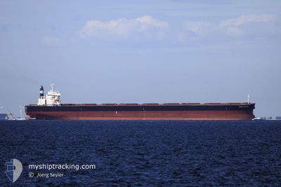
STAR PRINCESS
Bulk Carrier
Current Trip
| Time Travelled | --- |
|---|---|
| Remaining Time | 1 day |
| Distance Travelled | 2418.76 nm |
| Remaining Distance | 409.36 nm |
| AVG Speed | 8.2 Knopen |
| MAX Speed | 12.9 Knopen |
| AVG Wind | 6.9 knots |
| MAX Wind | 15.8 knots |
| MIN Temp | 19.1°C / 66.38°F |
| MAX Temp | 29.8°C / 85.64°F |
| Diepgang | 18.2 M |
| Positie ontvangen | 2 d geleden |
Current Position
| Lengtegraad | --- |
|---|---|
| Breedtegraat | --- |
| Status | Under way using engine |
| Snelheid | 8.6 Knopen |
| Koers | 0.9° |
| Gebied | Indian Ocean |
| Station | T-AIS |
| Positie ontvangen | 2 d geleden |
Info
Information
The current position of STAR PRINCESS is in Indian Ocean with coordinates -20.05442° / 57.41934° as reported on 2025-12-10 13:54 by AIS to our vessel tracker app. The vessel's current speed is 8.6 Knopen and is heading at the port of PORT LOUIS. The estimated time of arrival as calculated by MyShipTracking vessel tracking app is 2025-12-14 19:22 LT
The vessel STAR PRINCESS (IMO: 9296200, MMSI: 311000151) is a Bulk Carrier that was built in 2003 ( 22 Jaar oud ). It's sailing under the flag of [BS] Bahamas.
In this page you can find informations about the vessels current position, last detected port calls, and current voyage information. If the vessels is not in coverage by AIS you will find the latest position.
The current position of STAR PRINCESS is detected by our AIS receivers and we are not responsible for the reliability of the data. The last position was recorded while the vessel was in Coverage by the Ais receivers of our vessel tracking app.
The current draught of STAR PRINCESS as reported by AIS is 18.2 meters
Weather
| Temperature | 26°C / 78.8°F |
|---|---|
| Wind Speed | 13 knots |
| Direction | 118° ESE |
| Pressure | 1013.8 hPa |
| Humidity | 81 % |
| Cloud Coverage | 12 % |
Featured Company
Last Port Calls
Last Trips
| Origin | Departure | Destination | Arrival | Distance |
|---|
Events
| Tijd | Evenement | Details | Positie / Bestemming | Info |
|---|---|---|---|---|
| 2025-12-10 14:00 | Status Changed | Default Under way using engine |
-20.03944 / 57.41938
MU PLU
|
Snelheid: 8.6 kn Koers: 0.9° |
| 2025-12-10 13:54 | Buitenbereik |
-20.05442 / 57.41934
Indian Ocean
|
Snelheid: 8.6 kn Koers: 0.9° |
|
| 2025-12-10 13:51 | Status Changed | Under way using engine Default |
-20.06080 / 57.41931
MU PLU
|
Snelheid: 8.4 kn Koers: 1° |
| 2025-12-10 13:32 | Status Changed | Default Under way using engine |
-20.09939 / 57.43356
MU PLU
|
Snelheid: 7.3 kn Koers: 292.1° |
| 2025-12-10 13:12 | Status Changed | Under way using engine Default |
-20.11373 / 57.46771
MU PLU
|
Snelheid: 3.5 kn Koers: -1° |
| 2025-12-10 13:08 | Start beweging | 1.61 nm, North of PORT LOUIS |
-20.11566 / 57.47192
MU PLU
|
Snelheid: 3.5 kn Koers: -1° |
| 2025-12-10 12:56 | Binnenbereik |
-20.11313 / 57.46641
Indian Ocean
|
Snelheid: 4.2 kn Koers: 295.1° |
|
| 2025-12-10 11:06 | Status Changed | Default At anchor |
-20.11295 / 57.48046
MU PLU
|
Snelheid: 0.1 kn Koers: 511° |
| 2025-12-10 11:03 | Status Changed | At anchor Default |
-20.11309 / 57.48042
MU PLU
|
Snelheid: 0.1 kn Koers: -1° |
| 2025-12-10 11:03 | Buitenbereik |
-20.11309 / 57.48042
Indian Ocean
|
Snelheid: 0.1 kn Koers: 511° |