
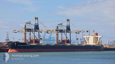
SOUTHERN CROSS DREAM
Bulk Carrier
Current Trip
| Time Travelled | 2 days |
|---|---|
| Remaining Time | 3 days |
| Distance Travelled | 869.63 nm |
| Remaining Distance | 1244.19 nm |
| AVG Speed | 12.3 Knopen |
| MAX Speed | 14.7 Knopen |
| AVG Wind | 10.7 knots |
| MAX Wind | 26.3 knots |
| MIN Temp | 12.1°C / 53.78°F |
| MAX Temp | 18.9°C / 66.02°F |
| Diepgang | 8.5 M |
| Positie ontvangen | 19 h, 0 m geleden |
Current Position
| Lengtegraad | --- |
|---|---|
| Breedtegraat | --- |
| Status | Under way using engine |
| Snelheid | 12.9 Knopen |
| Koers | 281.9° |
| Gebied | Mediterranean Sea - Eastern Basin |
| Station | T-AIS |
| Positie ontvangen | 19 h, 0 m geleden |
Info
Information
The current position of SOUTHERN CROSS DREAM is in Mediterranean Sea - Eastern Basin with coordinates 34.63121° / 23.87167° as reported on 2025-12-11 21:12 by AIS to our vessel tracker app. The vessel's current speed is 12.9 Knopen and is heading at the port of GIBRALTAR. The estimated time of arrival as calculated by MyShipTracking vessel tracking app is 2025-12-16 14:03 LT
The vessel SOUTHERN CROSS DREAM (IMO: 9558189, MMSI: 431051000) is a Bulk Carrier that was built in 2011 ( 14 Jaar oud ). It's sailing under the flag of [JP] Japan.
In this page you can find informations about the vessels current position, last detected port calls, and current voyage information. If the vessels is not in coverage by AIS you will find the latest position.
The current position of SOUTHERN CROSS DREAM is detected by our AIS receivers and we are not responsible for the reliability of the data. The last position was recorded while the vessel was in Coverage by the Ais receivers of our vessel tracking app.
The current draught of SOUTHERN CROSS DREAM as reported by AIS is 8.5 meters
Weather
| Temperature | 17.4°C / 63.32°F |
|---|---|
| Wind Speed | 10 knots |
| Direction | 22° NNE |
| Pressure | 1019.6 hPa |
| Humidity | 68.8 % |
| Cloud Coverage | 77 % |
Featured Company
Last Port Calls
| Port | Arrival | Departure | Time In Port |
|---|---|---|---|
| 2025-12-02 17:05 | 2025-12-09 21:49 | 7 d | |
| 2025-11-02 23:46 | 2025-11-04 00:27 | 1 d |
Most Visited Ports (Last year)
| Port | Arrivals | |
|---|---|---|
| 2 | ||
| 2 | ||
| 2 | ||
| 1 | ||
| 1 | ||
| 1 |
Last Trips
| Origin | Departure | Destination | Arrival | Distance | |
|---|---|---|---|---|---|
| 2025-11-04 00:27 | 2025-12-02 17:05 | 5481.08 nm | |||
| 2025-09-11 00:31 | 2025-11-02 23:46 | 8371.57 nm |
Events
| Tijd | Evenement | Details | Positie / Bestemming | Info |
|---|---|---|---|---|
| 2025-12-11 21:16 | Status Changed | Default Under way using engine |
34.63334 / 23.85333
GIGIB
|
Snelheid: 12.9 kn Koers: 281.9° |
| 2025-12-11 21:12 | Status Changed | Under way using engine Default |
34.63121 / 23.87167
GIGIB
|
Snelheid: 13 kn Koers: 281° |
| 2025-12-11 21:12 | Buitenbereik |
34.63121 / 23.87167
Mediterranean Sea - Eastern Basin
GIGIB
|
Snelheid: 12.9 kn Koers: 281.9° |
|
| 2025-12-11 20:55 | Binnenbereik |
34.63121 / 23.87167
Mediterranean Sea - Eastern Basin
GIGIB
|
Snelheid: 12.9 kn Koers: 281.9° |
|
| 2025-12-11 13:10 | Status Changed | Default Under way using engine |
34.58333 / 25.91500
GIGIB
|
Snelheid: 12.6 kn Koers: 270.5° |
| 2025-12-11 12:55 | Buitenbereik |
34.58262 / 25.97875
Mediterranean Sea - Eastern Basin
GIGIB
|
Snelheid: 12.6 kn Koers: 270.5° |
|
| 2025-12-11 12:47 | Status Changed | Under way using engine Default |
34.58243 / 26.01352
GIGIB
|
Snelheid: 12 kn Koers: 269° |
| 2025-12-11 12:28 | Status Changed | Default Under way using engine |
34.58217 / 26.09528
GIGIB
|
Snelheid: 12.9 kn Koers: 271° |
| 2025-12-11 11:57 | Status Changed | Under way using engine Default |
34.58208 / 26.22650
GIGIB
|
Snelheid: 12 kn Koers: 261° |
| 2025-12-11 11:23 | Wijzig zee gebeid | Greek part of the Mediterranean Sea - Eastern Basin Cypriote part of the Mediterranean Sea - Eastern Basin |
34.59859 / 26.37631
Mediterranean Sea - Eastern Basin
GIGIB
|
Snelheid: 14.1 kn Koers: 261.6° |