
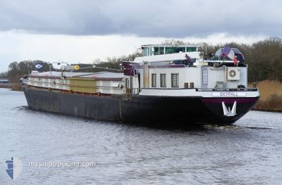
SKYFALL
Cargo
Current Trip
| Trip Time | --- |
|---|---|
| Trip Distance | --- |
| AVG Speed | --- |
| MAX Speed | --- |
| Diepgang | --- |
| AVG Wind | --- |
| MAX Wind | --- |
| MIN Temp | --- |
| MAX Temp | --- |
| Positie ontvangen | 1 d geleden |
Current Position
| Lengtegraad | --- |
|---|---|
| Breedtegraat | --- |
| Status | Under way using engine |
| Snelheid | 9.2 Knopen |
| Koers | 344.7° |
| Gebied | North Sea |
| Station | T-AIS |
| Positie ontvangen | 1 d geleden |
Info
Information
The current position of SKYFALL is in North Sea with coordinates 50.79321° / 5.68815° as reported on 2025-12-19 07:42 by AIS to our vessel tracker app. The vessel's current speed is 9.2 Knopen and is currently inside the port of OLEN.
The vessel SKYFALL (MMSI: 226007710) is a Cargo It's sailing under the flag of [FR] France.
In this page you can find informations about the vessels current position, last detected port calls, and current voyage information. If the vessels is not in coverage by AIS you will find the latest position.
The current position of SKYFALL is detected by our AIS receivers and we are not responsible for the reliability of the data. The last position was recorded while the vessel was in Coverage by the Ais receivers of our vessel tracking app.
The current draught of SKYFALL as reported by AIS is 2.8 meters
Weather
| Temperature | 7.1°C / 44.78°F |
|---|---|
| Wind Speed | 6 knots |
| Direction | 88° E |
| Pressure | 1013.9 hPa |
| Humidity | 81.1 % |
| Cloud Coverage | 100 % |
Featured Company
Last Port Calls
| Port | Arrival | Departure | Time In Port |
|---|---|---|---|
| 2025-12-10 19:13 | 2025-12-18 12:43 | 7 d | |
| 2025-12-09 14:59 | 2025-12-09 15:12 | 13 m | |
| 2025-12-09 09:27 | 2025-12-09 11:05 | 1 h | |
| 2025-12-01 09:02 | 2025-12-02 18:23 | 1 d | |
| 2025-11-30 19:38 | 2025-12-01 05:37 | 9 h | |
| 2025-11-29 07:53 | 2025-11-29 08:15 | 21 m | |
| 2025-11-28 21:10 | 2025-11-29 04:32 | 7 h | |
| 2025-11-25 07:25 | 2025-11-26 10:57 | 1 d | |
| 2025-11-21 19:04 | 2025-11-22 05:01 | 9 h | |
| 2025-11-21 15:38 | 2025-11-21 17:07 | 1 h |
Last Trips
| Origin | Departure | Destination | Arrival | Distance | |
|---|---|---|---|---|---|
| 2025-12-09 16:12 | 2025-12-10 20:13 | 95.91 nm | |||
| 2025-12-09 12:05 | 2025-12-09 15:59 | 21.52 nm | |||
| 2025-12-02 19:23 | 2025-12-09 10:27 | 153.62 nm | |||
| 2025-12-01 06:37 | 2025-12-01 10:02 | 20.99 nm | |||
| 2025-11-29 09:15 | 2025-11-30 20:38 | 176.73 nm | |||
| 2025-11-29 05:32 | 2025-11-29 08:53 | 14.87 nm | |||
| 2025-11-26 11:57 | 2025-11-28 22:10 | 194.22 nm | |||
| 2025-11-22 06:01 | 2025-11-25 08:25 | 199.76 nm | |||
| 2025-11-21 18:07 | 2025-11-21 20:04 | 7.75 nm | |||
| 2025-11-17 10:44 | 2025-11-21 16:38 | 311.36 nm |
Events
| Tijd | Evenement | Details | Positie / Bestemming | Info |
|---|---|---|---|---|
| 2025-12-19 10:32 | Stop beweging | 2.59 nm, West of GENK |
50.93833 / 5.43167
2E HAVENDOK
|
Snelheid: Koers: -1° |
| 2025-12-19 10:17 | Start beweging | 1.96 nm, West of GENK |
50.93667 / 5.44833
2E HAVENDOK
|
Snelheid: 6 kn Koers: 279° |
| 2025-12-19 07:44 | Status Changed | Default Under way using engine |
50.79666 / 5.68500
2E HAVENDOK
|
Snelheid: 9.2 kn Koers: 344.7° |
| 2025-12-19 07:41 | Status Changed | Under way using engine Moored |
50.79228 / 5.68856
2E HAVENDOK
|
Snelheid: Koers: 182° |
| 2025-12-19 07:41 | Start beweging | 0.59 nm, South West of WAOLENWIERT |
50.79228 / 5.68856
2E HAVENDOK
|
Snelheid: 8.6 kn Koers: 342.6° |
| 2025-12-19 07:31 | Buitenbereik |
50.79452 / 5.69095
North Sea
2E HAVENDOK
|
Snelheid: Koers: 0.2° |
|
| 2025-12-19 07:28 | Status Changed | Moored Under way using engine |
50.79452 / 5.69094
2E HAVENDOK
|
Snelheid: 3.2 kn Koers: 183° |
| 2025-12-19 07:28 | Stop beweging | 0.45 nm, West of WAOLENWIERT |
50.79452 / 5.69094
2E HAVENDOK
|
Snelheid: Koers: 183° |
| 2025-12-19 06:58 | Status Changed | Under way using engine Default |
50.79586 / 5.69111
2E HAVENDOK
|
Snelheid: 8 kn Koers: 199° |
| 2025-12-19 06:47 | Binnenbereik |
50.79586 / 5.69111
North Sea
2E HAVENDOK
|
Snelheid: 3.2 kn Koers: 185.3° |