
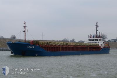
SIMON B
General Cargo
Current Trip
| Time Travelled | 16 h, 12 mins |
|---|---|
| Remaining Time | 16 h, 45 mins |
| Distance Travelled | 105.18 nm |
| Remaining Distance | 114.96 nm |
| AVG Speed | 6.6 Knopen |
| MAX Speed | 8.4 Knopen |
| AVG Wind | 11.3 knots |
| MAX Wind | 26.7 knots |
| MIN Temp | -1.4°C / 29.48°F |
| MAX Temp | 1.2°C / 34.16°F |
| Diepgang | 3.9 M |
| Positie ontvangen | Nu |
Current Position
| Lengtegraad | --- |
|---|---|
| Breedtegraat | --- |
| Status | Under way using engine |
| Snelheid | 6.7 Knopen |
| Koers | 200.2° |
| Gebied | Baltic Sea |
| Station | T-AIS |
| Positie ontvangen | Nu |
Info
Information
The current position of SIMON B is in Baltic Sea with coordinates 54.25530° / 9.61975° as reported on 2026-01-03 16:45 by AIS to our vessel tracker app. The vessel's current speed is 6.7 Knopen and is heading at the port of HUSUM. The estimated time of arrival as calculated by MyShipTracking vessel tracking app is 2026-01-04 10:31 LT
The vessel SIMON B (IMO: 8511029, MMSI: 218801000) is a General Cargo that was built in 1986 ( 40 Jaar oud ). It's sailing under the flag of [DE] Germany.
In this page you can find informations about the vessels current position, last detected port calls, and current voyage information. If the vessels is not in coverage by AIS you will find the latest position.
The current position of SIMON B is detected by our AIS receivers and we are not responsible for the reliability of the data. The last position was recorded while the vessel was in Coverage by the Ais receivers of our vessel tracking app.
The current draught of SIMON B as reported by AIS is 3.9 meters
Weather
| Temperature | -0.4°C / 31.28°F |
|---|---|
| Wind Speed | 5 knots |
| Direction | 255° WSW |
| Pressure | 995.1 hPa |
| Humidity | 86.4 % |
| Cloud Coverage | 97 % |
Featured Company
Last Port Calls
| Port | Arrival | Departure | Time In Port |
|---|---|---|---|
| 2025-12-23 14:58 | 2026-01-03 01:34 | 10 d | |
| 2025-12-19 14:39 | 2025-12-22 19:18 | 3 d | |
| 2025-12-17 18:28 | 2025-12-18 01:49 | 7 h | |
| 2025-12-16 12:37 | 2025-12-17 08:35 | 19 h | |
| 2025-12-15 03:32 | 2025-12-15 16:13 | 12 h | |
| 2025-12-14 05:30 | 2025-12-14 09:30 | 3 h | |
| 2025-12-13 00:28 | 2025-12-13 12:29 | 12 h | |
| 2025-12-12 00:53 | 2025-12-12 12:56 | 12 h | |
| 2025-12-06 21:49 | 2025-12-09 14:45 | 2 d | |
| 2025-12-02 00:53 | 2025-12-03 16:13 | 1 d |
Last Trips
| Origin | Departure | Destination | Arrival | Distance | |
|---|---|---|---|---|---|
| 2025-12-22 19:18 | 2025-12-23 14:58 | 152.92 nm | |||
| 2025-12-18 01:49 | 2025-12-19 14:39 | 235.24 nm | |||
| 2025-12-17 08:35 | 2025-12-17 18:28 | 87.48 nm | |||
| 2025-12-15 16:13 | 2025-12-16 12:37 | 158.41 nm | |||
| 2025-12-14 09:30 | 2025-12-15 03:32 | 147.73 nm | |||
| 2025-12-13 12:29 | 2025-12-14 05:30 | 122.52 nm | |||
| 2025-12-12 12:56 | 2025-12-13 00:28 | 62.24 nm | |||
| 2025-12-09 14:45 | 2025-12-12 00:53 | 240.27 nm | |||
| 2025-12-03 16:13 | 2025-12-06 21:49 | 531.21 nm | |||
| 2025-11-25 18:32 | 2025-12-02 00:53 | 585.65 nm |
Events
| Tijd | Evenement | Details | Positie / Bestemming | Info |
|---|---|---|---|---|
| 2026-01-03 16:02 | Status Changed | Under way using engine Default |
54.30749 / 9.71118
DEHUS
|
Snelheid: 6.8 kn Koers: 187° |
| 2026-01-03 15:58 | Status Changed | Default Under way using engine |
54.31504 / 9.71308
DEHUS
|
Snelheid: 6.7 kn Koers: 186.8° |
| 2026-01-03 15:54 | Status Changed | Under way using engine Default |
54.32187 / 9.71473
DEHUS
|
Snelheid: 6.7 kn Koers: 228° |
| 2026-01-03 15:22 | Status Changed | Default Under way using engine |
54.36129 / 9.79152
DEHUS
|
Snelheid: 6.9 kn Koers: 267.3° |
| 2026-01-03 13:26 | Start beweging | 1.43 nm, South West of STICKENHΟRN SPORT |
54.36583 / 10.13931
DEHUS
|
Snelheid: 3.4 kn Koers: 286° |
| 2026-01-03 13:07 | Stop beweging | 1.38 nm, South West of STICKENHΟRN SPORT |
54.36535 / 10.14231
DEHUS
|
Snelheid: 0.3 kn Koers: 283° |
| 2026-01-03 10:28 | Wijzig zee gebeid | German part of the Baltic Sea Danish part of the Baltic Sea |
54.56211 / 10.55078
Baltic Sea
DEHUS
|
Snelheid: 8.2 kn Koers: 246.9° |
| 2026-01-03 09:18 | Wijzig zee gebeid | Danish part of the Baltic Sea German part of the Baltic Sea |
54.59086 / 10.81676
Baltic Sea
DEHUS
|
Snelheid: 7.5 kn Koers: 263.5° |
| 2026-01-03 06:19 | Gevonden in zee | German part of the Baltic Sea |
54.54411 / 11.36269
Baltic Sea
DEHUS
|
Snelheid: 6.2 kn Koers: 296.5° |
| 2026-01-03 03:20 | Wijzig zee gebeid | Danish part of the Baltic Sea German part of the Baltic Sea |
54.36804 / 11.79017
Baltic Sea
DEHUS
|
Snelheid: 6.2 kn Koers: 311.9° |