
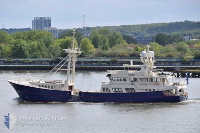
SCINTILLA MARIS
Pleasure Craft
Current Trip
| Time Travelled | 7 days |
|---|---|
| Remaining Time | 1 day |
| Distance Travelled | 418.57 nm |
| Remaining Distance | 402.66 nm |
| AVG Speed | 9.4 Knopen |
| MAX Speed | 14.2 Knopen |
| AVG Wind | 7.1 knots |
| MAX Wind | 11.9 knots |
| MIN Temp | 9.3°C / 48.74°F |
| MAX Temp | 15.9°C / 60.62°F |
| Diepgang | 5 M |
| Positie ontvangen | 1 m geleden |
Current Position
| Lengtegraad | -5.02832° |
|---|---|
| Breedtegraat | 49.94712° |
| Status | Under way using engine |
| Snelheid | 8.8 Knopen |
| Koers | 192° |
| Gebied | English Channel |
| Station | T-AIS |
| Positie ontvangen | 1 m geleden |
Info
Information
The current position of SCINTILLA MARIS is in English Channel with coordinates 49.94712° / -5.02832° as reported on 2024-05-11 17:59 by AIS to our vessel tracker app. The vessel's current speed is 8.8 Knopen and is heading at the port of GLASGOW. The estimated time of arrival as calculated by MyShipTracking vessel tracking app is 2024-05-13 14:34 LT
The vessel SCINTILLA MARIS (IMO: 8807222, MMSI: 538071876) is a Pleasure Craft It's sailing under the flag of [MH] Marshall Is.
In this page you can find informations about the vessels current position, last detected port calls, and current voyage information. If the vessels is not in coverage by AIS you will find the latest position.
The current position of SCINTILLA MARIS is detected by our AIS receivers and we are not responsible for the reliability of the data. The last position was recorded while the vessel was in Coverage by the Ais receivers of our vessel tracking app.
The current draught of SCINTILLA MARIS as reported by AIS is 5 meters
Weather
| Temperature | 13.7°C / 56.66°F |
|---|---|
| Wind Speed | 11 knots |
| Direction | 84° E |
| Pressure | 1016 hPa |
| Humidity | 89.2 % |
| Cloud Coverage | 92 % |
Featured Company
Last Port Calls
| Port | Arrival | Departure | Time In Port |
|---|---|---|---|
| 2024-04-27 15:21 | 2024-05-04 10:42 | 6 d | |
| 2024-04-19 11:21 | 2024-04-26 07:19 | 6 d | |
| 2024-04-19 09:16 | 2024-04-19 09:57 | 40 m | |
| 2024-04-18 14:23 | 2024-04-19 06:32 | 16 h | |
| 2024-04-18 07:45 |
Most Visited Ports (Last year)
| Port | Arrivals | |
|---|---|---|
| 12 | ||
| 1 |
Last Trips
| Origin | Departure | Destination | Arrival | Distance | |
|---|---|---|---|---|---|
| 2024-04-26 09:19 | 2024-04-27 16:21 | 230.16 nm | |||
| 2024-04-19 11:57 | 2024-04-19 13:21 | 2.83 nm | |||
| 2024-04-19 08:32 | 2024-04-19 11:16 | 8.34 nm | |||
| 2024-04-18 09:45 | 2024-04-18 16:23 | 28.76 nm |
Events
| Tijd | Evenement | Details | Positie / Bestemming | Info |
|---|---|---|---|---|
| 2024-05-11 16:26 | Start beweging | 0.82 nm, South East of MYLOR |
50.16916 / -5.03603
GB GLASGOW
|
Snelheid: 4.8 kn Koers: 226° |
| 2024-05-11 16:23 | Status Changed | Under way using engine At anchor |
50.17120 / -5.03413
GB GLASGOW
|
Snelheid: 0.1 kn Koers: 115° |
| 2024-05-11 14:30 | Destination Changed | GB GLASGOW GB FALMOUTH |
50.17106 / -5.03409
GB GLASGOW
|
Snelheid: 0.1 kn Koers: 98° |
| 2024-05-11 14:30 | ETA Changed | 2024/05/13 10:00 2024/05/09 17:00 |
50.17106 / -5.03409
GB GLASGOW
|
Snelheid: 0.1 kn Koers: 98° |
| 2024-05-11 11:58 | Binnenbereik |
50.17083 / -5.03399
English Channel
|
Snelheid: 0.1 kn Koers: 217.5° |
|
| 2024-05-11 10:07 | Buitenbereik |
50.17090 / -5.03404
English Channel
|
Snelheid: 0.1 kn Koers: 9.2° |
|
| 2024-05-11 09:46 | Binnenbereik |
50.17088 / -5.03402
English Channel
|
Snelheid: Koers: 165.2° |
|
| 2024-05-11 06:46 | Buitenbereik |
50.17102 / -5.03406
English Channel
|
Snelheid: Koers: 205.8° |
|
| 2024-05-11 05:55 | Binnenbereik |
50.17101 / -5.03406
English Channel
|
Snelheid: Koers: 172° |
|
| 2024-05-11 02:34 | Buitenbereik |
50.17103 / -5.03400
English Channel
|
Snelheid: Koers: 11.1° |