
SANTA BARBARA
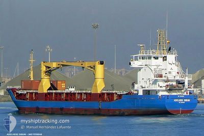
General Cargo
Current Trip
| Time Travelled | 8 days |
|---|---|
| Remaining Time | 20 h, 49 mins |
| Distance Travelled | 1564.21 nm |
| Remaining Distance | 279.95 nm |
| AVG Speed | 8 Knopen |
| MAX Speed | 11.2 Knopen |
| AVG Wind | 11.4 knots |
| MAX Wind | 30 knots |
| MIN Temp | 7.7°C / 45.86°F |
| MAX Temp | 18.3°C / 64.94°F |
| Diepgang | 5.6 M |
| Positie ontvangen | 11 h, 7 m geleden |
Current Position
| Lengtegraad | --- |
|---|---|
| Breedtegraat | --- |
| Status | Under way using engine |
| Snelheid | 10 Knopen |
| Koers | 242.9° |
| Gebied | Mediterranean Sea - Western Basin |
| Station | T-AIS |
| Positie ontvangen | 11 h, 7 m geleden |
Info
Information
The current position of SANTA BARBARA is in Mediterranean Sea - Western Basin with coordinates 37.48924° / 1.06999° as reported on 2025-12-10 19:18 by AIS to our vessel tracker app. The vessel's current speed is 10 Knopen and is heading at the port of CEUTA. The estimated time of arrival as calculated by MyShipTracking vessel tracking app is 2025-12-12 04:14 LT
The vessel SANTA BARBARA (IMO: 9210048, MMSI: 314788000) is a General Cargo that was built in 2000 ( 25 Jaar oud ). It's sailing under the flag of [BB] Barbados.
In this page you can find informations about the vessels current position, last detected port calls, and current voyage information. If the vessels is not in coverage by AIS you will find the latest position.
The current position of SANTA BARBARA is detected by our AIS receivers and we are not responsible for the reliability of the data. The last position was recorded while the vessel was in Coverage by the Ais receivers of our vessel tracking app.
The current draught of SANTA BARBARA as reported by AIS is 5.6 meters
Weather
| Temperature | 16.6°C / 61.88°F |
|---|---|
| Wind Speed | 15 knots |
| Direction | 45° NE |
| Pressure | 1020.7 hPa |
| Humidity | 81.8 % |
| Cloud Coverage | 97 % |
Featured Company
Last Port Calls
| Port | Arrival | Departure | Time In Port |
|---|---|---|---|
| 2025-11-30 01:54 | 2025-12-02 18:41 | 2 d | |
| 2025-11-26 00:35 | |||
| 2025-11-08 02:44 | 2025-11-08 11:17 | 8 h | |
| 2025-10-31 16:56 | 2025-11-04 12:34 | 3 d | |
| 2025-10-23 14:54 | 2025-10-24 23:42 | 1 d | |
| 2025-10-06 02:38 | 2025-10-16 14:50 | 10 d |
Most Visited Ports (Last year)
| Port | Arrivals | |
|---|---|---|
| 8 | ||
| 7 | ||
| 3 | ||
| 3 | ||
| 1 | ||
| 1 |
Last Trips
| Origin | Departure | Destination | Arrival | Distance | |
|---|---|---|---|---|---|
| 2025-11-26 00:35 | 2025-11-30 01:54 | 337.22 nm | |||
| 2025-11-04 12:34 | 2025-11-08 02:44 | 498.53 nm | |||
| 2025-10-24 23:42 | 2025-10-31 16:56 | 1599.70 nm | |||
| 2025-10-16 14:50 | 2025-10-23 14:54 | 19.73 nm | |||
| 2025-09-29 02:42 | 2025-10-06 02:38 | 1181.79 nm |
Events
| Tijd | Evenement | Details | Positie / Bestemming | Info |
|---|---|---|---|---|
| 2025-12-10 19:25 | Status Changed | Default Under way using engine |
37.48015 / 1.04640
ESCEU
|
Snelheid: 10 kn Koers: 242.9° |
| 2025-12-10 19:18 | Buitenbereik |
37.48924 / 1.06999
Mediterranean Sea - Western Basin
ESCEU
|
Snelheid: 10 kn Koers: 242.9° |
|
| 2025-12-10 17:50 | Gevonden in zee | Algerian part of the Mediterranean Sea - Western Basin |
37.60126 / 1.34627
Mediterranean Sea - Western Basin
ESCEU
|
Snelheid: 9.9 kn Koers: 242.8° |
| 2025-12-10 17:39 | Draught Changed | 5.6 5.7 |
37.61511 / 1.37861
ESCEU
|
Snelheid: 10 kn Koers: 242.5° |
| 2025-12-10 17:39 | ETA Changed | 2025/12/12 08:00 2025/12/10 18:00 |
37.61511 / 1.37861
ESCEU
|
Snelheid: 10 kn Koers: 242.5° |
| 2025-12-10 16:57 | Status Changed | Under way using engine Default |
37.67070 / 1.51340
ESCEU
|
Snelheid: 10.1 kn Koers: 242° |
| 2025-12-10 16:45 | Status Changed | Default Under way using engine |
37.68580 / 1.54963
ESCEU
|
Snelheid: 10.2 kn Koers: 244.4° |
| 2025-12-10 16:04 | Wijzig zee gebeid | Spanish part of the Mediterranean Sea - Western Basin Greek part of the Mediterranean Sea - Eastern Basin |
37.73647 / 1.68107
Mediterranean Sea - Western Basin
ESCEU
|
Snelheid: 10.2 kn Koers: 243.6° |
| 2025-12-10 16:03 | Status Changed | Under way using engine Default |
37.73856 / 1.68653
ESCEU
|
Snelheid: 10.3 kn Koers: 245° |
| 2025-12-10 15:57 | Binnenbereik |
37.73647 / 1.68107
Mediterranean Sea - Western Basin
ESCEU
|
Snelheid: 10.2 kn Koers: 243.6° |