
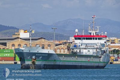
SAGASBANK
General Cargo
Current Trip
| Time Travelled | 2 days |
|---|---|
| Remaining Time | 1 day |
| Distance Travelled | 669.57 nm |
| Remaining Distance | 344.37 nm |
| AVG Speed | 11.7 Knopen |
| MAX Speed | 14 Knopen |
| AVG Wind | 14.1 knots |
| MAX Wind | 19 knots |
| MIN Temp | 2.5°C / 36.5°F |
| MAX Temp | 7.6°C / 45.68°F |
| Diepgang | 6.1 M |
| Positie ontvangen | 1 m geleden |
Current Position
| Lengtegraad | -2.67008° |
|---|---|
| Breedtegraat | 58.69420° |
| Status | Under way using engine |
| Snelheid | 11.3 Knopen |
| Koers | 277.9° |
| Gebied | North Sea |
| Station | T-AIS |
| Positie ontvangen | 1 m geleden |
Info
Information
The current position of SAGASBANK is in North Sea with coordinates 58.69420° / -2.67008° as reported on 2024-04-28 01:29 by AIS to our vessel tracker app. The vessel's current speed is 11.3 Knopen and is heading at the port of BELFAST. The estimated time of arrival as calculated by MyShipTracking vessel tracking app is 2024-04-29 07:49 LT
The vessel SAGASBANK (IMO: 9369655, MMSI: 246061000) is a General Cargo that was built in 2010 ( 14 Jaar oud ). It's sailing under the flag of [NL] Netherlands.
In this page you can find informations about the vessels current position, last detected port calls, and current voyage information. If the vessels is not in coverage by AIS you will find the latest position.
The current position of SAGASBANK is detected by our AIS receivers and we are not responsible for the reliability of the data. The last position was recorded while the vessel was in Coverage by the Ais receivers of our vessel tracking app.
The current draught of SAGASBANK as reported by AIS is 6.1 meters
Weather
| Temperature | 7.2°C / 44.96°F |
|---|---|
| Wind Speed | 13 knots |
| Direction | 136° SE |
| Pressure | 1010.9 hPa |
| Humidity | 80.7 % |
| Cloud Coverage | 20 % |
Featured Company
Last Port Calls
| Port | Arrival | Departure | Time In Port |
|---|---|---|---|
| 2024-04-24 15:50 | 2024-04-25 15:51 | 1 d | |
| 2024-04-21 18:48 | 2024-04-23 16:09 | 1 d | |
| 2024-04-21 10:49 | 2024-04-21 10:54 | 4 m | |
| 2024-04-02 11:11 | 2024-04-09 13:50 | 7 d | |
| 2024-03-27 18:56 | 2024-03-28 20:26 | 1 d | |
| 2024-03-26 15:53 | 2024-03-27 13:41 | 21 h | |
| 2024-03-24 15:03 | 2024-03-25 18:59 | 1 d | |
| 2024-03-17 15:13 | 2024-03-21 07:37 | 3 d | |
| 2024-03-09 10:22 | 2024-03-11 18:17 | 2 d | |
| 2024-03-06 02:36 | 2024-03-07 05:05 | 1 d |
Most Visited Ports (Last year)
| Port | Arrivals | |
|---|---|---|
| 7 | ||
| 6 | ||
| 4 | ||
| 3 | ||
| 3 | ||
| 3 |
Last Trips
| Origin | Departure | Destination | Arrival | Distance | |
|---|---|---|---|---|---|
| 2024-04-23 18:09 | 2024-04-24 17:50 | 94.41 nm | |||
| 2024-04-21 12:54 | 2024-04-21 20:48 | 80.65 nm | |||
| 2024-04-09 14:50 | 2024-04-21 12:49 | 1465.92 nm | |||
| 2024-03-28 21:26 | 2024-04-02 12:11 | 1057.15 nm | |||
| 2024-03-27 14:41 | 2024-03-27 19:56 | 34.72 nm | |||
| 2024-03-25 18:59 | 2024-03-26 16:53 | 202.29 nm | |||
| 2024-03-21 08:37 | 2024-03-24 15:03 | 369.88 nm | |||
| 2024-03-11 19:17 | 2024-03-17 16:13 | 1044.20 nm | |||
| 2024-03-07 05:05 | 2024-03-09 11:22 | 546.51 nm | |||
| 2024-03-05 02:07 | 2024-03-06 02:36 | 282.56 nm |
Events
| Tijd | Evenement | Details | Positie / Bestemming | Info |
|---|---|---|---|---|
| 2024-04-28 01:19 | Gevonden in zee | United Kingdom part of the North Sea |
58.68974 / -2.60846
North Sea
BELFAST
|
Snelheid: 11.4 kn Koers: 275.9° |
| 2024-04-28 01:19 | Status Changed | Under way using engine Default |
58.68974 / -2.60846
BELFAST
|
Snelheid: 11.3 kn Koers: 276° |
| 2024-04-28 01:06 | Binnenbereik |
58.68974 / -2.60846
North Sea
BELFAST
|
Snelheid: 11.4 kn Koers: 275.9° |
|
| 2024-04-27 06:32 | Status Changed | Default Under way using engine |
58.09429 / 4.07601
BELFAST
|
Snelheid: 11.9 kn Koers: 283.3° |
| 2024-04-27 06:32 | Buitenbereik |
58.09407 / 4.07814
North Sea
BELFAST
|
Snelheid: 11.9 kn Koers: 283.3° |
|
| 2024-04-26 21:38 | Gevonden in zee | Norwegian part of the North Sea |
57.80653 / 7.32058
North Sea
BELFAST
|
Snelheid: 12.1 kn Koers: 272.4° |
| 2024-04-26 16:53 | Wijzig zee gebeid | Norwegian part of the Skaggerak Danish part of the Skaggerak |
57.81576 / 9.07361
Skaggerak
BELFAST
|
Snelheid: 11 kn Koers: 266.6° |
| 2024-04-26 11:37 | Wijzig zee gebeid | Danish part of the Skaggerak Danish part of the Kattegat |
57.80292 / 10.92327
Skaggerak
BELFAST
|
Snelheid: 12 kn Koers: 319.8° |
| 2024-04-26 10:22 | Wijzig zee gebeid | Danish part of the Kattegat Swedish part of the Kattegat |
57.61752 / 11.23627
Kattegat
BELFAST
|
Snelheid: 12.4 kn Koers: 317° |
| 2024-04-26 01:49 | Wijzig zee gebeid | Swedish part of the Kattegat Danish part of the Kattegat |
56.12432 / 12.53439
Kattegat
BELFAST
|
Snelheid: 13.9 kn Koers: 315° |