
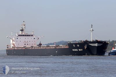
RONG MAY
Cargo
Current Trip
| Time Travelled | 3 days |
|---|---|
| Remaining Time | 4 days |
| Distance Travelled | 747.86 nm |
| Remaining Distance | 1215.43 nm |
| AVG Speed | 11.8 Knopen |
| MAX Speed | 15.2 Knopen |
| AVG Wind | 6.9 knots |
| MAX Wind | 26 knots |
| MIN Temp | 10°C / 50°F |
| MAX Temp | 18.7°C / 65.66°F |
| Diepgang | 7.3 M |
| Positie ontvangen | 32 m geleden |
Current Position
| Lengtegraad | 19.26863° |
|---|---|
| Breedtegraat | 36.32179° |
| Status | Under way using engine |
| Snelheid | 12.5 Knopen |
| Koers | 270° |
| Gebied | Mediterranean Sea - Eastern Basin |
| Station | T-AIS |
| Positie ontvangen | 32 m geleden |
Info
Information
The current position of RONG MAY is in Mediterranean Sea - Eastern Basin with coordinates 36.32179° / 19.26863° as reported on 2024-05-05 19:21 by AIS to our vessel tracker app. The vessel's current speed is 12.5 Knopen and is heading at the port of GIBRALTAR. The estimated time of arrival as calculated by MyShipTracking vessel tracking app is 2024-05-09 21:43 LT
The vessel RONG MAY (IMO: 9774484, MMSI: 636017370) is a Cargo It's sailing under the flag of [LR] Liberia.
In this page you can find informations about the vessels current position, last detected port calls, and current voyage information. If the vessels is not in coverage by AIS you will find the latest position.
The current position of RONG MAY is detected by our AIS receivers and we are not responsible for the reliability of the data. The last position was recorded while the vessel was in Coverage by the Ais receivers of our vessel tracking app.
The current draught of RONG MAY as reported by AIS is 7.3 meters
Weather
| Temperature | 17.8°C / 64.04°F |
|---|---|
| Wind Speed | 6 knots |
| Direction | 329° NNW |
| Pressure | 1017.6 hPa |
| Humidity | 78.1 % |
| Cloud Coverage | --- |
Featured Company
Last Port Calls
| Port | Arrival | Departure | Time In Port |
|---|---|---|---|
| 2024-04-27 16:16 | 2024-05-02 14:59 | 4 d | |
| 2024-03-22 05:03 | 2024-03-26 18:51 | 4 d | |
| 2024-03-11 01:53 | 2024-03-19 09:11 | 8 d |
Last Trips
| Origin | Departure | Destination | Arrival | Distance | |
|---|---|---|---|---|---|
| 2024-03-26 13:51 | 2024-04-27 19:16 | 6722.65 nm | |||
| 2024-03-19 04:11 | 2024-03-22 00:03 | 299.65 nm | |||
| 2024-01-29 22:33 | 2024-03-10 20:53 | 9039.44 nm |
Events
| Tijd | Evenement | Details | Positie / Bestemming | Info |
|---|---|---|---|---|
| 2024-05-05 19:27 | Status Changed | Default Under way using engine |
36.32196 / 19.24068
TRERE>GIGIB
|
Snelheid: 12.5 kn Koers: 270° |
| 2024-05-05 19:13 | Status Changed | Under way using engine Default |
36.32186 / 19.30371
TRERE>GIGIB
|
Snelheid: 12.5 kn Koers: 271° |
| 2024-05-05 19:13 | Binnenbereik |
36.32186 / 19.30371
Mediterranean Sea - Eastern Basin
TRERE>GIGIB
|
Snelheid: 12.4 kn Koers: 270.3° |
|
| 2024-05-05 17:38 | Status Changed | Default Under way using engine |
36.31255 / 19.70995
TRERE>GIGIB
|
Snelheid: 12.5 kn Koers: 272.9° |
| 2024-05-05 17:31 | Buitenbereik |
36.31145 / 19.74001
Mediterranean Sea - Eastern Basin
TRERE>GIGIB
|
Snelheid: 12.5 kn Koers: 272.9° |
|
| 2024-05-05 16:23 | Status Changed | Under way using engine Default |
36.30593 / 20.03127
TRERE>GIGIB
|
Snelheid: 12.3 kn Koers: 271° |
| 2024-05-05 16:05 | Status Changed | Default Under way using engine |
36.30477 / 20.10482
TRERE>GIGIB
|
Snelheid: 12.5 kn Koers: 270.3° |
| 2024-05-05 15:48 | Status Changed | Under way using engine Default |
36.30397 / 20.18145
TRERE>GIGIB
|
Snelheid: 12.3 kn Koers: 271° |
| 2024-05-05 15:27 | Status Changed | Default Under way using engine |
36.30263 / 20.26911
TRERE>GIGIB
|
Snelheid: 12.3 kn Koers: 271.6° |
| 2024-05-05 15:05 | Status Changed | Under way using engine Default |
36.30147 / 20.35988
TRERE>GIGIB
|
Snelheid: 12.3 kn Koers: 271° |