
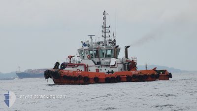
POSH ZEST
Tug
Current Trip
TUAS TERMINAL
| Time Travelled | 3 h, 50 mins |
|---|---|
| Remaining Time | --- |
| Distance Travelled | 11.24 nm |
| Remaining Distance | --- |
| AVG Speed | 5.6 Knopen |
| MAX Speed | 8.2 Knopen |
| AVG Wind | 10.2 knots |
| MAX Wind | 11 knots |
| MIN Temp | 26.8°C / 80.24°F |
| MAX Temp | 27.7°C / 81.86°F |
| Diepgang | 0 M |
| Positie ontvangen | 48 m geleden |
Current Position
| Lengtegraad | --- |
|---|---|
| Breedtegraat | --- |
| Status | Under way using engine |
| Snelheid | 3 Knopen |
| Koers | 324.9° |
| Gebied | Singapore Strait |
| Station | T-AIS |
| Positie ontvangen | 48 m geleden |
Info
Information
The current position of POSH ZEST is in Singapore Strait with coordinates 1.22170° / 103.73628° as reported on 2025-12-05 15:40 by AIS to our vessel tracker app. The vessel's current speed is 3 Knopen
The vessel POSH ZEST (IMO: 9797905, MMSI: 563023200) is a Tug It's sailing under the flag of [SG] Singapore.
In this page you can find informations about the vessels current position, last detected port calls, and current voyage information. If the vessels is not in coverage by AIS you will find the latest position.
The current position of POSH ZEST is detected by our AIS receivers and we are not responsible for the reliability of the data. The last position was recorded while the vessel was in Coverage by the Ais receivers of our vessel tracking app.
Weather
| Temperature | 26.8°C / 80.24°F |
|---|---|
| Wind Speed | 10 knots |
| Direction | 24° NNE |
| Pressure | 1011.6 hPa |
| Humidity | 80.4 % |
| Cloud Coverage | 95 % |
Featured Company
Last Port Calls
| Port | Arrival | Departure | Time In Port |
|---|---|---|---|
| 2025-12-05 19:09 | 2025-12-05 20:39 | 1 h | |
| 2025-12-05 13:41 | 2025-12-05 17:29 | 3 h | |
| 2025-12-03 19:17 | 2025-12-04 07:01 | 11 h | |
| 2025-12-03 16:51 | 2025-12-03 17:37 | 45 m | |
| 2025-12-03 08:37 | 2025-12-03 15:05 | 6 h | |
| 2025-12-02 21:33 | 2025-12-03 06:37 | 9 h | |
| 2025-12-02 12:21 | 2025-12-02 19:33 | 7 h | |
| 2025-12-02 09:21 | 2025-12-02 11:45 | 2 h | |
| 2025-12-01 22:05 | 2025-12-02 06:51 | 8 h | |
| 2025-12-01 21:24 | 2025-12-01 21:43 | 19 m |
Most Visited Ports (Last year)
| Port | Arrivals | |
|---|---|---|
| 708 | ||
| 278 | ||
| 14 |
Last Trips
| Origin | Departure | Destination | Arrival | Distance | |
|---|---|---|---|---|---|
| 2025-12-05 17:29 | 2025-12-05 19:09 | 8.05 nm | |||
| 2025-12-04 07:01 | 2025-12-05 13:41 | 37.64 nm | |||
| 2025-12-03 17:37 | 2025-12-03 19:17 | 7.51 nm | |||
| 2025-12-03 15:05 | 2025-12-03 16:51 | 4.51 nm | |||
| 2025-12-03 06:37 | 2025-12-03 08:37 | 10.53 nm | |||
| 2025-12-02 19:33 | 2025-12-02 21:33 | 9.35 nm | |||
| 2025-12-02 11:45 | 2025-12-02 12:21 | 2.64 nm | |||
| 2025-12-02 06:51 | 2025-12-02 09:21 | 11.02 nm | |||
| 2025-12-01 21:43 | 2025-12-01 22:05 | 0.84 nm | |||
| 2025-12-01 18:37 | 2025-12-01 21:24 | 9.46 nm |
Events
| Tijd | Evenement | Details | Positie / Bestemming | Info |
|---|---|---|---|---|
| 2025-12-05 16:28 | Status Changed | Under way using engine Default |
1.22191 / 103.73643
TUAS TERMINAL
|
Snelheid: 0.2 kn Koers: -1° |
| 2025-12-05 15:45 | Status Changed | Default Under way using engine |
1.22224 / 103.73628
TUAS TERMINAL
|
Snelheid: 3 kn Koers: 324.9° |
| 2025-12-05 15:45 | Stop beweging | 1.34 nm, South West of BUKOM ISLAND |
1.22224 / 103.73628
TUAS TERMINAL
|
Snelheid: 0.1 kn Koers: -1° |
| 2025-12-05 15:02 | Start beweging | 3.45 nm, South East of BUKOM ISLAND |
1.19760 / 103.79572
TUAS TERMINAL
|
Snelheid: 3.9 kn Koers: 288.1° |
| 2025-12-05 14:47 | Stop beweging | 3.38 nm, South East of BUKOM ISLAND |
1.19965 / 103.79596
TUAS TERMINAL
|
Snelheid: Koers: 511° |
| 2025-12-05 13:51 | Start beweging | 1.52 nm, South West of BUKOM ISLAND |
1.22222 / 103.73264
TUAS TERMINAL
|
Snelheid: 5.3 kn Koers: 90.5° |
| 2025-12-05 13:06 | Stop beweging | 1.62 nm, South West of BUKOM ISLAND |
1.22308 / 103.72995
TUAS TERMINAL
|
Snelheid: 0.3 kn Koers: 511° |
| 2025-12-05 12:39 | Vertrekhaven |
|
1.23757 / 103.69464
TUAS TERMINAL
|
Snelheid: 6.2 kn Koers: 139° |
| 2025-12-05 12:38 | Start beweging |
1.23844 / 103.69373
[SG] JURONG ISLAND
|
Snelheid: 6.2 kn Koers: 139° |
|
| 2025-12-05 11:11 | Stop beweging |
1.24065 / 103.69201
[SG] JURONG ISLAND
|
Snelheid: Koers: 511° |