
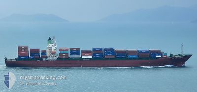
PORT KLANG VOYAGER
Container Ship
Current Trip
| Time Travelled | 11 days |
|---|---|
| Remaining Time | --- |
| Distance Travelled | 3282.47 nm |
| Remaining Distance | --- |
| AVG Speed | 12.8 Knopen |
| MAX Speed | 16 Knopen |
| AVG Wind | 11.7 knots |
| MAX Wind | 25.4 knots |
| MIN Temp | 9.8°C / 49.64°F |
| MAX Temp | 21.1°C / 69.98°F |
| Diepgang | 12.2 M |
| Positie ontvangen | 6 h, 49 m geleden |
Current Position
| Lengtegraad | -16.72150° |
|---|---|
| Breedtegraat | 24.98763° |
| Status | Under way using engine |
| Snelheid | 1.1 Knopen |
| Koers | 295° |
| Gebied | North Atlantic Ocean |
| Station | T-AIS |
| Positie ontvangen | 6 h, 49 m geleden |
Info
Information
The current position of PORT KLANG VOYAGER is in North Atlantic Ocean with coordinates 24.98763° / -16.72150° as reported on 2024-05-10 10:13 by AIS to our vessel tracker app. The vessel's current speed is 1.1 Knopen and is heading at the port of PORT KLANG. The estimated time of arrival as calculated by MyShipTracking vessel tracking app is 2024-06-13 04:00 LT
The vessel PORT KLANG VOYAGER (IMO: 9275385, MMSI: 440162000) is a Container Ship that was built in 2003 ( 21 Jaar oud ). It's sailing under the flag of [KR] Korea.
In this page you can find informations about the vessels current position, last detected port calls, and current voyage information. If the vessels is not in coverage by AIS you will find the latest position.
The current position of PORT KLANG VOYAGER is detected by our AIS receivers and we are not responsible for the reliability of the data. The last position was recorded while the vessel was in Coverage by the Ais receivers of our vessel tracking app.
The current draught of PORT KLANG VOYAGER as reported by AIS is 12.2 meters
Weather
| Temperature | 20.9°C / 69.62°F |
|---|---|
| Wind Speed | 15 knots |
| Direction | 13° NNE |
| Pressure | 1012.5 hPa |
| Humidity | 81.3 % |
| Cloud Coverage | --- |
Featured Company
Last Port Calls
| Port | Arrival | Departure | Time In Port |
|---|---|---|---|
| 2024-04-27 03:04 | 2024-04-29 15:12 | 2 d | |
| 2024-04-22 21:20 | 2024-04-24 15:51 | 1 d | |
| 2024-03-15 07:24 | |||
| 2024-03-12 05:08 | 2024-03-12 15:33 | 10 h | |
| 2024-03-02 21:53 | |||
| 2024-03-01 06:26 |
Most Visited Ports (Last year)
| Port | Arrivals | |
|---|---|---|
| 10 | ||
| 5 | ||
| 4 | ||
| 3 | ||
| 3 | ||
| 3 |
Last Trips
| Origin | Departure | Destination | Arrival | Distance | |
|---|---|---|---|---|---|
| 2024-04-24 18:51 | 2024-04-27 06:04 | 526.28 nm | |||
| 2024-03-12 22:33 | 2024-03-15 15:24 | 823.83 nm | |||
| 2024-03-01 15:26 | 2024-03-03 05:53 | 465.99 nm |
Events
| Tijd | Evenement | Details | Positie / Bestemming | Info |
|---|---|---|---|---|
| 2024-05-10 10:17 | Status Changed | Default Under way using engine |
24.98652 / -16.72168
MYPKG
|
Snelheid: 1.1 kn Koers: 295° |
| 2024-05-10 10:13 | Status Changed | Under way using engine Default |
24.98763 / -16.72150
MYPKG
|
Snelheid: 1.2 kn Koers: 288° |
| 2024-05-10 10:13 | Buitenbereik |
24.98763 / -16.72150
North Atlantic Ocean
|
Snelheid: 1.1 kn Koers: 187° |
|
| 2024-05-10 09:37 | Status Changed | Default Under way using engine |
24.99770 / -16.72030
MYPKG
|
Snelheid: 0.9 kn Koers: 293° |
| 2024-05-10 09:30 | Status Changed | Under way using engine Default |
24.99943 / -16.72025
MYPKG
|
Snelheid: 0.9 kn Koers: 302° |
| 2024-05-10 09:20 | Status Changed | Default Under way using engine |
25.00222 / -16.72022
MYPKG
|
Snelheid: 1.1 kn Koers: 309° |
| 2024-05-10 09:07 | Status Changed | Under way using engine Default |
25.00553 / -16.71995
MYPKG
|
Snelheid: 1 kn Koers: 329° |
| 2024-05-10 09:05 | Binnenbereik |
25.00548 / -16.71995
North Atlantic Ocean
|
Snelheid: 1 kn Koers: 180° |
|
| 2024-05-10 01:40 | Status Changed | Default Under way using engine |
26.10217 / -15.58182
MYPKG
|
Snelheid: 13.8 kn Koers: 223° |
| 2024-05-10 01:34 | Buitenbereik |
26.12020 / -15.56290
North Atlantic Ocean
|
Snelheid: 13.8 kn Koers: 223° |