
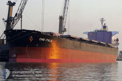
PANAMAX NOSTOS
Bulk Carrier
Current Trip
GOA-AQABA-ARM GD OBD
| Time Travelled | 18 days |
|---|---|
| Remaining Time | --- |
| Distance Travelled | 3646.26 nm |
| Remaining Distance | --- |
| AVG Speed | 12.6 Knopen |
| MAX Speed | 17.5 Knopen |
| AVG Wind | 8.7 knots |
| MAX Wind | 19 knots |
| MIN Temp | 22.3°C / 72.14°F |
| MAX Temp | 29.9°C / 85.82°F |
| Diepgang | 7.3 M |
| Positie ontvangen | 9 d geleden |
Current Position
| Lengtegraad | 37.39445° |
|---|---|
| Breedtegraat | 22.52188° |
| Status | Under way using engine |
| Snelheid | 13.5 Knopen |
| Koers | 333° |
| Gebied | Red Sea |
| Station | T-AIS |
| Positie ontvangen | 9 d geleden |
Info
Information
The current position of PANAMAX NOSTOS is in Red Sea with coordinates 22.52188° / 37.39445° as reported on 2024-04-18 23:59 by AIS to our vessel tracker app. The vessel's current speed is 13.5 Knopen
The vessel PANAMAX NOSTOS (IMO: 9325051, MMSI: 212619000) is a Bulk Carrier that was built in 2005 ( 19 Jaar oud ). It's sailing under the flag of [CY] Cyprus.
In this page you can find informations about the vessels current position, last detected port calls, and current voyage information. If the vessels is not in coverage by AIS you will find the latest position.
The current position of PANAMAX NOSTOS is detected by our AIS receivers and we are not responsible for the reliability of the data. The last position was recorded while the vessel was in Coverage by the Ais receivers of our vessel tracking app.
The current draught of PANAMAX NOSTOS as reported by AIS is 7.3 meters
Weather
| Temperature | 25°C / 77°F |
|---|---|
| Wind Speed | 13 knots |
| Direction | 311° NW |
| Pressure | 1007.9 hPa |
| Humidity | 77.5 % |
| Cloud Coverage | --- |
Featured Company
Most Visited Ports (Last year)
| Port | Arrivals | |
|---|---|---|
| 3 | ||
| 3 | ||
| 1 | ||
| 1 | ||
| 1 | ||
| 1 |
Last Trips
Events
| Tijd | Evenement | Details | Positie / Bestemming | Info |
|---|---|---|---|---|
| 2024-04-18 23:59 | Buitenbereik |
22.52188 / 37.39445
Red Sea
GOA-AQABA-ARM GD OBD
|
Snelheid: 13.5 kn Koers: 333° |
|
| 2024-04-18 21:14 | Wijzig zee gebeid | Disputed Sudan-Egypt part of the Red Sea Sudanese part of the Red Sea |
21.96488 / 37.70345
Red Sea
GOA-AQABA-ARM GD OBD
|
Snelheid: 13.6 kn Koers: 334° |
| 2024-04-18 17:43 | Binnenbereik |
21.26398 / 38.08997
Red Sea
GOA-AQABA-ARM GD OBD
|
Snelheid: 12.9 kn Koers: 332° |
|
| 2024-04-18 16:36 | Buitenbereik |
21.04650 / 38.21195
Red Sea
GOA-AQABA-ARM GD OBD
|
Snelheid: 12.7 kn Koers: 332° |
|
| 2024-04-18 15:19 | Wijzig zee gebeid | Sudanese part of the Red Sea Saudi Arabian part of the Red Sea |
20.80170 / 38.34832
Red Sea
GOA-AQABA-ARM GD OBD
|
Snelheid: 12.8 kn Koers: 334° |
| 2024-04-18 12:56 | Status Changed | Under way using engine Default |
20.35018 / 38.59513
GOA-AQABA-ARM GD OBD
|
Snelheid: 12 kn Koers: 334° |
| 2024-04-18 12:56 | Binnenbereik |
20.35018 / 38.59513
Red Sea
GOA-AQABA-ARM GD OBD
|
Snelheid: 12.4 kn Koers: 333° |
|
| 2024-04-18 10:59 | Buitenbereik |
19.99818 / 38.78595
Red Sea
GOA-AQABA-ARM GD OBD
|
Snelheid: 12.3 kn Koers: 332° |
|
| 2024-04-18 10:32 | ETA Changed | 2024/04/20 18:00 2024/04/20 22:00 |
19.91395 / 38.83220
GOA-AQABA-ARM GD OBD
|
Snelheid: 12 kn Koers: 332° |
| 2024-04-18 09:53 | Wijzig zee gebeid | Saudi Arabian part of the Red Sea Sudanese part of the Red Sea |
19.80157 / 38.89567
Red Sea
GOA-AQABA-ARM GD OBD
|
Snelheid: 12.2 kn Koers: 331° |