
OPTIMANA
General Cargo
Current Trip
| Time Travelled | 4 days |
|---|---|
| Remaining Time | --- |
| Distance Travelled | 139.03 nm |
| Remaining Distance | --- |
| AVG Speed | 10.3 Knopen |
| MAX Speed | 14.4 Knopen |
| AVG Wind | 6.5 knots |
| MAX Wind | 18 knots |
| MIN Temp | 11.6°C / 52.88°F |
| MAX Temp | 15°C / 59°F |
| Diepgang | 10.1 M |
| Positie ontvangen | 1 m geleden |
Current Position
| Lengtegraad | 1.66011° |
|---|---|
| Breedtegraat | 51.88918° |
| Status | At anchor |
| Snelheid | |
| Koers | 2° |
| Gebied | North Sea |
| Station | T-AIS |
| Positie ontvangen | 1 m geleden |
Info
Information
The current position of OPTIMANA is in North Sea with coordinates 51.88918° / 1.66011° as reported on 2024-05-27 22:31 by AIS to our vessel tracker app. The vessel's current speed is 0 Knopen
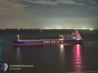
The vessel OPTIMANA (IMO: 9253856, MMSI: 232004359) is a General Cargo that was built in 2003 ( 21 Jaar oud ). It's sailing under the flag of [GB] United Kingdom.
In this page you can find informations about the vessels current position, last detected port calls, and current voyage information. If the vessels is not in coverage by AIS you will find the latest position.
The current position of OPTIMANA is detected by our AIS receivers and we are not responsible for the reliability of the data. The last position was recorded while the vessel was in Coverage by the Ais receivers of our vessel tracking app.
The current draught of OPTIMANA as reported by AIS is 10.1 meters
Weather
| Temperature | 13°C / 55.4°F |
|---|---|
| Wind Speed | 14 knots |
| Direction | 245° WSW |
| Pressure | 1015.9 hPa |
| Humidity | 84.2 % |
| Cloud Coverage | 31 % |
Featured Company
Events
| Tijd | Evenement | Details | Positie / Bestemming | Info |
|---|---|---|---|---|
| 2024-05-24 09:11 | Stop beweging | 14.07 nm, East of FELIXSTOWE |
51.88805 / 1.66066
TILBURY/SUNK
|
Snelheid: 0.3 kn Koers: 32° |
| 2024-05-24 09:01 | Status Changed | At anchor Under way using engine |
51.88921 / 1.66289
TILBURY/SUNK
|
Snelheid: 1.9 kn Koers: 3° |
| 2024-05-24 07:11 | Draught Changed | 10.1 10.3 |
51.72427 / 1.80256
TILBURY/SUNK
|
Snelheid: 10.3 kn Koers: 347.1° |
| 2024-05-24 05:12 | Wijzig zee gebeid | United Kingdom part of the North Sea French part of the North Sea |
51.41127 / 2.04378
North Sea
TILBURY/SUNK
|
Snelheid: 11.3 kn Koers: 302.5° |
| 2024-05-24 05:12 | Status Changed | Under way using engine Default |
51.41127 / 2.04378
TILBURY/SUNK
|
Snelheid: 11.2 kn Koers: 302° |
| 2024-05-24 05:08 | Status Changed | Default Under way using engine |
51.41463 / 2.03540
TILBURY/SUNK
|
Snelheid: 11.3 kn Koers: 303.6° |
| 2024-05-24 04:32 | Status Changed | Under way using engine Default |
51.36332 / 2.19561
TILBURY/SUNK
|
Snelheid: 11.1 kn Koers: 291° |
| 2024-05-24 04:28 | Status Changed | Default Under way using engine |
51.35806 / 2.21645
TILBURY/SUNK
|
Snelheid: 11 kn Koers: 286° |
| 2024-05-24 04:20 | Status Changed | Under way using engine Default |
51.35009 / 2.25270
TILBURY/SUNK
|
Snelheid: 10.7 kn Koers: 288° |
| 2024-05-24 04:16 | Status Changed | Default Under way using engine |
51.34656 / 2.27133
TILBURY/SUNK
|
Snelheid: 10.5 kn Koers: 265.3° |