
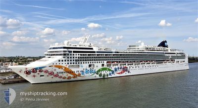
NORWEGIAN PEARL
Passengers Ship
Current Trip
| Time Travelled | 1 day |
|---|---|
| Remaining Time | 36 mins |
| Distance Travelled | 278.66 nm |
| Remaining Distance | 10.08 nm |
| AVG Speed | 11.9 Knopen |
| MAX Speed | 15.5 Knopen |
| AVG Wind | 6.1 knots |
| MAX Wind | 13.5 knots |
| MIN Temp | 17.2°C / 62.96°F |
| MAX Temp | 18.9°C / 66.02°F |
| Diepgang | 8.6 M |
| Positie ontvangen | Nu |
Current Position
| Lengtegraad | 10.14862° |
|---|---|
| Breedtegraat | 43.46533° |
| Status | Under way using engine |
| Snelheid | 14.5 Knopen |
| Koers | 53° |
| Gebied | Tyrrhenian Sea |
| Station | T-AIS |
| Positie ontvangen | Nu |
Info
Information
The current position of NORWEGIAN PEARL is in Tyrrhenian Sea with coordinates 43.46533° / 10.14862° as reported on 2024-05-21 02:30 by AIS to our vessel tracker app. The vessel's current speed is 14.5 Knopen and is heading at the port of LIVORNO. The estimated time of arrival as calculated by MyShipTracking vessel tracking app is 2024-05-21 03:06 LT
The vessel NORWEGIAN PEARL (IMO: 9342281, MMSI: 309653000) is a Passengers Ship that was built in 2006 ( 18 Jaar oud ). It's sailing under the flag of [BS] Bahamas.
In this page you can find informations about the vessels current position, last detected port calls, and current voyage information. If the vessels is not in coverage by AIS you will find the latest position.
The current position of NORWEGIAN PEARL is detected by our AIS receivers and we are not responsible for the reliability of the data. The last position was recorded while the vessel was in Coverage by the Ais receivers of our vessel tracking app.
The current draught of NORWEGIAN PEARL as reported by AIS is 8.6 meters
Weather
| Temperature | 17.3°C / 63.14°F |
|---|---|
| Wind Speed | 12 knots |
| Direction | 303° WNW |
| Pressure | 1006.1 hPa |
| Humidity | 89.5 % |
| Cloud Coverage | 100 % |
Featured Company
Last Port Calls
| Port | Arrival | Departure | Time In Port |
|---|---|---|---|
| 2024-05-19 05:10 | 2024-05-19 16:37 | 11 h | |
| 2024-05-18 02:59 | 2024-05-18 16:33 | 13 h | |
| 2024-05-17 04:46 | 2024-05-17 17:32 | 12 h | |
| 2024-05-16 09:47 | 2024-05-16 20:10 | 10 h | |
| 2024-05-15 03:23 | 2024-05-15 14:36 | 11 h | |
| 2024-05-14 06:34 | 2024-05-14 18:23 | 11 h | |
| 2024-05-13 05:24 | 2024-05-13 15:45 | 10 h | |
| 2024-05-12 06:19 | 2024-05-12 17:28 | 11 h | |
| 2024-05-11 06:09 | 2024-05-11 17:12 | 11 h | |
| 2024-05-09 02:51 | 2024-05-09 15:55 | 13 h |
Last Trips
| Origin | Departure | Destination | Arrival | Distance | |
|---|---|---|---|---|---|
| 2024-05-18 18:33 | 2024-05-19 07:10 | 193.97 nm | |||
| 2024-05-17 19:32 | 2024-05-18 04:59 | 133.02 nm | |||
| 2024-05-16 22:10 | 2024-05-17 06:46 | 69.77 nm | |||
| 2024-05-15 16:36 | 2024-05-16 11:47 | 361.57 nm | |||
| 2024-05-14 20:23 | 2024-05-15 05:23 | 166.43 nm | |||
| 2024-05-13 16:45 | 2024-05-14 08:34 | 288.73 nm | |||
| 2024-05-12 18:28 | 2024-05-13 06:24 | 193.53 nm | |||
| 2024-05-11 19:12 | 2024-05-12 07:19 | 235.73 nm | |||
| 2024-05-09 16:55 | 2024-05-11 08:09 | 599.58 nm | |||
| 2024-05-08 21:11 | 2024-05-09 03:51 | 108.73 nm |
Events
| Tijd | Evenement | Details | Positie / Bestemming | Info |
|---|---|---|---|---|
| 2024-05-21 01:33 | ETA Changed | 2024/05/21 03:00 2024/05/21 03:45 |
43.53936 / 9.87328
LIVORNO, ITALY
|
Snelheid: 14.9 kn Koers: 88° |
| 2024-05-21 00:52 | Wijzig zee gebeid | Italian part of the Tyrrhenian Sea Italian part of the Ligurian Sea |
43.53210 / 9.64671
Tyrrhenian Sea
LIVORNO, ITALY
|
Snelheid: 15 kn Koers: 87.8° |
| 2024-05-20 23:34 | Wijzig zee gebeid | Italian part of the Ligurian Sea French part of the Ligurian Sea |
43.52027 / 9.20461
Ligurian Sea
LIVORNO, ITALY
|
Snelheid: 15.1 kn Koers: 87.9° |
| 2024-05-20 22:25 | Gevonden in zee | French part of the Ligurian Sea |
43.50680 / 8.81257
Ligurian Sea
LIVORNO, ITALY
|
Snelheid: 14.7 kn Koers: 85.8° |
| 2024-05-20 20:49 | Wijzig zee gebeid | Italian part of the Ligurian Sea Italian part of the Mediterranean Sea - Western Basin |
43.48137 / 8.27702
Ligurian Sea
LIVORNO, ITALY
|
Snelheid: 14.5 kn Koers: 91.3° |
| 2024-05-20 18:59 | Wijzig zee gebeid | Italian part of the Mediterranean Sea - Western Basin French part of the Mediterranean Sea - Western Basin |
43.48124 / 7.66225
Mediterranean Sea - Western Basin
LIVORNO, ITALY
|
Snelheid: 15.3 kn Koers: 88.1° |
| 2024-05-20 18:40 | Gevonden in zee | French part of the Mediterranean Sea - Western Basin |
43.47879 / 7.56594
Mediterranean Sea - Western Basin
LIVORNO, ITALY
|
Snelheid: 14.7 kn Koers: 87.9° |
| 2024-05-20 18:34 | Wijzig zee gebeid | Mon�gasque part of the Mediterranean Sea - Western Basin French part of the Mediterranean Sea - Western Basin |
43.47794 / 7.53199
Mediterranean Sea - Western Basin
LIVORNO, ITALY
|
Snelheid: 14.6 kn Koers: 87.8° |
| 2024-05-20 16:38 | Start beweging | 1.03 nm, South West of CANNES |
43.53121 / 7.00844
LIVORNO, ITALY
|
Snelheid: 5.3 kn Koers: 209.9° |
| 2024-05-20 16:31 | Status Changed | Under way using engine At anchor |
43.53319 / 7.00964
LIVORNO, ITALY
|
Snelheid: 0.3 kn Koers: 231° |