
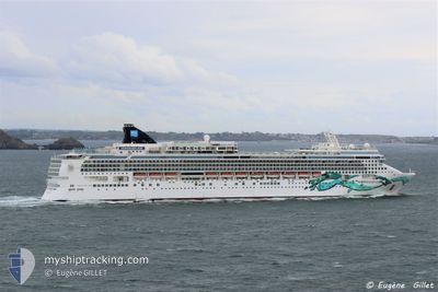
NORWEGIAN JADE
Passengers Ship
Current Trip
| Time Travelled | 2 days |
|---|---|
| Remaining Time | 3 h, 52 mins |
| Distance Travelled | 881.86 nm |
| Remaining Distance | 79.65 nm |
| AVG Speed | 18.7 Knopen |
| MAX Speed | 21 Knopen |
| AVG Wind | 7.6 knots |
| MAX Wind | 15.3 knots |
| MIN Temp | 17.3°C / 63.14°F |
| MAX Temp | 25.8°C / 78.44°F |
| Diepgang | 8.7 M |
| Positie ontvangen | Nu |
Current Position
| Lengtegraad | --- |
|---|---|
| Breedtegraat | --- |
| Status | Under way using engine |
| Snelheid | 19.7 Knopen |
| Koers | 334.5° |
| Gebied | North Pacific Ocean |
| Station | T-AIS |
| Positie ontvangen | Nu |
Info
Information
The current position of NORWEGIAN JADE is in North Pacific Ocean with coordinates 31.49855° / -117.11032° as reported on 2025-12-06 09:03 by AIS to our vessel tracker app. The vessel's current speed is 19.7 Knopen and is heading at the port of SAN DIEGO. The estimated time of arrival as calculated by MyShipTracking vessel tracking app is 2025-12-06 04:56 LT
The vessel NORWEGIAN JADE (IMO: 9304057, MMSI: 308416000) is a Passengers Ship that was built in 2006 ( 19 Jaar oud ). It's sailing under the flag of [BS] Bahamas.
In this page you can find informations about the vessels current position, last detected port calls, and current voyage information. If the vessels is not in coverage by AIS you will find the latest position.
The current position of NORWEGIAN JADE is detected by our AIS receivers and we are not responsible for the reliability of the data. The last position was recorded while the vessel was in Coverage by the Ais receivers of our vessel tracking app.
The current draught of NORWEGIAN JADE as reported by AIS is 8.7 meters
Weather
| Temperature | 17.3°C / 63.14°F |
|---|---|
| Wind Speed | 11 knots |
| Direction | 340° NNW |
| Pressure | 1017.1 hPa |
| Humidity | 74.4 % |
| Cloud Coverage | --- |
Featured Company
Last Port Calls
| Port | Arrival | Departure | Time In Port |
|---|---|---|---|
| 2025-12-03 07:05 | 2025-12-03 17:50 | 10 h | |
| 2025-12-02 07:07 | 2025-12-02 18:06 | 10 h | |
| 2025-11-29 05:24 | 2025-11-29 16:42 | 11 h | |
| 2025-11-26 07:04 | 2025-11-26 17:49 | 10 h | |
| 2025-11-25 06:04 | 2025-11-25 18:11 | 12 h | |
| 2025-11-22 05:24 | 2025-11-22 16:52 | 11 h | |
| 2025-11-19 06:53 | 2025-11-19 17:58 | 11 h | |
| 2025-11-18 07:10 | 2025-11-18 18:08 | 10 h | |
| 2025-11-15 05:22 | 2025-11-15 16:41 | 11 h | |
| 2025-11-12 07:06 | 2025-11-12 17:58 | 10 h |
Last Trips
| Origin | Departure | Destination | Arrival | Distance | |
|---|---|---|---|---|---|
| 2025-12-02 18:06 | 2025-12-03 07:05 | 185.02 nm | |||
| 2025-11-29 16:42 | 2025-12-02 07:07 | 1054.08 nm | |||
| 2025-11-26 17:49 | 2025-11-29 05:24 | 954.88 nm | |||
| 2025-11-25 18:11 | 2025-11-26 07:04 | 185.07 nm | |||
| 2025-11-22 16:52 | 2025-11-25 06:04 | 1053.00 nm | |||
| 2025-11-19 17:58 | 2025-11-22 05:24 | 956.86 nm | |||
| 2025-11-18 18:08 | 2025-11-19 06:53 | 185.12 nm | |||
| 2025-11-15 16:41 | 2025-11-18 07:10 | 1049.54 nm | |||
| 2025-11-12 17:58 | 2025-11-15 05:22 | 960.45 nm | |||
| 2025-11-11 18:16 | 2025-11-12 07:06 | 184.85 nm |
Events
| Tijd | Evenement | Details | Positie / Bestemming | Info |
|---|---|---|---|---|
| 2025-12-06 07:06 | Destination Changed | MX CSL > US SAN MX MZT > MX CSL |
30.89454 / -116.87942
MX CSL > US SAN
|
Snelheid: 19.2 kn Koers: 342.2° |
| 2025-12-06 07:06 | ETA Changed | 2025/12/06 13:00 |
30.89454 / -116.87942
MX CSL > US SAN
|
Snelheid: 19.2 kn Koers: 342.2° |
| 2025-12-06 06:33 | Status Changed | Under way using engine Default |
30.72421 / -116.81414
MX MZT > MX CSL
|
Snelheid: 19.6 kn Koers: 341° |
| 2025-12-06 06:19 | Binnenbereik |
30.72990 / -116.81642
North Pacific Ocean
|
Snelheid: 19.7 kn Koers: 341.1° |
|
| 2025-12-06 01:57 | Status Changed | Default Under way using engine |
29.30320 / -116.24841
MX MZT > MX CSL
|
Snelheid: 19.2 kn Koers: 344° |
| 2025-12-06 01:53 | Buitenbereik |
29.28321 / -116.24174
North Pacific Ocean
|
Snelheid: 19.2 kn Koers: 344° |
|
| 2025-12-06 01:48 | Status Changed | Under way using engine Default |
29.25359 / -116.23497
MX MZT > MX CSL
|
Snelheid: 19.5 kn Koers: 350° |
| 2025-12-06 01:33 | Binnenbereik |
29.27805 / -116.24011
North Pacific Ocean
|
Snelheid: 19.2 kn Koers: 345.7° |
|
| 2025-12-05 19:54 | Status Changed | Default Under way using engine |
27.48294 / -115.32537
MX MZT > MX CSL
|
Snelheid: 20.2 kn Koers: 323.5° |
| 2025-12-05 19:47 | Buitenbereik |
27.45294 / -115.29991
North Pacific Ocean
|
Snelheid: 20.2 kn Koers: 323.5° |