
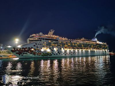
NORWEGIAN GEM
Passengers Ship
Current Trip
| Trip Time | 11 h, 38 mins |
|---|---|
| Trip Distance | 176.54 nm |
| AVG Speed | 14.6 Knopen |
| MAX Speed | 17 Knopen |
| Diepgang | 8.6 M |
| AVG Wind | 18 knots |
| MAX Wind | 19.5 knots |
| MIN Temp | 26.7°C / 80.06°F |
| MAX Temp | 27.5°C / 81.5°F |
| Positie ontvangen | 3 m geleden |
Current Position
| Lengtegraad | --- |
|---|---|
| Breedtegraat | --- |
| Status | Moored |
| Snelheid | |
| Koers | 91° |
| Gebied | Caribbean Sea |
| Station | T-AIS |
| Positie ontvangen | 3 m geleden |
Info
Information
The current position of NORWEGIAN GEM is in Caribbean Sea with coordinates 17.12151° / -61.84764° as reported on 2025-12-06 15:37 by AIS to our vessel tracker app. The vessel's current speed is 0 Knopen and is currently inside the port of ST JOHNS.
The vessel NORWEGIAN GEM (IMO: 9355733, MMSI: 309951000) is a Passengers Ship that was built in 2007 ( 18 Jaar oud ). It's sailing under the flag of [BS] Bahamas.
In this page you can find informations about the vessels current position, last detected port calls, and current voyage information. If the vessels is not in coverage by AIS you will find the latest position.
The current position of NORWEGIAN GEM is detected by our AIS receivers and we are not responsible for the reliability of the data. The last position was recorded while the vessel was in Coverage by the Ais receivers of our vessel tracking app.
The current draught of NORWEGIAN GEM as reported by AIS is 8.6 meters
Weather
| Temperature | 27.1°C / 80.78°F |
|---|---|
| Wind Speed | 19 knots |
| Direction | 89° E |
| Pressure | 1016.4 hPa |
| Humidity | 74.3 % |
| Cloud Coverage | 22 % |
Featured Company
Last Port Calls
| Port | Arrival | Departure | Time In Port |
|---|---|---|---|
| 2025-12-06 06:41 | |||
| 2025-12-05 10:58 | 2025-12-05 19:03 | 8 h | |
| 2025-12-04 06:22 | 2025-12-04 15:24 | 9 h | |
| 2025-12-02 10:16 | 2025-12-02 17:26 | 7 h | |
| 2025-11-29 06:59 | 2025-11-29 17:22 | 10 h | |
| 2025-11-28 06:11 | 2025-11-28 17:39 | 11 h | |
| 2025-11-24 06:15 | 2025-11-24 17:15 | 10 h | |
| 2025-11-22 10:34 | 2025-11-22 17:54 | 7 h | |
| 2025-11-17 15:10 | 2025-11-18 17:09 | 1 d | |
| 2025-11-13 07:41 | 2025-11-13 17:07 | 9 h |
Most Visited Ports (Last year)
| Port | Arrivals | |
|---|---|---|
| 54 | ||
| 43 | ||
| 9 | ||
| 8 | ||
| 8 | ||
| 8 |
Last Trips
| Origin | Departure | Destination | Arrival | Distance | |
|---|---|---|---|---|---|
| 2025-12-05 19:03 | 2025-12-06 06:41 | 176.54 nm | |||
| 2025-12-04 15:24 | 2025-12-05 10:58 | 373.98 nm | |||
| 2025-12-02 17:26 | 2025-12-04 06:22 | 634.52 nm | |||
| 2025-11-29 17:22 | 2025-12-02 10:16 | 625.29 nm | |||
| 2025-11-28 17:39 | 2025-11-29 06:59 | 128.24 nm | |||
| 2025-11-24 17:15 | 2025-11-28 06:11 | 861.81 nm | |||
| 2025-11-22 17:54 | 2025-11-24 06:15 | 209.91 nm | |||
| 2025-11-18 17:09 | 2025-11-22 10:34 | 770.45 nm | |||
| 2025-11-13 17:07 | 2025-11-17 15:10 | 936.06 nm | |||
| 2025-11-12 15:07 | 2025-11-13 07:41 | 235.29 nm |
Events
| Tijd | Evenement | Details | Positie / Bestemming | Info |
|---|---|---|---|---|
| 2025-12-06 11:06 | Status Changed | Moored Under way using engine |
17.12153 / -61.84764
[AG] ST JOHNS
|
Snelheid: 0.1 kn Koers: 90° |
| 2025-12-06 10:57 | Stop beweging |
17.12159 / -61.84868
[AG] ST JOHNS
|
Snelheid: Koers: 94° |
|
| 2025-12-06 10:41 | Aankomsthaven |
|
17.12680 / -61.86603
[AG] ST JOHNS
|
Snelheid: 6.9 kn Koers: 113.2° |
| 2025-12-06 09:36 | Status Changed | Under way using engine Default |
17.21935 / -62.07465
ST.JOHN, ANTIGUA
|
Snelheid: 14.5 kn Koers: 114° |
| 2025-12-06 09:35 | Status Changed | Default Under way using engine |
17.22094 / -62.07855
ST.JOHN, ANTIGUA
|
Snelheid: 14.5 kn Koers: 113.5° |
| 2025-12-06 09:27 | Status Changed | Under way using engine Default |
17.23507 / -62.11011
ST.JOHN, ANTIGUA
|
Snelheid: 15.6 kn Koers: 116° |
| 2025-12-06 09:19 | Status Changed | Default Under way using engine |
17.24986 / -62.14179
ST.JOHN, ANTIGUA
|
Snelheid: 15.1 kn Koers: 115.2° |
| 2025-12-06 09:12 | Wijzig zee gebeid | Antigua and Barbuda part of the Caribbean Sea Saint Kitts and Nevis part of the Caribbean Sea |
17.26202 / -62.16909
Caribbean Sea
ST.JOHN, ANTIGUA
|
Snelheid: 15.4 kn Koers: 114.8° |
| 2025-12-06 09:12 | Status Changed | Under way using engine Default |
17.26202 / -62.16909
ST.JOHN, ANTIGUA
|
Snelheid: 15.4 kn Koers: 115° |
| 2025-12-06 09:07 | Status Changed | Default Under way using engine |
17.27224 / -62.19169
ST.JOHN, ANTIGUA
|
Snelheid: 15.4 kn Koers: 115.3° |