
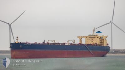
NORTH LOYALTY
Crude Oil Tanker
Current Trip
INVAD
| Time Travelled | 45 days |
|---|---|
| Remaining Time | --- |
| Distance Travelled | 7771.26 nm |
| Remaining Distance | --- |
| AVG Speed | 11.3 Knopen |
| MAX Speed | 16.7 Knopen |
| AVG Wind | 16 knots |
| MAX Wind | 38.8 knots |
| MIN Temp | 6.5°C / 43.7°F |
| MAX Temp | 29°C / 84.2°F |
| Diepgang | 20.5 M |
| Positie ontvangen | 6 d geleden |
Current Position
| Lengtegraad | -94.42639° |
|---|---|
| Breedtegraat | 28.08065° |
| Status | Under way using engine |
| Snelheid | 13.7 Knopen |
| Koers | 135.6° |
| Gebied | Gulf of Mexico |
| Station | T-AIS |
| Positie ontvangen | 6 d geleden |
Info
Information
The current position of NORTH LOYALTY is in Gulf of Mexico with coordinates 28.08065° / -94.42639° as reported on 2024-05-14 19:29 by AIS to our vessel tracker app. The vessel's current speed is 13.7 Knopen
The vessel NORTH LOYALTY (IMO: 9537771, MMSI: 538010032) is a Crude Oil Tanker that was built in 2011 ( 13 Jaar oud ). It's sailing under the flag of [MH] Marshall Is.
In this page you can find informations about the vessels current position, last detected port calls, and current voyage information. If the vessels is not in coverage by AIS you will find the latest position.
The current position of NORTH LOYALTY is detected by our AIS receivers and we are not responsible for the reliability of the data. The last position was recorded while the vessel was in Coverage by the Ais receivers of our vessel tracking app.
The current draught of NORTH LOYALTY as reported by AIS is 20.5 meters
Weather
| Temperature | 28.4°C / 83.12°F |
|---|---|
| Wind Speed | 17 knots |
| Direction | 101° E |
| Pressure | 1013.9 hPa |
| Humidity | 76.7 % |
| Cloud Coverage | 97 % |
Featured Company
Last Port Calls
| Port | Arrival | Departure | Time In Port |
|---|---|---|---|
| 2024-03-25 01:29 | 2024-04-06 09:49 | 12 d | |
| 2024-03-06 04:59 | 2024-03-15 20:10 | 9 d |
Most Visited Ports (Last year)
| Port | Arrivals | |
|---|---|---|
| 3 | ||
| 2 | ||
| 1 | ||
| 1 | ||
| 1 |
Last Trips
| Origin | Departure | Destination | Arrival | Distance | |
|---|---|---|---|---|---|
| 2024-03-15 21:10 | 2024-03-25 02:29 | 730.65 nm | |||
| 2024-02-20 20:05 | 2024-03-06 05:59 | 827.21 nm |
Events
| Tijd | Evenement | Details | Positie / Bestemming | Info |
|---|---|---|---|---|
| 2024-05-14 19:34 | Status Changed | Default Under way using engine |
28.06657 / -94.41524
INVAD
|
Snelheid: 13.7 kn Koers: 135.6° |
| 2024-05-14 19:29 | Buitenbereik |
28.08065 / -94.42639
Gulf of Mexico
|
Snelheid: 13.7 kn Koers: 135.6° |
|
| 2024-05-14 19:00 | Status Changed | Under way using engine Default |
28.15886 / -94.50776
INVAD
|
Snelheid: 13.8 kn Koers: 140° |
| 2024-05-14 18:46 | Status Changed | Default Under way using engine |
28.19837 / -94.54581
INVAD
|
Snelheid: 13.7 kn Koers: 140° |
| 2024-05-14 18:40 | Status Changed | Under way using engine Default |
28.21718 / -94.56361
INVAD
|
Snelheid: 13.8 kn Koers: 137° |
| 2024-05-14 18:10 | Status Changed | Default Under way using engine |
28.29866 / -94.64882
INVAD
|
Snelheid: 13.7 kn Koers: 133° |
| 2024-05-14 18:01 | Status Changed | Under way using engine Default |
28.32250 / -94.67593
INVAD
|
Snelheid: 13.7 kn Koers: 128° |
| 2024-05-14 17:42 | Binnenbereik |
28.32096 / -94.67375
Gulf of Mexico
|
Snelheid: 13.7 kn Koers: 129.6° |
|
| 2024-05-14 17:06 | Status Changed | Default Under way using engine |
28.40055 / -94.85115
INVAD
|
Snelheid: 3.2 kn Koers: 127° |
| 2024-05-14 17:00 | Buitenbereik |
28.40396 / -94.85860
Gulf of Mexico
|
Snelheid: 3.2 kn Koers: 138.1° |