
NORMAND MAXIMUS
Cargo
Current Trip
GELA
| Time Travelled | --- |
|---|---|
| Remaining Time | --- |
| Distance Travelled | 31.02 nm |
| Remaining Distance | --- |
| AVG Speed | --- |
| MAX Speed | --- |
| AVG Wind | 10.7 knots |
| MAX Wind | 35.9 knots |
| MIN Temp | 8.6°C / 47.48°F |
| MAX Temp | 18.8°C / 65.84°F |
| Diepgang | 7.6 M |
| Positie ontvangen | 15 h, 43 m geleden |
Current Position
| Lengtegraad | 14.22500° |
|---|---|
| Breedtegraat | 36.99825° |
| Status | At anchor |
| Snelheid | 0.2 Knopen |
| Koers | 140° |
| Gebied | Mediterranean Sea - Eastern Basin |
| Station | T-AIS |
| Positie ontvangen | 15 h, 43 m geleden |
Info
Information
The current position of NORMAND MAXIMUS is in Mediterranean Sea - Eastern Basin with coordinates 36.99825° / 14.22500° as reported on 2024-04-29 14:28 by AIS to our vessel tracker app. The vessel's current speed is 0.2 Knopen
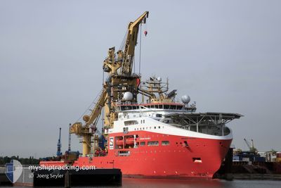
The vessel NORMAND MAXIMUS (IMO: 9744518, MMSI: 258987000) is a Cargo It's sailing under the flag of [NO] Norway.
In this page you can find informations about the vessels current position, last detected port calls, and current voyage information. If the vessels is not in coverage by AIS you will find the latest position.
The current position of NORMAND MAXIMUS is detected by our AIS receivers and we are not responsible for the reliability of the data. The last position was recorded while the vessel was in Coverage by the Ais receivers of our vessel tracking app.
The current draught of NORMAND MAXIMUS as reported by AIS is 7.6 meters
Weather
| Temperature | 22.1°C / 71.78°F |
|---|---|
| Wind Speed | 18 knots |
| Direction | 116° ESE |
| Pressure | 1015.5 hPa |
| Humidity | 46.9 % |
| Cloud Coverage | --- |
Featured Company
Last Port Calls
Most Visited Ports (Last year)
| Port | Arrivals | |
|---|---|---|
| 2 | ||
| 1 | ||
| 1 | ||
| 1 | ||
| 1 | ||
| 1 |
Last Trips
| Origin | Departure | Destination | Arrival | Distance |
|---|
Events
| Tijd | Evenement | Details | Positie / Bestemming | Info |
|---|---|---|---|---|
| 2024-04-29 14:28 | Buitenbereik |
36.99825 / 14.22500
Mediterranean Sea - Eastern Basin
|
Snelheid: 0.2 kn Koers: 344.3° |