
NICHOLAS G.S
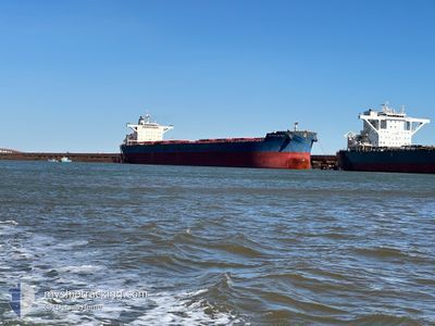
Bulk Carrier
Current Trip
| Trip Time | 24 days |
|---|---|
| Trip Distance | 4845.25 nm |
| AVG Speed | 11.3 Knopen |
| MAX Speed | 15.5 Knopen |
| Diepgang | 8.6 M |
| AVG Wind | 15.1 knots |
| MAX Wind | 34 knots |
| MIN Temp | 10.8°C / 51.44°F |
| MAX Temp | 29.5°C / 85.1°F |
| Positie ontvangen | 3 d geleden |
Current Position
| Lengtegraad | --- |
|---|---|
| Breedtegraat | --- |
| Status | At anchor |
| Snelheid | 0.1 Knopen |
| Koers | 340° |
| Gebied | Coral Sea |
| Station | T-AIS |
| Positie ontvangen | 3 d geleden |
Info
Information
The current position of NICHOLAS G.S is in Coral Sea with coordinates -23.81915° / 151.50088° as reported on 2025-12-01 18:52 by AIS to our vessel tracker app. The vessel's current speed is 0.1 Knopen and is currently inside the port of GLADSTONE.
The vessel NICHOLAS G.S (IMO: 9451264, MMSI: 538010861) is a Bulk Carrier that was built in 2010 ( 15 Jaar oud ). It's sailing under the flag of [MH] Marshall Is.
In this page you can find informations about the vessels current position, last detected port calls, and current voyage information. If the vessels is not in coverage by AIS you will find the latest position.
The current position of NICHOLAS G.S is detected by our AIS receivers and we are not responsible for the reliability of the data. The last position was recorded while the vessel was in Coverage by the Ais receivers of our vessel tracking app.
The current draught of NICHOLAS G.S as reported by AIS is 8.6 meters
Weather
| Temperature | 22.4°C / 72.32°F |
|---|---|
| Wind Speed | 5 knots |
| Direction | 122° ESE |
| Pressure | 1014.1 hPa |
| Humidity | 71.3 % |
| Cloud Coverage | --- |
Featured Company
Last Port Calls
| Port | Arrival | Departure | Time In Port |
|---|---|---|---|
| 2025-12-03 15:12 | |||
| 2025-11-06 20:18 | 2025-11-09 09:24 | 2 d | |
| 2025-10-19 12:11 | 2025-10-21 09:55 | 1 d | |
| 2025-10-03 12:12 |
Last Trips
| Origin | Departure | Destination | Arrival | Distance | |
|---|---|---|---|---|---|
| 2025-11-09 09:24 | 2025-12-03 15:12 | 4845.25 nm | |||
| 2025-10-21 09:55 | 2025-11-06 20:18 | 3879.77 nm | |||
| 2025-10-03 12:12 | 2025-10-19 12:11 | 3534.19 nm |
Events
| Tijd | Evenement | Details | Positie / Bestemming | Info |
|---|---|---|---|---|
| 2025-12-03 05:48 | Stop beweging |
-23.82052 / 151.24373
[AU] GLADSTONE
|
Snelheid: 0.3 kn Koers: 140° |
|
| 2025-12-03 05:12 | Aankomsthaven |
|
-23.82782 / 151.25757
[AU] GLADSTONE
|
Snelheid: 11.4 kn Koers: 292° |
| 2025-12-03 03:08 | Start beweging | 13.93 nm, East of GLADSTONE |
-23.81546 / 151.50363
AU GLT
|
Snelheid: 3.7 kn Koers: 80° |
| 2025-12-01 18:58 | Status Changed | Default At anchor |
-23.81900 / 151.50117
AU GLT
|
Snelheid: 0.1 kn Koers: 340° |
| 2025-12-01 18:52 | Buitenbereik |
-23.81915 / 151.50088
Coral Sea
|
Snelheid: 0.1 kn Koers: 61.7° |
|
| 2025-12-01 18:46 | Status Changed | At anchor Default |
-23.81921 / 151.50065
AU GLT
|
Snelheid: 0.1 kn Koers: 348° |
| 2025-12-01 18:43 | Status Changed | Default At anchor |
-23.81920 / 151.50050
AU GLT
|
Snelheid: Koers: 353° |
| 2025-12-01 18:16 | ETA Changed | 2026/11/27 12:00 2025/11/27 12:00 |
-23.81930 / 151.49991
AU GLT
|
Snelheid: Koers: 1° |
| 2025-12-01 18:16 | Status Changed | At anchor Default |
-23.81930 / 151.49991
AU GLT
|
Snelheid: Koers: 3° |
| 2025-12-01 18:16 | Binnenbereik |
-23.81930 / 151.49991
Coral Sea
|
Snelheid: Koers: 101.3° |