
NEW ISLAND
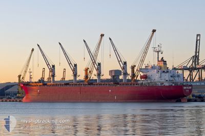
Bulk Carrier
Current Trip
| Time Travelled | 2 days |
|---|---|
| Remaining Time | --- |
| Distance Travelled | 597.82 nm |
| Remaining Distance | --- |
| AVG Speed | 11.7 Knopen |
| MAX Speed | 14.1 Knopen |
| AVG Wind | 15.3 knots |
| MAX Wind | 24.4 knots |
| MIN Temp | 15.5°C / 59.9°F |
| MAX Temp | 19.6°C / 67.28°F |
| Diepgang | 5.9 M |
| Positie ontvangen | 5 m geleden |
Current Position
| Lengtegraad | 26.13584° |
|---|---|
| Breedtegraat | 40.01050° |
| Status | Under way using engine |
| Snelheid | 11.1 Knopen |
| Koers | 78.2° |
| Gebied | Aegean Sea |
| Station | T-AIS |
| Positie ontvangen | 5 m geleden |
Info
Information
The current position of NEW ISLAND is in Aegean Sea with coordinates 40.01050° / 26.13584° as reported on 2024-05-02 14:47 by AIS to our vessel tracker app. The vessel's current speed is 11.1 Knopen and is heading at the port of BATUMI. The estimated time of arrival as calculated by MyShipTracking vessel tracking app is 2024-05-05 06:00 LT
The vessel NEW ISLAND (IMO: 9258349, MMSI: 249860000) is a Bulk Carrier that was built in 2002 ( 22 Jaar oud ). It's sailing under the flag of [MT] Malta.
In this page you can find informations about the vessels current position, last detected port calls, and current voyage information. If the vessels is not in coverage by AIS you will find the latest position.
The current position of NEW ISLAND is detected by our AIS receivers and we are not responsible for the reliability of the data. The last position was recorded while the vessel was in Coverage by the Ais receivers of our vessel tracking app.
The current draught of NEW ISLAND as reported by AIS is 5.9 meters
Weather
| Temperature | 19.5°C / 67.1°F |
|---|---|
| Wind Speed | 8 knots |
| Direction | 316° NW |
| Pressure | 1010.4 hPa |
| Humidity | 59.1 % |
| Cloud Coverage | 3 % |
Featured Company
Last Port Calls
| Port | Arrival | Departure | Time In Port |
|---|---|---|---|
| 2024-04-20 22:41 | 2024-04-30 09:48 | 9 d | |
| 2024-04-20 10:20 | 2024-04-20 21:54 | 11 h | |
| 2024-04-03 01:51 | 2024-04-03 03:07 | 1 h | |
| 2024-03-22 10:04 | 2024-03-27 15:23 | 5 d | |
| 2024-03-07 12:25 | 2024-03-15 18:09 | 8 d |
Most Visited Ports (Last year)
| Port | Arrivals | |
|---|---|---|
| 4 | ||
| 3 | ||
| 2 | ||
| 2 | ||
| 1 | ||
| 1 |
Last Trips
| Origin | Departure | Destination | Arrival | Distance | |
|---|---|---|---|---|---|
| 2024-04-20 23:54 | 2024-04-21 00:41 | 3.93 nm | |||
| 2024-04-03 06:07 | 2024-04-20 12:20 | 1720.87 nm | |||
| 2024-03-27 18:23 | 2024-04-03 04:51 | 656.19 nm | |||
| 2024-03-15 20:09 | 2024-03-22 13:04 | 538.48 nm |
Events
| Tijd | Evenement | Details | Positie / Bestemming | Info |
|---|---|---|---|---|
| 2024-05-02 14:45 | Status Changed | Under way using engine Default |
40.00904 / 26.12721
GE BUS
|
Snelheid: 11.3 kn Koers: 77° |
| 2024-05-02 14:38 | Status Changed | Default Under way using engine |
40.00471 / 26.10155
GE BUS
|
Snelheid: 11.4 kn Koers: 78.4° |
| 2024-05-02 14:25 | Status Changed | Under way using engine Default |
39.99542 / 26.04675
GE BUS
|
Snelheid: 11.9 kn Koers: 50° |
| 2024-05-02 13:59 | Status Changed | Default Under way using engine |
39.94562 / 25.95318
GE BUS
|
Snelheid: 12.7 kn Koers: 54.1° |
| 2024-05-02 13:52 | Status Changed | Under way using engine Default |
39.93116 / 25.92772
GE BUS
|
Snelheid: 13 kn Koers: 57° |
| 2024-05-02 13:46 | Status Changed | Default Under way using engine |
39.91866 / 25.90442
GE BUS
|
Snelheid: 13 kn Koers: 56.9° |
| 2024-05-02 13:40 | Wijzig zee gebeid | Turkish part of the Aegean Sea Greek part of the Aegean Sea |
39.90752 / 25.88193
Aegean Sea
GE BUS
|
Snelheid: 13.1 kn Koers: 57.9° |
| 2024-05-02 12:48 | Start beweging | 16.56 nm, West of BOZCAADA |
39.80868 / 25.71871
GE BUS
|
Snelheid: 3.2 kn Koers: 16° |
| 2024-05-02 11:25 | Stop beweging | 16.73 nm, West of BOZCAADA |
39.80486 / 25.71545
GE BUS
|
Snelheid: 0.3 kn Koers: 41° |
| 2024-05-01 12:41 | Wijzig zee gebeid | Greek part of the Aegean Sea Greek part of the Mediterranean Sea - Eastern Basin |
35.82626 / 27.63062
Aegean Sea
GE BUS
|
Snelheid: 11.3 kn Koers: 322° |