
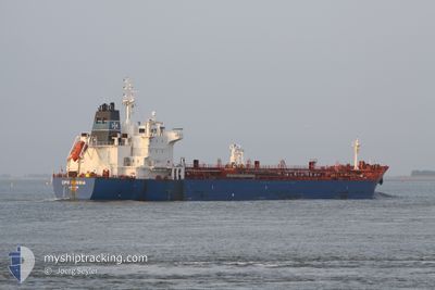
NARGIS
Oil/Chemical Tanker
Current Trip
| Time Travelled | 4 days |
|---|---|
| Remaining Time | --- |
| Distance Travelled | 532.04 nm |
| Remaining Distance | --- |
| AVG Speed | 10.3 Knopen |
| MAX Speed | 21.2 Knopen |
| AVG Wind | 8.6 knots |
| MAX Wind | 21 knots |
| MIN Temp | 9.8°C / 49.64°F |
| MAX Temp | 16.8°C / 62.24°F |
| Diepgang | 10.6 M |
| Positie ontvangen | 6 h, 25 m geleden |
Current Position
| Lengtegraad | 29.29766° |
|---|---|
| Breedtegraat | 41.49992° |
| Status | Under way using engine |
| Snelheid | 0.5 Knopen |
| Koers | 224° |
| Gebied | Black Sea |
| Station | T-AIS |
| Positie ontvangen | 6 h, 25 m geleden |
Info
Information
The current position of NARGIS is in Black Sea with coordinates 41.49992° / 29.29766° as reported on 2024-05-14 21:19 by AIS to our vessel tracker app. The vessel's current speed is 0.5 Knopen and is heading at the port of KALAMATA. The estimated time of arrival as calculated by MyShipTracking vessel tracking app is 2024-05-14 04:01 LT
The vessel NARGIS (IMO: 9353125, MMSI: 626283000) is a Oil/Chemical Tanker that was built in 2008 ( 16 Jaar oud ). It's sailing under the flag of [GA] Gabon.
In this page you can find informations about the vessels current position, last detected port calls, and current voyage information. If the vessels is not in coverage by AIS you will find the latest position.
The current position of NARGIS is detected by our AIS receivers and we are not responsible for the reliability of the data. The last position was recorded while the vessel was in Coverage by the Ais receivers of our vessel tracking app.
The current draught of NARGIS as reported by AIS is 10.6 meters
Weather
| Temperature | 13.5°C / 56.3°F |
|---|---|
| Wind Speed | 8 knots |
| Direction | 113° ESE |
| Pressure | 1017.9 hPa |
| Humidity | 62.2 % |
| Cloud Coverage | 81 % |
Featured Company
Last Port Calls
| Port | Arrival | Departure | Time In Port |
|---|---|---|---|
| 2024-05-08 11:12 | 2024-05-10 19:03 | 2 d | |
| 2024-04-23 12:23 | |||
| 2024-03-29 03:24 |
Most Visited Ports (Last year)
| Port | Arrivals | |
|---|---|---|
| 4 | ||
| 4 | ||
| 2 | ||
| 1 | ||
| 1 |
Last Trips
| Origin | Departure | Destination | Arrival | Distance |
|---|
Events
| Tijd | Evenement | Details | Positie / Bestemming | Info |
|---|---|---|---|---|
| 2024-05-14 21:25 | Status Changed | Default Under way using engine |
41.50048 / 29.29690
GR KLX
|
Snelheid: 0.5 kn Koers: 224° |
| 2024-05-14 21:19 | Buitenbereik |
41.49992 / 29.29766
Black Sea
|
Snelheid: 0.5 kn Koers: 312.4° |
|
| 2024-05-14 20:09 | Status Changed | Under way using engine Default |
41.49413 / 29.30895
GR KLX
|
Snelheid: 0.4 kn Koers: 211° |
| 2024-05-14 20:08 | Status Changed | Default Under way using engine |
41.49406 / 29.30912
GR KLX
|
Snelheid: 0.4 kn Koers: 210° |
| 2024-05-14 19:07 | Status Changed | Under way using engine Default |
41.49105 / 29.31960
GR KLX
|
Snelheid: 0.3 kn Koers: 195° |
| 2024-05-14 18:56 | Status Changed | Default Under way using engine |
41.49067 / 29.32130
GR KLX
|
Snelheid: 0.4 kn Koers: 180° |
| 2024-05-14 18:27 | Status Changed | Under way using engine Default |
41.49010 / 29.32598
GR KLX
|
Snelheid: 0.4 kn Koers: 184° |
| 2024-05-14 18:21 | Status Changed | Default Under way using engine |
41.49004 / 29.32689
GR KLX
|
Snelheid: 0.4 kn Koers: 185° |
| 2024-05-14 18:20 | Status Changed | Under way using engine Default |
41.49004 / 29.32694
GR KLX
|
Snelheid: 0.3 kn Koers: 186° |
| 2024-05-14 18:00 | Status Changed | Default Under way using engine |
41.48954 / 29.32981
GR KLX
|
Snelheid: 0.3 kn Koers: 195° |