
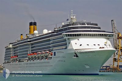
MVAS ISLANDER
Passengers Ship
Current Trip
| Time Travelled | 1 day |
|---|---|
| Remaining Time | -15 mins |
| Distance Travelled | 512.58 nm |
| Remaining Distance | 2.37 nm |
| AVG Speed | 13.8 Knopen |
| MAX Speed | 21 Knopen |
| AVG Wind | 16.2 knots |
| MAX Wind | 21.8 knots |
| MIN Temp | 21.5°C / 70.7°F |
| MAX Temp | 27.4°C / 81.32°F |
| Diepgang | 8.2 M |
| Positie ontvangen | 1 m geleden |
Current Position
| Lengtegraad | --- |
|---|---|
| Breedtegraat | --- |
| Status | Under way using engine |
| Snelheid | 3 Knopen |
| Koers | 68° |
| Gebied | Caribbean Sea |
| Station | T-AIS |
| Positie ontvangen | 1 m geleden |
Info
Information
The current position of MVAS ISLANDER is in Caribbean Sea with coordinates 20.51181° / -86.96073° as reported on 2025-12-24 06:59 by AIS to our vessel tracker app. The vessel's current speed is 3 Knopen and is heading at the port of COZUMEL. The estimated time of arrival as calculated by MyShipTracking vessel tracking app is 2025-12-24 01:46 LT
The vessel MVAS ISLANDER (IMO: 9187796, MMSI: 311001063) is a Passengers Ship that was built in 2000 ( 25 Jaar oud ). It's sailing under the flag of [BS] Bahamas.
In this page you can find informations about the vessels current position, last detected port calls, and current voyage information. If the vessels is not in coverage by AIS you will find the latest position.
The current position of MVAS ISLANDER is detected by our AIS receivers and we are not responsible for the reliability of the data. The last position was recorded while the vessel was in Coverage by the Ais receivers of our vessel tracking app.
The current draught of MVAS ISLANDER as reported by AIS is 8.2 meters
Weather
| Temperature | 25.3°C / 77.54°F |
|---|---|
| Wind Speed | 13 knots |
| Direction | 81° E |
| Pressure | 1018.4 hPa |
| Humidity | 84.1 % |
| Cloud Coverage | 95 % |
Featured Company
Last Port Calls
| Port | Arrival | Departure | Time In Port |
|---|---|---|---|
| 2025-12-22 04:46 | 2025-12-22 17:17 | 12 h | |
| 2025-12-20 08:23 | 2025-12-20 17:05 | 8 h | |
| 2025-12-19 06:16 | 2025-12-19 15:59 | 9 h | |
| 2025-12-17 05:00 | 2025-12-17 16:40 | 11 h | |
| 2025-12-15 06:14 | 2025-12-15 15:47 | 9 h | |
| 2025-12-14 07:17 | 2025-12-14 16:12 | 8 h | |
| 2025-12-12 04:38 | 2025-12-12 16:53 | 12 h | |
| 2025-12-10 06:11 | 2025-12-10 15:15 | 9 h | |
| 2025-12-09 07:17 | 2025-12-09 16:07 | 8 h | |
| 2025-12-07 03:36 | 2025-12-07 17:48 | 14 h |
Most Visited Ports (Last year)
| Port | Arrivals | |
|---|---|---|
| 71 | ||
| 63 | ||
| 28 | ||
| 27 | ||
| 9 | ||
| 8 |
Last Trips
| Origin | Departure | Destination | Arrival | Distance | |
|---|---|---|---|---|---|
| 2025-12-20 17:05 | 2025-12-22 04:46 | 516.96 nm | |||
| 2025-12-19 15:59 | 2025-12-20 08:23 | 268.41 nm | |||
| 2025-12-17 16:40 | 2025-12-19 06:16 | 562.80 nm | |||
| 2025-12-15 15:47 | 2025-12-17 05:00 | 563.44 nm | |||
| 2025-12-14 16:12 | 2025-12-15 06:14 | 272.17 nm | |||
| 2025-12-12 16:53 | 2025-12-14 07:17 | 513.30 nm | |||
| 2025-12-10 15:15 | 2025-12-12 04:38 | 561.04 nm | |||
| 2025-12-09 16:07 | 2025-12-10 06:11 | 273.66 nm | |||
| 2025-12-07 17:48 | 2025-12-09 07:17 | 514.72 nm | |||
| 2025-12-05 17:03 | 2025-12-07 03:36 | 515.28 nm |
Events
| Tijd | Evenement | Details | Positie / Bestemming | Info |
|---|---|---|---|---|
| 2025-12-24 05:23 | ETA Changed | 2025/12/24 06:30 2025/12/24 12:00 |
20.81338 / -86.80021
MXCZM
|
Snelheid: 18.1 kn Koers: 214.9° |
| 2025-12-24 05:22 | Wijzig zee gebeid | Mexican part of the Caribbean Sea United States part of the Gulf of Mexico |
20.81594 / -86.79831
Caribbean Sea
MXCZM
|
Snelheid: 18.1 kn Koers: 216.1° |
| 2025-12-24 05:11 | Status Changed | Under way using engine Default |
20.86370 / -86.76192
MXCZM
|
Snelheid: 19 kn Koers: 215° |
| 2025-12-24 05:04 | Binnenbereik |
20.85152 / -86.77108
Gulf of Mexico
MXCZM
|
Snelheid: 18.5 kn Koers: 213.9° |
|
| 2025-12-22 23:24 | Status Changed | Default Under way using engine |
27.62480 / -82.64612
MXCZM
|
Snelheid: 15.3 kn Koers: 217.4° |
| 2025-12-22 23:18 | Buitenbereik |
27.63845 / -82.62139
Gulf of Mexico
MXCZM
|
Snelheid: 15.3 kn Koers: 217.4° |
|
| 2025-12-22 23:16 | Status Changed | Under way using engine Default |
27.64487 / -82.61585
MXCZM
|
Snelheid: 15.4 kn Koers: 218° |
| 2025-12-22 22:47 | Status Changed | Default Under way using engine |
27.73514 / -82.53094
MXCZM
|
Snelheid: 13.5 kn Koers: 186.5° |
| 2025-12-22 22:17 | Vertrekhaven |
|
27.80847 / -82.45550
MXCZM
|
Snelheid: 12.9 kn Koers: 235° |
| 2025-12-22 21:20 | Start beweging |
27.93836 / -82.44518
[US] TAMPA
|
Snelheid: 3.1 kn Koers: 189° |